It is up to the GIS professionals to provide leadership in exploiting the real value of this technology now, when it is sorely needed.As "Directions' Magazine readers know, it's not about mapping.
The trends that have been catapulted
in recent months were already starting several years ago. The integration
of GIS into back office IT, such that it becomes transparent, has been
ongoing for several years. The Open GIS Consortium, working since
the early 90's to foster interoperability among technologies involving
spatial information, now has a membership that includes 237 organizations
worldwide.It has become the premier standards organization to provide
GIS technology producers and users a forum for cooperative integration,
and it has resulted in phenomenal joint development projects through "coopetition".
The walls are tumbling down, and that is crucial in the worldwide effort
to protect humanity from natural and man-made threats to health and safety.
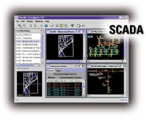 There is now an increased awareness
of the need to combine GIS with other technologies. Supervisory Control
And Data Acquisition (SCADA) has long been integrated with GIS in the utility
industry to automate substation monitoring and control. Now we need
to integrate sensor technology with the management of the electric utility
network so, for example, every traffic signal has a sensor that alerts
authorities of the presence of chemicals or radioactivity and predicts
the spread.The use of GPS and bar coding, combined with spatial analysis
was used successfully at "ground 0", thanks to the efforts of Linkspoint,
a GE Network Solutions partner located in Norwalk, CT. The firefighters
were recording evidence in the World Trade Center rubble by hand on paper
until the Linkspoint developers created a simple application on a handheld
device that produced a bar coded evidence label that was related to a GPS
location and some simple data input fields that the rescue workers could
populate at the scene.After download to a central data store, spatial
analysis could be used to reconstruct the scene.
There is now an increased awareness
of the need to combine GIS with other technologies. Supervisory Control
And Data Acquisition (SCADA) has long been integrated with GIS in the utility
industry to automate substation monitoring and control. Now we need
to integrate sensor technology with the management of the electric utility
network so, for example, every traffic signal has a sensor that alerts
authorities of the presence of chemicals or radioactivity and predicts
the spread.The use of GPS and bar coding, combined with spatial analysis
was used successfully at "ground 0", thanks to the efforts of Linkspoint,
a GE Network Solutions partner located in Norwalk, CT. The firefighters
were recording evidence in the World Trade Center rubble by hand on paper
until the Linkspoint developers created a simple application on a handheld
device that produced a bar coded evidence label that was related to a GPS
location and some simple data input fields that the rescue workers could
populate at the scene.After download to a central data store, spatial
analysis could be used to reconstruct the scene.
Automation of the data collection and spatial analysis provides unmanned monitoring, minimizing resources and expense and resulting in more widespread protection.For example, disease surveillance systems track the normal everyday reports of symptoms to doctor's offices, clinics, and emergency rooms, so that they can automatically send an alert when higher than normal levels may signal an epidemic, either naturally occurring or resulting from terrorist activities. This model for disease surveillance has been used in the military where daily recording of visits in a central data repository is routine. It will be applied in the civilian population when it has been successfully integrated with electronic claims filing.
One of the most challenging aspects of terrorism is that events can happen anywhere at any time using a multitude of agents and methods, making preparation very difficult.Modeling and simulation is of value in contingency planning, and it can lead to much more effective methods. For example, some models of small pox contagion lead quickly to the conclusion that a widespread exposure can get out of control before it is recognized. This has lead to the proposal by the Center for Disease Detection in San Antonio, TX, that normal blood, such as that collected at donation centers and military induction locations, be monitored for antibodies so exposure can be detected prior to the development of symptoms.
Naturally occurring epidemics, such as the West Nile Virus outbreak in the United States, have been effectively modeled by Dr.Sean Ahearn and his colleagues at Hunter College. The Center for Analysis and Research of Spatial Information (CARSI), which he directs, has created a predictive model using Smallworld GIS. Based on mathematical and statistical algorithms using such data as the closeness in time and space of dead crows reported in NYC, Dr.Ahearn's team has actually predicted the specific geographic area where four out of five human cases of WNV would occur two weeks before symptoms were reported. The obvious benefit of such a model is that if you can predict the occurrence, you have an opportunity to provide targeted prevention.
The characteristics of GIS technology that are important in supporting such requirements are not currently available in desktop GIS products. Applications on a national or global scale must have an enterprise architecture that is capable of supporting a dynamic multi-source environment with quick response time regardless of the size of the data stores. The object modeling capability must be robust, supporting complex object interactions and easy creation of objects and modification of behaviors with safeguards against unintended relationship corruption. A truly object based technology supports multiple geometries for each object so, for instance, a hospital object can have a point location as well as a catchment area representation.A metro station can be area in which you can model the distribution of riders on the platform as well as a node on the street network for routing ambulances in response to a bomb blast in the station.Existing software solutions, which have the ability to model multiple geometries, coupled with the capability of extending the model to any scale in one integrated system opens the door to some very sophisticated modeling and simulation.Imagine, for example, a contagion model in which a traveler carrying an infectious disease travels from Africa to New York City and then to Chicago. Consider using one continuous data model that can track the infected traveler "object" and all human objects he comes into contact with at the scale of the airplane interior, and then the terminal waiting areas as well as the various destinations worldwide of all the other traveler objects, perhaps using multiple modes of transportation. Add to that the ability to apply an algorithm to the model, such as the percent probability that each interaction will result in infection, and you have a powerful modeling capability.
In summary, I suggest that readers look beyond the boundaries of mapping and conventional spatial analysis, and take GIS technology to a new level of creative application. We must take advantage of the integration made possible by Open GIS Consortium standards, the other new technologies that can be combined with GIS, and the availability of powerful tools for modeling and simulation. We can apply the current homeland security focus to support both protection against future disasters and process improvements we have needed all along.