The state of Delaware tapped
a team of three organizations, Integrated Warehousing Solutions,
ESi and Towson University's Center for Geographic Services, to assemble
and provide a "public health preparedness" system. Integrated
Warehousing Solutions' (IWS) President Carl Brewer shared details of
the project.
"Delaware's Division of Public Health is an industry thought leader with one of the most comprehensive emergency response visions in the country," said Brewer. Healthcare professionals across the country are observing the Delaware integrated preparedness project as a template for their own state preparedness initiative, he said. The system is due to go live in May.
The project's charter is to integrate all facets of emergency management (preparedness, mitigation, response and recovery) to create a "one touch" solution. The primary goal of the project is to integrate existing and planned systems in a way that will allow the information sharing that leads to efficient planning, monitoring, deploying and tracking systems during a public health emergency.
IWS will deliver its enterprise level Inventory & Resource
Management System (IRMS), which
will provide Delaware with real-time inventory and asset management,
patient tracking, and emergency, program and personnel management via a
Web-hosted environment. Brewer explained, "When we apply IRMS [the
warehouse management system] to Delaware, we can see that [medical and
drug supply] inventory quickly so state officials can determine what is
where, where it should be sent, etc. In the case of a flu outbreak, for
example, we wouldn't want to send all the flu vaccine to the first
county reporting a problem."
IWS will also deploy a portable version of IRMS as a mobile emergency response system. Called the "IRMS Go-Kit," it is designed to set up anywhere during an emergency situation and be ready to operate within 12 minutes. "We store in our database the latitude and longitude information about any place the Department of Health might use as a location, such as hospitals, schools, military locations, even parking lots," explained Brewer.
ESi, a global crisis information management solution provider, will install its Web product, WebEOC, to serve as a centralized message system with GIS capabilities. The Towson University Center for Geographic Information Sciences will provide its Emergency Management Mapping Application (EMMA). EMMA provides basic and advanced tools for map visualization, location analysis and report generation via the Web. EMMA was built using ESRI's ArcIMS software, to be interoperable with incident management software, such as WebEOC.
"The combination of solutions has provided the industry's most comprehensive solution for real-time accurate inventory details so you can apply it to evolving situations," said Brewer. Evolving situations might include changes in weather, or bridge and road failures.
Other states (Ohio, Georgia, Tennessee and Kentucky, for example) have implemented systems that involve a similar combination of IRMS, the Go-Kit and WebEOC, but this is the first time the three organizations have bid as a team.
"Delaware's Division of Public Health is an industry thought leader with one of the most comprehensive emergency response visions in the country," said Brewer. Healthcare professionals across the country are observing the Delaware integrated preparedness project as a template for their own state preparedness initiative, he said. The system is due to go live in May.
The project's charter is to integrate all facets of emergency management (preparedness, mitigation, response and recovery) to create a "one touch" solution. The primary goal of the project is to integrate existing and planned systems in a way that will allow the information sharing that leads to efficient planning, monitoring, deploying and tracking systems during a public health emergency.
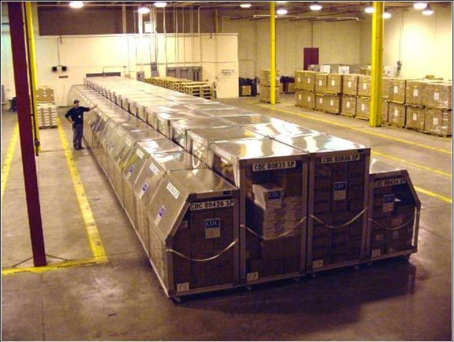 |
IWS will also deploy a portable version of IRMS as a mobile emergency response system. Called the "IRMS Go-Kit," it is designed to set up anywhere during an emergency situation and be ready to operate within 12 minutes. "We store in our database the latitude and longitude information about any place the Department of Health might use as a location, such as hospitals, schools, military locations, even parking lots," explained Brewer.
ESi, a global crisis information management solution provider, will install its Web product, WebEOC, to serve as a centralized message system with GIS capabilities. The Towson University Center for Geographic Information Sciences will provide its Emergency Management Mapping Application (EMMA). EMMA provides basic and advanced tools for map visualization, location analysis and report generation via the Web. EMMA was built using ESRI's ArcIMS software, to be interoperable with incident management software, such as WebEOC.
"The combination of solutions has provided the industry's most comprehensive solution for real-time accurate inventory details so you can apply it to evolving situations," said Brewer. Evolving situations might include changes in weather, or bridge and road failures.
Other states (Ohio, Georgia, Tennessee and Kentucky, for example) have implemented systems that involve a similar combination of IRMS, the Go-Kit and WebEOC, but this is the first time the three organizations have bid as a team.
From Our Homepage
Saying Farewell to an Amazing Journey
Communicating with Maps
Is There a GIS Career Ladder?
What does it mean to be geospatially smart? Series
Ways Real Estate and Property Developers Utilize Melissa GeoData for Data-Driven Decisions
Unlocking Value From Daily Satellite Imagery and Insights
Maximizing the Value of Your Address Data with Geo Addressing
How Indoor Mapping Enhances the Security of Smart Buildings
Look Ahead: AI, Location Intelligence and Efficiency
Collaboration Takes on Sea Level Rise & Dynamic Technology Environments
Brownies for Brownfields
Has Everything Been Mapped Already?
How Is Data Literacy Changing in an Artificial Intelligence Landscape
Portfolios for GIS Professionals: More Than Just Maps
How to Create a Distance Matrix in QGIS - A Step-by-Step Guide
7 Ideas for Bringing GIS into the K-12 Classroom
The Geography of Movement