Distance and Infrastructure
Seattle, Washington is quite far from the destruction brought by the December 26th tsunami to Southeast Asia.While that distance isn't the only thing on Glenn Brooks' mind, it's one of them.Brooks is Mercy Corps' Geographic Information Officer, where he aims to bring the power of GIS and remote sensing to help with livelihood redevelopment in areas impacted by the giant wave.
 |
"The distance makes communication difficult," Brooks notes "and so does the limited bandwidth available, especially from Indonesia." But that hasn't slowed GIS disaster response in the Pacific Northwest.In the two months since the disaster, Brooks has organized a volunteer GIS disaster response group, found space to set up a lab (courtesy of the University of Washington), received donated software to use (courtesy of ESRI, LizardTech, Leica Geosystems and others), organized satellite image processing services for the Pacific Data Center in Hawaii (Brooks' team will process imagery for the areas of Sri Lanka, India and the Maldives) and created a Tsunami research and educational partnership with the Mark Lindenberg Center for Humanitarian Action and Global Citizenship at the University of Washington.
It's that sort of infrastructure that Brooks hopes is going to ensure that Mercy Corps' two GIS Response Teams can do the best job possible once they reach hard hit areas in Sri Lanka and Sumatra in March and April.Mercy Corps has a substantial presence in Indonesia and was just preparing to open an office in Sri Lanka before the disaster.One big asset each team will have is a GIS and imagery database for the host country.Even now volunteers are collecting all the data they can, documenting it and organizing it for use in country.Because both Sri Lanka and Sumatra have substantial GIS programs (or did before the disaster) its very likely more detailed and up-to-date data (some better than what we have here in the US, Brooks is quick to add) will be added after the teams arrive.
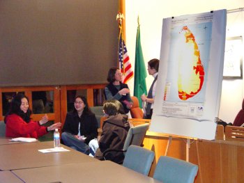
Volunteers
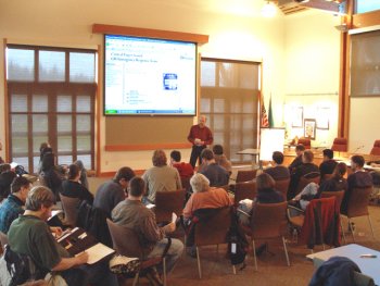
Brooks has assembled a team of 75 volunteers, mostly from the Central Puget Sound GIS Users' Group, to begin data development in Seattle.The volunteers include GIS and remote sensing users from the private, public and academic areas, representing all five of the counties that touch the Sound.
There are area specialists involved, too.Five Emergency Operations Center (EOC) personnel are documenting the team's work to learn what might be applicable in future efforts.Another team of GIS specialists with medical experience are involved.So is a FEMA regional response staffer.One other team involves police officers.They are exploring crime mapping tools that might help resolve civil land disputes arising from conflicting land use claims in severely affected areas teams will visit, both of which suffer from insurgent attacks.
Strategic Plan
Brooks' task, besides keeping an eye on the volunteer work (he's lucky to have a volunteer "volunteer coordinator" and volunteer looking over fundraising) is to lay out a GIS strategic plan for the two areas.To do that he depends on Mercy Corps' situation reports written by staffers in country.The e-mails come in at different intervals but give a detailed overview of what's happening on the ground.From these reports Brooks will tease out the best plan for using geospatial technologies to get the local economies back up and running.That means thinking through how to document the inundation and recovery of agricultural fields by salt water or where to extend micro-credit (small loans) to repair fishermens' boats.Brooks notes that one key need in some areas of Sri Lanka is transportation.The main form of transportation, the bicycle, was pretty much swept away during the tsunami.Obtaining a bicycle may be the difference between fish being caught on the coast and sold further inland.
 |
"Typically," Brooks explained "the 'emergency' phase of a disaster is three weeks to a month.With this one it's been about two months.The Indonesian government just recently announced the emergency was 'over.' But, that means it's just the beginning of getting people back on their feet.And, remember this disaster hit twelve countries and 3000 miles of coastline.Further, each and every location has different impacts and a different set of needs.That's why getting detailed information for specific geographic locations is so important."
Brooks is quick to applaud the efforts of MapAction a non-governmental organization (NGO) mapping group from London that quickly got to Sri Lanka and almost single-handedly established centralized coordination for emergency relief.MapAction left the area on January 12.Unfortunately, that level of organization and mapping was not available in Sumatra and while the various agencies did their best to serve those in need, sometimes resources didn't get to where they were needed or extra rations were dropped in the same place, time after time.
GIS and Remote Sensing in Relief Efforts
After arriving in Southeast Asia, the two Mercy Corps GIS Response Teams will first orient the Mercy Corps staff about the power of geospatial technology and then go to work on their respective projects.Each team will have two goals: to provide good technical support on the ground and to highlight the importance of these technologies in relief efforts.The ultimate goal is to turn the tools and procedures over to specialists in country or to well-established NGOs in the area.The first two teams are scheduled for a three month deployment.
 |
"GIS and remote sensing are not established technologies in the NGO world.No one in the International community has combined these technologies to support humanitarian aid workers directly in villages or disaster zones" reports Brooks.And, he knows.As a volunteer with Mercy Corps he provided GIS support for Mercy Corps programs in Central Asia, and was in the process of bringing GIS technologies to bear on the Darfur genocide in Sudan.Just prior to the tsunami in South Asia, Peter Dickinson, the Mercy Corps Information Technology Director in Portland and he were working on a two to three year orientation plan to introduce GIS concepts into Mercy Corps Field programs."When the tsunami occurred," Brooks acknowledges, "everything was, well, pushed up.We compressed a year's worth of planning and implementation into thirty days." That "change in plan" meant that Brooks left his job as GIS Coordinator for the town of Woodinville, Washington to join Mercy Corps full-time for six months "to help prove GIS technology will work in international disaster relief efforts." "
Still Needed
For now, Brooks' teams' days are busy gathering data and preparing to support those going overseas.So, what does Brooks still need? He's looking for a remote sensing specialist with experience in fisheries and agricultural change detection for a three month paid assignment in Sri Lanka.And, of course contributions to fund the GIS and remote sensing effort are always welcome.
Brooks has agreed to check in with Directions Magazine in the coming months to let readers know of his team's progress both in Seattle and overseas.
To learn more about Mercy Corps or donate to the Geospatial Initiative visit the website.