 |
Directions Magazine (DM): Why was the Android operating system chosen for this app and what advantages did it present for the developer or the user?
Alex Philp (AP): We chose Android due to the explosive nature of its release on the Motorola phone and our developers found it very easy to develop applications for it. GCS started experimentation with Droid-enabled phones for a series of mobile solutions, so we went with this OS first. We have plans, depending upon customer need, to support the next-generation Windows Mobile and iPhone OS, as well, in the near future.
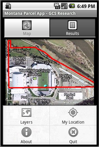
DM: The application seems to lend itself to parcel identification, particularly for those with an immediate, onsite need. Will it be integrated into an MLS service for realtors, or is it intended to be a strictly stand alone application?
AP: We have existing customers that are concerned with and interested in specific workflows that would benefit their business functions, such as real estate companies, title companies, insurance companies and such. The Parcel Droid App was designed to demonstrate capability, cost-effectiveness, ease-of-deployment, and the viral nature of the application space. Since the Droid application leverages existing Web services and is part of our mobile SOA strategy, it can be easily integrated into existing and future customer workflows to help them be more effective in the fields, but also leverage their private and public sector geospatial Web services and geodatabases. For our Montana state government customers, we wanted to demonstrate the ability to go mobile for the benefit of the public they serve with their federated state government geospatial services.
 |
DM: What is the size of the downloaded app?
AP: 94.1KB
DM: Was the development funded by the state of Montana or will it be supported by advertising?
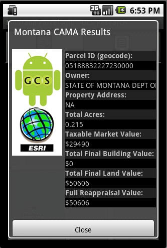
AP: This is private R&D activity by GCS Research to demonstrate capability and we currently have no plans to support it through advertising, although we are open to discussions for creative ways to finance the public sector resources currently being leveraged into the application, such as the state of Montana cadastral geodatabase and the CAMA - Web services. We also are in some protected discussions with some of our existing private sector clients who are open to the advertising model. We think ubiquitous mobile geospatial apps represent a paradigm shift in potential creative, public-private collaborations for cost-recovering to help achieve ROI for public investment in state data
From Our Homepage
Saying Farewell to an Amazing Journey
Communicating with Maps
Is There a GIS Career Ladder?
What does it mean to be geospatially smart? Series
Ways Real Estate and Property Developers Utilize Melissa GeoData for Data-Driven Decisions
Unlocking Value From Daily Satellite Imagery and Insights
Maximizing the Value of Your Address Data with Geo Addressing
How Indoor Mapping Enhances the Security of Smart Buildings
Look Ahead: AI, Location Intelligence and Efficiency
Collaboration Takes on Sea Level Rise & Dynamic Technology Environments
Brownies for Brownfields
Has Everything Been Mapped Already?
How Is Data Literacy Changing in an Artificial Intelligence Landscape
Portfolios for GIS Professionals: More Than Just Maps
How to Create a Distance Matrix in QGIS - A Step-by-Step Guide
7 Ideas for Bringing GIS into the K-12 Classroom
The Geography of Movement