A small group operating in Victoria, British Columbia, Canada is achieving success in integrating disparate geospatial data sets. This is not unusual. However, the interesting part is that these data come from some 200 different and equally disparate organizations throughout the province. Even more amazing is the fact that the contribution of data is voluntary. Contributed data layers come from the provincial government, local governments, all of the major utilities, the property assessment authority and other stakeholders, resulting in a multi layer geospatial fabric.
 |
Today, this data contribution represents more than 95% of the land base in the province. British Columbia (BC) is Canada's westernmost province, located on the Pacific coast of North America, and has a land and freshwater area of 95 million hectares. It is Canada's third-largest province and comprises 9.5 percent of the country's total land area. The province is nearly four times the size of Great Britain, 2.5 times larger than Japan, and larger than any American state except Alaska. Crown land (government owned) comprises about 92% of the total geographic area of BC, with the balance of 8% privately owned. As of the end of 2009, there were 1.9 million active titles in British Columbia.
 |
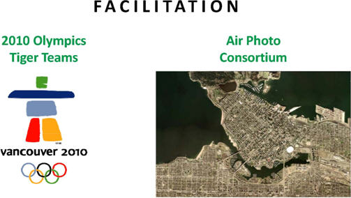
Obviously, it has taken time and effort to reach this stage. Integrated Cadastral Information Society (ICIS) is a non-profit society formed in 2001 to provide integrated spatial mapping data to its members. The three founding member segments comprise provincial government ministries and Crown corporations, utilities and local governments. Within the last two years, the expansion of membership has embraced First Nations and other organizations that benefit from sharing and integrating cadastral data. The Royal Canadian Mounted Police and Federal Department of Defence are just two examples. The RCMP and DND's combined need for geospatial data from a variety of sources escalated due to their lead roles in securing the 2010 Olympic Games.
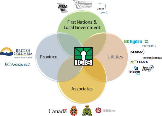 |
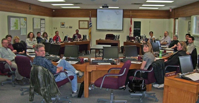
Many interesting challenges have confronted ICIS since inception. The founding members, the utilities and provincial ministries in particular recognized early on the importance of creating and maintaining a single parcel cadastre for the province. To ensure success, all involved realized that for these data to be embraced, local government participation was essential. Creating buy-in for 188 local governments, ranging in size from small hamlets to large metropolitan cities such as Vancouver, was daunting to say the least. The ultimate challenge was to create a trustworthy organization capable of offering a compelling value proposition supported by adequate technical and managerial skills that operated in a transparent, non-partisan manner. It has taken nine years to evolve to this organization. The proof lies with the data. Over 200 membership data sharing licensing agreements (DSLAs) are in place, representing 95% of the provincial land base previously highlighted. The expectation is that the remaining 5% will be onboard within the next 12 months.
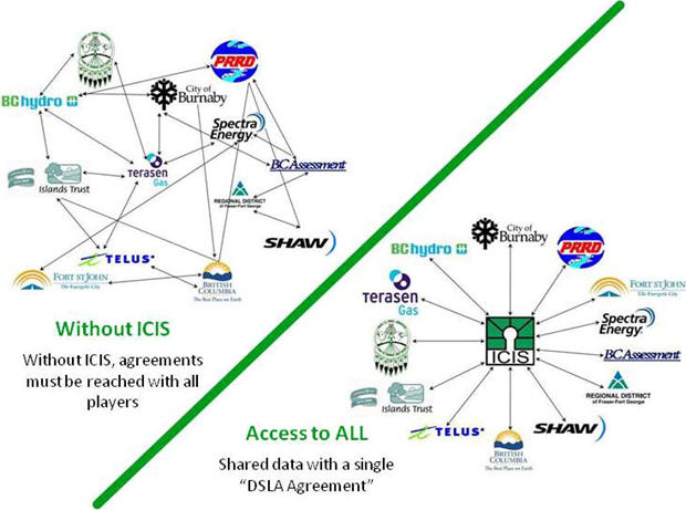 |
Why has interest in ICIS propagated? There are a few fundamental and simple reasons accompanied by more complex and altruistic ones. ICIS members contribute their specific attributed cadastres via a single portal. ICIS overlays and integrates all of the data and delivers them back in a Web-based, viewable, variable and downloadable format. ICIS coordinates data sets across boundaries and jurisdictions that otherwise would remain disparate and silo-based. That simply addresses, but dramatically understates, the technical part of the value proposition. Another piece of the value proposition involves collaboration. ICIS provides a single administrative hub to join the many distinct, and again disparate, organizations and allows information to flow back and forth seamlessly. Without ICIS, organizations would have individual agreements with each other resulting in multiple duplications of effort, negotiation, associated work and costs. ICIS works under the rules of a strong constitution with governance coming from an equally strong board of directors representing each of the three member segments (province, utility and local government). This results in the addressing of cadastral needs at one table for the betterment of the entire province versus one jurisdiction at a time.
 |
Another significant piece of the value pie involves money. The design of ICIS' CivicSpatial Grant program encourages local government participation in ICIS' effort to build a province-wide cadastral fabric by offsetting costs associated with cadastral data improvement and data delivery automation. This successful program was the brainchild of the ICIS' board of directors and is funded by the provincial members and utilities who are motivated to assist local governments with their cadastre initiatives for the benefit of all.
The success of the ICIS model has earned distinction. ESRI Canada awarded ICIS its Award of Excellence in 2009. The accompanying clip from the ESRI Canada press release elaborates on the significance of this award.
Victoria, BC - May 20, 2009 - The Integrated Cadastral Information Society (ICIS) received ESRI Canada's Award of Excellence at the Regional User Conference in Victoria, BC earlier today. The award was presented to recognize the Society's ability to develop a workable and successful model for provincial data sharing that is the first of its kind in Canada.
"ICIS has demonstrated remarkable leadership by developing an innovative approach to data sharing that is unique in this country," said Myron Doherty, Pacific Regional Manager, ESRI Canada. "Providing a common portal for all members to access spatial data has brought efficiencies and economies of scale to member organizations that are unprecedented even on a global scale."
Of course there were, and continue to be, challenges. Each one is worthy of its own story. Some revolve around such issues as funding for sustainability, creating and evolving embraceable standard data models, and satisfying new geospatial business requirements. These challenges are always dynamic and can lead to opportunities for ICIS in the future.
How do challenges lead to opportunity and accompanying success? This will occur only if the right lessons are learned. ICIS is in a constant state of learning and it is the ongoing interaction and communication with the individual members that facilitates this learning. Two overarching lessons are worth sharing.
Lesson number one is to stick to your knitting. ICIS abides by the ICIS vision of "collaborative sharing and integration of spatial data for the economic and social benefit of British Columbia." All goals and objectives support this vision and must be in alignment with the four strategic themes of demonstrating value, sustaining the society, growing collaboration and communicating. Deviation in the past has diluted results. Today, ICIS delivers on forecasted results while operating within the confines of a relatively small budget.
 |
Lesson number two is to listen carefully. ICIS continually interacts with its stakeholders, formally and informally. ICIS communicates with its board of directors on a quarterly basis for planning and results assessment. ICIS participates in over 30 industry-related events throughout the province annually, and conducted 11 workshops in 2009. The effectiveness of this work is not always an obvious measurable. However, the subsequent increases in membership activity, data sharing and intelligence gathering are clear indicators that the investment is worthwhile. Expenses reduction could accompany technology implementation to achieve seemingly similar results. However, the old-fashioned approach to conducting on-site ICIS workshops seems to work and have its place. The reasons are pretty basic and fundamental: human contact, interaction and spontaneity are just a few. ICIS workshops are not just about providing one-way information on where ICIS is today and education on the use of the Web map. The workshops have proven to be invaluable for fostering collaboration, building relationships and earning trust. The learning never stops and the resultant lessons will always benefit ICIS and its members.
Where is ICIS going? The focus of ICIS' efforts is concentrated on two major initiatives: BCSpatial and AddressBC. There is unanimous agreement throughout the ICIS world that these two projects are fundamental to the ICIS vision and address two major geospatial needs.
Consequently, concentrated ICIS efforts will bring BCSpatial and AddressBC to market.
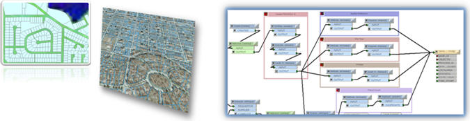 |
BCSpatial is the single parcel fabric initiative. Its mandate is to "establish integration services for and one-stop access to the best available cadastral data for the province." This mandate was realized after pondering the reality that ICIS cannot build a single based parcel fabric on its own. ICIS bases its strengths and successes on sharing, trust, facilitation, and enablement versus imposed change or legislation. A collaborative, decentralized model that respects the autonomy of data custodians and which documents data accuracy and currency as a service is practical and economical. In essence, the value of BCSpatial will facilitate one-stop access to a uniform parcel fabric for the province of British Columbia, resolving multiple and redundant data sources where they exist via qualitative selection criteria.
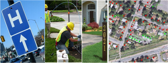 |
AddressBC is the central authoritative, accurate and accessible point-based civic address registry for the province of British Columbia. Many public services and businesses rely on accurate location of civic addresses. Particularly in rural areas, a point address can locate the precise location of a property, building or access point. Local governments in BC currently create and distribute addresses to many users. A central source will make sure users can retrieve address points and locations quickly and accurately. AddressBC will improve access to address locations for a variety of applications including emergency planning. Members benefit through improved and simplified communication of address changes and access to a robust address data model.
The small group operating in Victoria, British Columbia, Canada remains focused on achieving success in integrating disparate geospatial data sets and achieving collaborative success. Now, this is unusual.
 |