 The
storage of spatial data has always been an issue for GIS.The problem
has always been that when you move from the desktop and into the
enterprise, the corporation's ability to allow more users access to
data while maintaining different software for mapping, CAD and even
imagery is difficult at best? Local governments are among the most
common group of users with this need.They have the need to share,
overlay, add data to and store GIS and CAD files in the same place.
They have both the CAD and GIS departments' work against the common
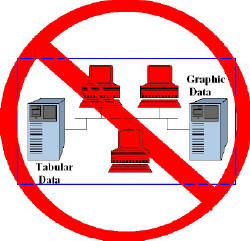
data store.Businesses want to do the same for their data, whether it
is business intelligence (BI) related, location intelligence related,
tabular, graphic or a combination of both.
The
storage of spatial data has always been an issue for GIS.The problem
has always been that when you move from the desktop and into the
enterprise, the corporation's ability to allow more users access to
data while maintaining different software for mapping, CAD and even
imagery is difficult at best? Local governments are among the most
common group of users with this need.They have the need to share,
overlay, add data to and store GIS and CAD files in the same place.
They have both the CAD and GIS departments' work against the common
data store.Businesses want to do the same for their data, whether it
is business intelligence (BI) related, location intelligence related,
tabular, graphic or a combination of both.This concept of common enterprise spatial data has been the focus of product offerings by ESRI, IBM and Oracle as well as several other companies.However, a new wrinkle for BI is the inclusion of location-based information, in addition to the element of "time" as a data type.IBM has defined a new term, STC - spatial temporal computing - in order to frame this concept as a key part of stored data (see GIS Across America).There are even other diversions such as ESRI's OLAP (On-Line Analytical Processing) data analysis plus mapping.
The concept of seamless access and storage and the need to glean, reconcile, analyze data and store it in four dimensions is something already in use by the intelligence community.The challenge is to develop something actionable from disparate data sources that are tabular, graphic, GIS, voice and even text.This sort of data processing and evaluation are what happens in products like Starlight (see Detectives track terrorists by Starlight, by Tom Paulson, Seattle Post-Intelligencer Reporter and Starlight Overview).
The bottom line is that the storage and even definition of data is becoming much different than days past when the spatial dimension of data was not considered.Where before only tables or graphs were the extents of data visualization, now spatial databases are making it easier to integrate a variety of data types.BI dashboards include maps as well as other graphic elements.Location-based data is now an essential component for decision-makers because the solutions by spatial database providers has made it easier to retrieve and analyze in conjunction with other enterprise applications for supply chain management, logistics or marketing.
The December 2005 of LI Magazine explores some of these new ways of seeing and using data.I hope you will find this issue enlightening.
From Our Homepage
Saying Farewell to an Amazing Journey
Communicating with Maps
Is There a GIS Career Ladder?
What does it mean to be geospatially smart? Series
Ways Real Estate and Property Developers Utilize Melissa GeoData for Data-Driven Decisions
Unlocking Value From Daily Satellite Imagery and Insights
Maximizing the Value of Your Address Data with Geo Addressing
How Indoor Mapping Enhances the Security of Smart Buildings
Look Ahead: AI, Location Intelligence and Efficiency
Collaboration Takes on Sea Level Rise & Dynamic Technology Environments
Brownies for Brownfields
Has Everything Been Mapped Already?
How Is Data Literacy Changing in an Artificial Intelligence Landscape
Portfolios for GIS Professionals: More Than Just Maps
How to Create a Distance Matrix in QGIS - A Step-by-Step Guide
7 Ideas for Bringing GIS into the K-12 Classroom
The Geography of Movement