Historically transportation and field services organizations were
interested in one thing "" tracking the location of their personnel and
vehicles. Today however, organizations are focused more than ever on
cutting costs and improving productivity. As a result, many want
to go beyond simply monitoring vehicle movement to include tracking of
other assets and resources out in the field. Until recently
however, the infrastructure and costs required to do this have been out
of reach for most companies.
A number of factors have now made this feasible for operations of any size. In particular, the introduction and widespread availability of mobile GPS (global positioning systems) applications combined with the lower costs of GPS handsets; the growing selection of wireless data solutions; and, the pervasiveness of the Internet have enabled most organizations to implement some type of GPS tracking of their resources, including field workers (service technicians, drivers, sales agents or merchandisers) and assets (trucks, high value assets, trailers or heavy equipment).
Pinpointing the location of workers and/or assets in real-time is now critical for most organizations with resources out in the field.This capability is viewed as a "must have" for enterprises with mobile assets/workers and that recognize the value of more sophisticated location tracking for increasing productivity, improving asset utilization and increasing visibility.
Yet the question remains, is GPS just a high tech audit trail - or does it provide significant value? GPS definitely provides value in cases where mapping and GIS technology can be combined with sophisticated planning applications such as a managed logistics service.Together, the capabilities of these technologies and services can reach beyond just pinging drivers/field workers for their location.
Click for larger image
While straight GPS tracking provides an effective hands free audit trail that allows users to see where their mobile workforce is at any given time, without the ability to measure these workers against an engineered plan, the value of this information is limited. Combing GPS with wireless data solutions however, provides an interactive robust real-time visibility tool that can dramatically reduce operating costs, increase efficiency and improve customer service.
The following summary provides an overview on the types of solutions available, the things to consider when acquiring a GPS tracking service, and the potential benefits of each type of service.

Click for larger image
Options in Tracking Technology
In the marketplace today there are two basic types of tracking technology in use today - GPS and location-based services (LBS).There are considerable variations in service levels and capabilities.Both GPS and LBS are now being combined with wireless data solutions and applications to provide a variety of additional benefits to the mobile resource market.
It is confusing to understand the difference between a $9.99 and a $25 plus a month GPS offering. Managers therefore need to know how to differentiate these services based on their business model and requirements in order to receive the optimum hard benefits and return on investment.
Location-based service (LBS) is a cellular-based service that uses information about the current location of a vehicle using a mobile device.The position can be identified by user entry into a device, or through a GPS receiver carried by the user or vehicle. The location function built into the cell network uses triangulation between the known geographic coordinates of the base stations through which the communication takes place.
Global Positioning System (GPS) (the US military refers to it as NAVSTAR GPS) is a satellite navigation system used for determining one's precise location and providing a highly accurate time reference almost anywhere on earth or in earth's orbit. It uses an intermediate circular orbit (ICO) satellite constellation of at least 24 satellites.
 The essential difference between the two is that LBS utilizes cellular tower networks to pinpoint the GPS receiver location, while GPS uses orbital satellites (at least 24) to deliver a more accurate reading.In addition, LBS has limited reach, since it is not accessible when the GPS receiver moves out of cellular coverage range. The decision to use LBS versus GPS depends on a business' geographical range of operations and level of detail required.
Management of Resources Through Web-based Services
As mentioned earlier, GPS or LBS technologies are now being integrated with wireless data solutions to provide more robust capabilities and to access more detailed information via the Internet. These service offerings, detailed below, vary in sophistication, and should be considered depending on users' specific needs.
Tracking Service
A GPS tracking application provides a simple, affordable way for businesses to track employee or vehicle locations, record shift times and breaks, and capture job/work order information from GPS-enabled mobile phones.Data is sent from the GPS-enabled mobile phone via a mobile application to provide organizations with real-time updates on employee locations.This provides users with a virtually hands free visibility tool that produces a detailed audit trail of the historical location of a mobile resource or asset.

Click for larger image
Tracking and Planning Service
A tracking and planning application combines sophisticated tracking and planning functionality with the simplicity of web-based service to provide dispatchers, managers and support agents with a real-time view of movement and order status.Information can be input from the field and captured as it happens. With this type of application, users have the resources to measure performance against an engineered plan, while still having GPS tracking running in the background as an audit trail.
 In addition to the benefits of a GPS tracking application, this type of service provides the added advantages of allowing users to develop an engineered labor plan to measure real-time information and input updates.By comparing actual performance data to plan, organizations can improve driver/field worker performance by gaining a more accurate accounting of their entire day including, drive time, a.m., p.m., break and service times to increase stops per paid hour.Users can also have more control over field exception management and tracking, and incorporate changes to the plan in real-time (e.g.ETAs and labor standards updates, cancellations, postponements, moves, etc.)
Tracking, Planning and Routing Service
A tracking, planning and routing application goes one step further by providing the ability to optimize routes, and track and monitor fleets or field workers in real-time. As with tracking and planning, it allows for sophisticated tracking and planning functionality but in addition, users have the ability to optimize both static and dynamic routes for maximum efficiency by taking into account geographic zones, time windows and other constraints.It also provides dispatchers, managers and support agents with a real-time, global view of field worker movement and status across an entire fleet.
Both of the tracking and planning and routing service allow for continuous adaptive planning to create a realistic engineered plan and reduce costs in areas such as stops per paid hour, fuel consumption, miles driven and data entry. Features such as automated data transfer and geocoding also improves accuracy and data integrity while reducing the risk of issues, delays and schedule disruptions.
The Bottom Line
While GPS tracking certainly has its merits as a standalone solution, there is much more than can be achieved through the adoption of more comprehensive offerings that leverage the power of GPS resources to deliver more business benefits. However, evolving into these types of solutions does not necessarily mean investing in a complete conversion overnight.As Web-based services, offered on a subscription, pay-as-you-go basis allow for improved control and management of resources.
When seeking out a supplier, it is important that the provider can offer both baseline GPS tracking, as well as a migration path towards a more comprehensive offerings such as combined tracking, planning and/or routing to support business requirements as they grow and increase in complexity.Â
To achieve the full benefits of these types of applications, it is also important to work with the supplier to understand how to maximize total cost of ownership and return on investment. For many operations today, getting the full value out of GPS services through more sophisticated applications delivers considerable financial and productivity benefits within a relatively short space of time. In today's highly competitive world, where cost of services continue to escalate, this type of functionality will be critical to ensuring survival over the long term.
Images provided by Cube Route
A number of factors have now made this feasible for operations of any size. In particular, the introduction and widespread availability of mobile GPS (global positioning systems) applications combined with the lower costs of GPS handsets; the growing selection of wireless data solutions; and, the pervasiveness of the Internet have enabled most organizations to implement some type of GPS tracking of their resources, including field workers (service technicians, drivers, sales agents or merchandisers) and assets (trucks, high value assets, trailers or heavy equipment).
Pinpointing the location of workers and/or assets in real-time is now critical for most organizations with resources out in the field.This capability is viewed as a "must have" for enterprises with mobile assets/workers and that recognize the value of more sophisticated location tracking for increasing productivity, improving asset utilization and increasing visibility.
Yet the question remains, is GPS just a high tech audit trail - or does it provide significant value? GPS definitely provides value in cases where mapping and GIS technology can be combined with sophisticated planning applications such as a managed logistics service.Together, the capabilities of these technologies and services can reach beyond just pinging drivers/field workers for their location.

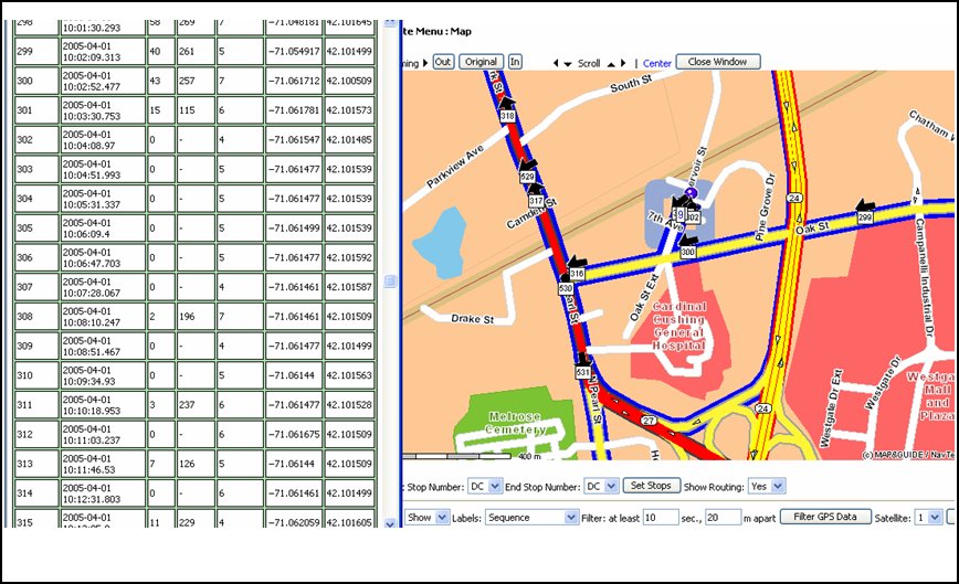
Click for larger image
Combining GPS enabled devices with
wireless data solutions allows
managers to set an engineered plan, as well as track and capture field
data based on that plan to see where changes were made and if and when
any exceptions occurred.GPS in conjunction with GIS and planning
applications provides visibility into service activities in the field,
whether personnel are on the road or at the client site.Â
While straight GPS tracking provides an effective hands free audit trail that allows users to see where their mobile workforce is at any given time, without the ability to measure these workers against an engineered plan, the value of this information is limited. Combing GPS with wireless data solutions however, provides an interactive robust real-time visibility tool that can dramatically reduce operating costs, increase efficiency and improve customer service.
The following summary provides an overview on the types of solutions available, the things to consider when acquiring a GPS tracking service, and the potential benefits of each type of service.

Click for larger image
Options in Tracking Technology
In the marketplace today there are two basic types of tracking technology in use today - GPS and location-based services (LBS).There are considerable variations in service levels and capabilities.Both GPS and LBS are now being combined with wireless data solutions and applications to provide a variety of additional benefits to the mobile resource market.
It is confusing to understand the difference between a $9.99 and a $25 plus a month GPS offering. Managers therefore need to know how to differentiate these services based on their business model and requirements in order to receive the optimum hard benefits and return on investment.
Location-based service (LBS) is a cellular-based service that uses information about the current location of a vehicle using a mobile device.The position can be identified by user entry into a device, or through a GPS receiver carried by the user or vehicle. The location function built into the cell network uses triangulation between the known geographic coordinates of the base stations through which the communication takes place.
Global Positioning System (GPS) (the US military refers to it as NAVSTAR GPS) is a satellite navigation system used for determining one's precise location and providing a highly accurate time reference almost anywhere on earth or in earth's orbit. It uses an intermediate circular orbit (ICO) satellite constellation of at least 24 satellites.
 The essential difference between the two is that LBS utilizes cellular tower networks to pinpoint the GPS receiver location, while GPS uses orbital satellites (at least 24) to deliver a more accurate reading.In addition, LBS has limited reach, since it is not accessible when the GPS receiver moves out of cellular coverage range. The decision to use LBS versus GPS depends on a business' geographical range of operations and level of detail required.
Management of Resources Through Web-based Services
As mentioned earlier, GPS or LBS technologies are now being integrated with wireless data solutions to provide more robust capabilities and to access more detailed information via the Internet. These service offerings, detailed below, vary in sophistication, and should be considered depending on users' specific needs.
Tracking Service
A GPS tracking application provides a simple, affordable way for businesses to track employee or vehicle locations, record shift times and breaks, and capture job/work order information from GPS-enabled mobile phones.Data is sent from the GPS-enabled mobile phone via a mobile application to provide organizations with real-time updates on employee locations.This provides users with a virtually hands free visibility tool that produces a detailed audit trail of the historical location of a mobile resource or asset.
Benefits of a GPS tracking application
include the ability to:
** Track hours and enforce overtime policies
** Allow best practice management of field workers
** Have real-time status of field workers and deliveries
** Improve customer service through real-time status update
** Improve field worker efficiency
** Decrease complexity of communication between office and field workers
** Manage service times
** Protect assets

Click for larger image
Tracking and Planning Service
A tracking and planning application combines sophisticated tracking and planning functionality with the simplicity of web-based service to provide dispatchers, managers and support agents with a real-time view of movement and order status.Information can be input from the field and captured as it happens. With this type of application, users have the resources to measure performance against an engineered plan, while still having GPS tracking running in the background as an audit trail.
 In addition to the benefits of a GPS tracking application, this type of service provides the added advantages of allowing users to develop an engineered labor plan to measure real-time information and input updates.By comparing actual performance data to plan, organizations can improve driver/field worker performance by gaining a more accurate accounting of their entire day including, drive time, a.m., p.m., break and service times to increase stops per paid hour.Users can also have more control over field exception management and tracking, and incorporate changes to the plan in real-time (e.g.ETAs and labor standards updates, cancellations, postponements, moves, etc.)
Tracking, Planning and Routing Service
A tracking, planning and routing application goes one step further by providing the ability to optimize routes, and track and monitor fleets or field workers in real-time. As with tracking and planning, it allows for sophisticated tracking and planning functionality but in addition, users have the ability to optimize both static and dynamic routes for maximum efficiency by taking into account geographic zones, time windows and other constraints.It also provides dispatchers, managers and support agents with a real-time, global view of field worker movement and status across an entire fleet.
Both of the tracking and planning and routing service allow for continuous adaptive planning to create a realistic engineered plan and reduce costs in areas such as stops per paid hour, fuel consumption, miles driven and data entry. Features such as automated data transfer and geocoding also improves accuracy and data integrity while reducing the risk of issues, delays and schedule disruptions.
The Bottom Line
While GPS tracking certainly has its merits as a standalone solution, there is much more than can be achieved through the adoption of more comprehensive offerings that leverage the power of GPS resources to deliver more business benefits. However, evolving into these types of solutions does not necessarily mean investing in a complete conversion overnight.As Web-based services, offered on a subscription, pay-as-you-go basis allow for improved control and management of resources.
When seeking out a supplier, it is important that the provider can offer both baseline GPS tracking, as well as a migration path towards a more comprehensive offerings such as combined tracking, planning and/or routing to support business requirements as they grow and increase in complexity.Â
To achieve the full benefits of these types of applications, it is also important to work with the supplier to understand how to maximize total cost of ownership and return on investment. For many operations today, getting the full value out of GPS services through more sophisticated applications delivers considerable financial and productivity benefits within a relatively short space of time. In today's highly competitive world, where cost of services continue to escalate, this type of functionality will be critical to ensuring survival over the long term.
Images provided by Cube Route
From Our Homepage
Saying Farewell to an Amazing Journey
Communicating with Maps
Is There a GIS Career Ladder?
What does it mean to be geospatially smart? Series
Ways Real Estate and Property Developers Utilize Melissa GeoData for Data-Driven Decisions
Unlocking Value From Daily Satellite Imagery and Insights
Maximizing the Value of Your Address Data with Geo Addressing
How Indoor Mapping Enhances the Security of Smart Buildings
Look Ahead: AI, Location Intelligence and Efficiency
Collaboration Takes on Sea Level Rise & Dynamic Technology Environments
Brownies for Brownfields
Has Everything Been Mapped Already?
How Is Data Literacy Changing in an Artificial Intelligence Landscape
Portfolios for GIS Professionals: More Than Just Maps
How to Create a Distance Matrix in QGIS - A Step-by-Step Guide
7 Ideas for Bringing GIS into the K-12 Classroom
The Geography of Movement