
Directions Magazine
recently conducted an interview with the people responsible for establishing
GIS technology in the city of Hope, Arkansas, a rural town of about 11,000
people and more popularly recognized as the birthplace of former president
Bill Clinton.We asked Catherine Cook, the city manager, and Darrell Allen,
GIS Manager about how it got started and their current site configuration.
The information they provided is a detailed look at how one city is taking
advantage of GIS and how it maintains its mission.Their insights will
be extremely informative to those local governments who are just now looking
at what might work best for their rural communities.
1.How was GIS first
introduced to the City of Hope?
The City Manager,
Catherine Cook, heard about GIS at the ICMA (International City/County
Management Association) and the ACMA (Arkansas City Management Association)
conferences in 1995/1996.The CAST (Center for Advanced Spatial Technology)Lab from the University of Arkansas
at Fayetteville supplied information through a presentation about GIS and
its many uses at the ACMA conference.This exposure got the ball rolling
and the idea for Hope to start a GIS program was discussed.The then Assistant
City Manager David Sterling and Shelby Johnson, at that time with CAST, did a presentation of the GIS concept to the Board of Directors.
2.What factors,
political or managerial, prompted you to consider investing in the technology?
Ms.Cook saw an opportunity
to create, store, and use information about the City's infrastructure and
tasks more efficiently.More readily available data about Hope and the
surrounding area would give the City a better way to help its citizens
and bring in economic development.
3.What sources
of information (consultants, universities, etc.) helped to formulate your
opinion on the value of this technology?
The resources sought
to gather information about GIS came from other cities' experiences, ICMA,
the Arkansas Municipal League, the National League of Cities, CAST, and
the internet.
4.Can you describe
the "day to day" applications for which you use the technology to inform
the public or other city officials?
"What is the zoning
here?", "What subdivision am I in?" "Where is the nearest sewer?" and "Am
I in the city limits?" are common, day-to-day questions received by City
staff.Information in the GIS can help answer these and many
other basic questions,
in addition to providing location maps for prospective Economic Development
clients and for grant applications.
5.What obstacles,
if any, did you face in promoting the technology in order to receive funding?
The City of Hope Board
of Directors saw the potential benefits of this technology and did not
have any substantial problems to funding a GIS development and maintenance.
The only thing that could be an obstacle in the future is if we do not
keep promoting and showing results to the Board.This is something Catherine
has stressed since the beginning.Always give periodic updates to the people
who decide the future of the program.
6.What departments
have you determined should be using the technology and how are you promoting
the need to share resources?
All departments would
benefit from some aspect of having a GIS.All department Superintendents
are encouraged to seek assistance with any question or project that could
be answered or enhanced with maps or some form of location-based information.
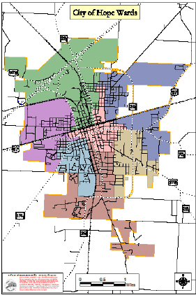
Click for larger image
7.What are your
long range goals for deploying this technology in helping the city to be
a better managed community?
Integration of pertinent
information created through the GIS into the Emergency Services facet of
the City and other entities is a long-term goal for the program.The community
expects faster and more efficient responses to be ongoing goals from the
Fire and Police Departments and the Ambulance Service.Other long-range
goals include better planning, having more information available for Economic
Development prospects, and inclusion of data on the internet so citizens
can look-up answers to questions, thus avoiding a trip to City Hall or
the Public Works building.
8.What system did
you choose?
I chose ESRI's ArcView
GIS software due to features and previous experience.
9.What is the current
configuration (software, hardware, data, staff)?
Software:
We are currently using ArcGIS 8.1 (ArcView package) for the main GIS software.
We also have ArcView 3.x, TerraSync for GPS data collection, MediaMapper
for digital photo/GPS integration, and Blue Marble's Geographic
Transformer.
Hardware:
The department has a Trimble Pro XRS GPS unit, a HP 755CM plotter, a HP
4500 color laserjet, an UMAX 11x17 scanner, a Sony digital camera, and
a Contour XLRic laser rangefinder that integrates with the GPS.The
computers running
the GIS are a dual Pentium Xeon workstation and an IBM Pentium III laptop.
Data: The City of Hope GIS consists of a wide array of data.The base is the street network that consists of street centerline data created by a GPS. This data was produced for the local utility company before the City of Hope began its system.We have zoning, subdivisions, sewer system, addressed streets, infrastructure at the park, City property locations, and dozens of smaller layers of information.
Staff: The staff currently consists of only Darrell Allen as the GIS Coordinator.
10.How much was
your initial cost for installation?
Initial expenditure
for startup was approximately $30,000 for most of the items listed above.
The workstation has been upgraded since the start and the laptop added,
along with software upgrades, but the base items are still the same.The
base data (GPS road network) was given to us by Hope Water & Light,
a local utility company.It cost them about $15,000, thus saving us time
and money.
11.What training
did you or staff members obtain?
I received a Cerificate
in GIS from the University of New Haven.This was composed of a series
of four Graduate courses in GIS.I have also taken two courses in ArcView
3.2 and an Introduction to ArcView 8.1 class since employment with the
City of Hope.
12.What is your
ongoing budget to sustain GIS technology development?
This varies from year
to year, but the average is about $15,000.Large projects, like DOQQ production
slated for next year, would significantly increase that amount.
13.Do you spend
more on software? Data? Hardware?
So far in the three
years since the City of Hope GIS began, more has been spent on building
the hardware system, but will change when various projects come up.The
expenditure will probably be cyclic due to hardware needing to be replaced
every 3-5 years.
14.On a daily basis,
what takes most of your time?
There are generally
no two days alike, but map production is probably a big time consumer that
comes in spurts..The GPS locating of the sewer system takes a lot of time,
but is not done but one day every couple of weeks, on average.
15.What are your
long term goals for using the technology?
I would like to see
the all the various departments able to access and use the data on their
own.For example, the wastewater guys using the manhole layer and a GPS
to navigate to a remote manhole.I would like to see our 911 system and
Police Department using address point locations to respond to an emergency.
The main goal is to have others using the data to make better, more efficient
decisions during their daily work routine.
Visit the City of Hope, today at http://www.hopeusa.com/