Educators have always insisted they not leave out the
"three Rs": reading, writing and arithmetic. That paradigm may be
shifting to "three Rs and a G" - and world enterprise is most
appreciative.
The "G" is for geography - the science that links a range of interests and information from a variety of cultures based on a visual map. This subject is moving to the forefront of the minds of educators as its utility, later in life, in developing business strategy within public and private sectors around the world becomes more and more evident.
As a nation, the United States has received a clear signal from studies like the 2006 National Geographic/Roper survey, which followed an earlier survey in 2002. In the latest survey, young adults aged 18 to 24 in nine countries were surveyed and the results showed that Americans were outperformed in geographic literacy by young adults in seven countries - Sweden, Germany, Italy, France, Japan, Great Britain and Canada. Only 13% of the Americans surveyed correctly identified Iraq on a map of Asia and the Middle East. Only about half of young Americans were able to locate landmasses such as Japan and India on a global map. And 20% of those surveyed could not find the Pacific Ocean.
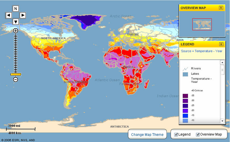
But set aside our less-than-satisfactory performance at a Geography Bee, and jump ahead to the terrain of public and private firms where geography has become one of the most powerful weapons in the arsenal. Maybe our educational system does not play out well in a Geography Bee, but you need to look at the extra edge firms are getting when they embrace not just geography, but the story that it tells. With the coming of age of GIS, the geography story becomes one where decisions can be made like never before. Almost anything can be plotted on a map.
Political affiliation, beliefs, shoe size, hydrologic data, superfund sites - you name it and it can be plotted and viewed. This is where a spatial eye identifies a trend at a glance. GIS now allows many different entities to utilize huge amounts of important data and show them spatially on a digital map.
Recently TerraGo Technologies conducted a survey of Geospatial Solutions newsletter subscribers. The survey found that over 90% of the respondents believed that "demand for geospatial data from non-traditional users is increasing, with almost as many reporting increasing demand from outside their organizations as well."
Interestingly, the survey showed that less than half of respondents said they currently have an enterprise strategy in place for sharing geospatial data with other departments and organizations. According to the survey, "Another third said they are working on one."
Why were the survey results so skewed?
Because... geography helps tell a story like no other means of communication. This story may go on to help develop a strategy and achieve results. Before GIS: difficult story to tell. After GIS: comprehensive, visual, easy story to tell. GIS and information can be so powerful. They can illustrate impending problems before, and after, they've struck.
In his movie "An Inconvenient Truth," former Vice President Al Gore visually illustrates the impending doom of global warming by illustrating many different points on a map. In his presentation, he shows rising water levels and how they may easily obliterate present day cities in the years ahead.
He spans the globe, showing where bodies of water are receding and have even dried up. He zooms in to show the arid land that was once water. The maps are unfolded to show the world and the dots represent troubled areas due to many different variables, from carbon dioxide content to temperature decreases. The story that Gore tells is parallel to many, many stories that can be told for the modern enterprise.
When it comes to important information, location matters. When the stock market is sinking in the United States, there's a story to be told about its effect in Europe and the Far East. You don't need to make a decision on what to do by reading an email. You can see the indicators on a map. From that perspective, geography is gaining recognition as a key ingredient in the strategy of a business or other organization.
A public health organization is hardly one that would rely on mapping to make decisions. But when there is an outbreak of Avian Flu, the geographic coordinates of its spread are important facts that can make a big difference in controlling and understanding the problem. A map presents a clear picture of the problem and aids in controlling it.
It's difficult to walk away from such facts without wondering why we'd ever want to let geography slip off our plate as a critical discipline whose importance is greater now than ever before.
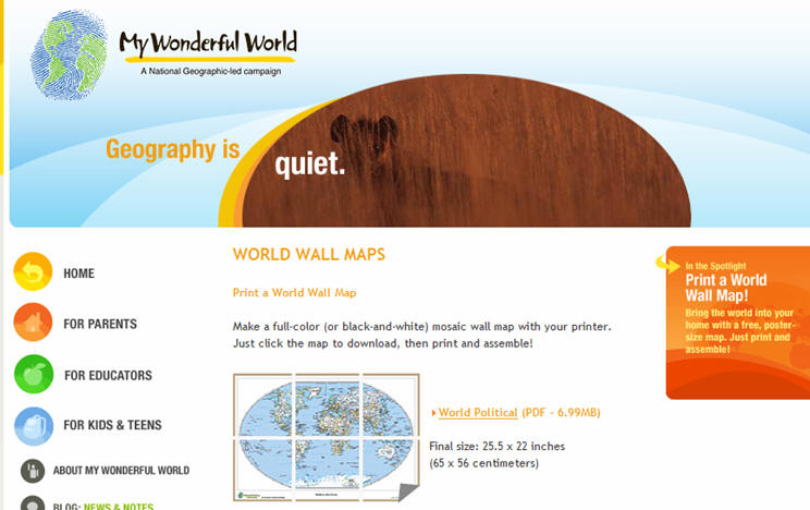
This may be why National Geographic has set up websites like MyWonderfulWorld.org in partnership with firms like ESRI. Or why the American Association of Geographers was awarded a half-million dollar grant to provide a Teachers Guide for the inclusion of geography in the classroom. It's not meant to spotlight what we can't do geographically, but rather to accent just what geography can do for the next generation of workers - in financial services, economic development, healthcare, construction, state and local government and every corner of our economy.
The presence of GIS technology only amplifies this concern. Geography with technology can precipitate powerful solutions to problems in all corners or our economic, environmental and even political terrain.
For example, geography is the fabric of foreign relations and political policy. In an article in the Pittsburgh Tribune-Review (Sunday, January 28, 2007), reporter Joseph Mistick reported how geography is an important part of everyday news stories: "Who knew the difference between Iran and Iraq before Bush's war against Saddam Hussein? The whole Middle East has come into focus since 'the great geographer' launched 'Shock and Awe' between the Tigris and the Euphrates."
Mistick went on to say, "While war teaches us much about geography, a solid knowledge of geography can provide the key to political success. On every rung of the political ladder there is no substitute for a thorough understanding of the geography of an election district or ward or city as our civic wars are fought."
The Pittsburgh Tribune-Review article also pointed out that Mother Teresa started her work in Calcutta as a geography teacher at a local high school in 1923. Perhaps her geography teachings gave direction to her endeavors in spanning the globe and leaving a permanent legacy.
It is geography that can tell a complete and meaningful story. And the story it tells can solve problems and give meaning that is not only riveting, but also penetrating and long lasting in developing strategy and direction for public and private entities of the world.
The "G" is for geography - the science that links a range of interests and information from a variety of cultures based on a visual map. This subject is moving to the forefront of the minds of educators as its utility, later in life, in developing business strategy within public and private sectors around the world becomes more and more evident.
As a nation, the United States has received a clear signal from studies like the 2006 National Geographic/Roper survey, which followed an earlier survey in 2002. In the latest survey, young adults aged 18 to 24 in nine countries were surveyed and the results showed that Americans were outperformed in geographic literacy by young adults in seven countries - Sweden, Germany, Italy, France, Japan, Great Britain and Canada. Only 13% of the Americans surveyed correctly identified Iraq on a map of Asia and the Middle East. Only about half of young Americans were able to locate landmasses such as Japan and India on a global map. And 20% of those surveyed could not find the Pacific Ocean.
But set aside our less-than-satisfactory performance at a Geography Bee, and jump ahead to the terrain of public and private firms where geography has become one of the most powerful weapons in the arsenal. Maybe our educational system does not play out well in a Geography Bee, but you need to look at the extra edge firms are getting when they embrace not just geography, but the story that it tells. With the coming of age of GIS, the geography story becomes one where decisions can be made like never before. Almost anything can be plotted on a map.
Political affiliation, beliefs, shoe size, hydrologic data, superfund sites - you name it and it can be plotted and viewed. This is where a spatial eye identifies a trend at a glance. GIS now allows many different entities to utilize huge amounts of important data and show them spatially on a digital map.
 |
Recently TerraGo Technologies conducted a survey of Geospatial Solutions newsletter subscribers. The survey found that over 90% of the respondents believed that "demand for geospatial data from non-traditional users is increasing, with almost as many reporting increasing demand from outside their organizations as well."
Interestingly, the survey showed that less than half of respondents said they currently have an enterprise strategy in place for sharing geospatial data with other departments and organizations. According to the survey, "Another third said they are working on one."
Why were the survey results so skewed?
Because... geography helps tell a story like no other means of communication. This story may go on to help develop a strategy and achieve results. Before GIS: difficult story to tell. After GIS: comprehensive, visual, easy story to tell. GIS and information can be so powerful. They can illustrate impending problems before, and after, they've struck.
In his movie "An Inconvenient Truth," former Vice President Al Gore visually illustrates the impending doom of global warming by illustrating many different points on a map. In his presentation, he shows rising water levels and how they may easily obliterate present day cities in the years ahead.
He spans the globe, showing where bodies of water are receding and have even dried up. He zooms in to show the arid land that was once water. The maps are unfolded to show the world and the dots represent troubled areas due to many different variables, from carbon dioxide content to temperature decreases. The story that Gore tells is parallel to many, many stories that can be told for the modern enterprise.
When it comes to important information, location matters. When the stock market is sinking in the United States, there's a story to be told about its effect in Europe and the Far East. You don't need to make a decision on what to do by reading an email. You can see the indicators on a map. From that perspective, geography is gaining recognition as a key ingredient in the strategy of a business or other organization.
 |
A public health organization is hardly one that would rely on mapping to make decisions. But when there is an outbreak of Avian Flu, the geographic coordinates of its spread are important facts that can make a big difference in controlling and understanding the problem. A map presents a clear picture of the problem and aids in controlling it.
It's difficult to walk away from such facts without wondering why we'd ever want to let geography slip off our plate as a critical discipline whose importance is greater now than ever before.
This may be why National Geographic has set up websites like MyWonderfulWorld.org in partnership with firms like ESRI. Or why the American Association of Geographers was awarded a half-million dollar grant to provide a Teachers Guide for the inclusion of geography in the classroom. It's not meant to spotlight what we can't do geographically, but rather to accent just what geography can do for the next generation of workers - in financial services, economic development, healthcare, construction, state and local government and every corner of our economy.
The presence of GIS technology only amplifies this concern. Geography with technology can precipitate powerful solutions to problems in all corners or our economic, environmental and even political terrain.
For example, geography is the fabric of foreign relations and political policy. In an article in the Pittsburgh Tribune-Review (Sunday, January 28, 2007), reporter Joseph Mistick reported how geography is an important part of everyday news stories: "Who knew the difference between Iran and Iraq before Bush's war against Saddam Hussein? The whole Middle East has come into focus since 'the great geographer' launched 'Shock and Awe' between the Tigris and the Euphrates."
Mistick went on to say, "While war teaches us much about geography, a solid knowledge of geography can provide the key to political success. On every rung of the political ladder there is no substitute for a thorough understanding of the geography of an election district or ward or city as our civic wars are fought."
The Pittsburgh Tribune-Review article also pointed out that Mother Teresa started her work in Calcutta as a geography teacher at a local high school in 1923. Perhaps her geography teachings gave direction to her endeavors in spanning the globe and leaving a permanent legacy.
It is geography that can tell a complete and meaningful story. And the story it tells can solve problems and give meaning that is not only riveting, but also penetrating and long lasting in developing strategy and direction for public and private entities of the world.
From Our Homepage
Saying Farewell to an Amazing Journey
Communicating with Maps
Is There a GIS Career Ladder?
What does it mean to be geospatially smart? Series
Ways Real Estate and Property Developers Utilize Melissa GeoData for Data-Driven Decisions
Unlocking Value From Daily Satellite Imagery and Insights
Maximizing the Value of Your Address Data with Geo Addressing
How Indoor Mapping Enhances the Security of Smart Buildings
Look Ahead: AI, Location Intelligence and Efficiency
Collaboration Takes on Sea Level Rise & Dynamic Technology Environments
Brownies for Brownfields
Has Everything Been Mapped Already?
How Is Data Literacy Changing in an Artificial Intelligence Landscape
Portfolios for GIS Professionals: More Than Just Maps
How to Create a Distance Matrix in QGIS - A Step-by-Step Guide
7 Ideas for Bringing GIS into the K-12 Classroom
The Geography of Movement