With the country bracing itself for a war with Iraq, Americans are concerned about their security.Local, state, and federal agencies realize they need a single application to facilitate and coordinate the rapid movement of personnel and resources in response to emergency situations.
The Problem
Since emergency response responsibilities cross all levels of government,
such a tool must be secure and offer a common operating environment.This
application would also need to be capable of combining data with other
information systems and integrating separate data sources, while supplying
access to critical transportation infrastructure data.This includes roads,
bridges, tunnels and dams, and real-time information relating to dynamic
factors, such as weather, traffic, and vehicle locations.
The Solution
Fortunately, a system with many of these capabilities already exists.
In 1999, the Military Traffic Management Command Transportation Engineering
Agency (MTMCTEA) spearheaded the
development of the Intelligent Road & Rail Information Server (IRRIS).
IRRIS is a fully secure Web-accessible geographic information system (GIS)
that leverages open architecture technology to combine static and real-time
transportation information into one simple mapping interface.
In the year after September 11, MTMCTEA and GeoDecisions,
a software-independent information technology company and the prime contractor
for IRRIS, have worked with government agencies engaged in U.S.military
and Homeland Security operations to expand IRRIS' capabilities to meet
their changing needs.During this period, IRRIS has evolved with the addition
of location based services technologies, to become a single source of transportation
logistics and real-time tracking information.
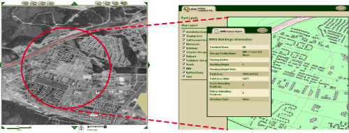
Detailed Infrastructure Maps (Click above for larger image)
Currently, IRRIS accesses more than 140 different data layers, including a Homeland Security database that is now under development by the U.S. government.These data layers include items, such as the location of hospitals, roads, bridges, railroads, waterways, and traffic and weather incidents. The IRRIS database contains one terabyte of data and is accessible by 400-500 military users at any given time.
Tracking Capabilities
The core mapping and information functions of IRRIS provide an ideal
platform for real-time vehicle and cargo tracking. IRRIS incorporates
the latest tracking technology by using global positioning system units
mounted on vehicles to track location.This allows military planners anywhere
in the country to view a national or regional map of the locations of all
military freight traffic or just those carrying sensitive shipments.
![]()
Convoy Tracking (Click above for larger image)
IRRIS is currently tracking sensitive cargo in the continental U.S. and freight of all kinds, everything from missiles to toothpaste, worldwide.
User-Friendly Technology
As a spatial information and mapping system, IRRIS leverages Web-based
GIS technology, providing an array of map layers and applications to the
decision makers responsible for troop and cargo transport. These
users log onto the system via the Internet to preview road conditions or
rail routes before traveling to their destination.
"The great thing about this system is anybody who can access the Internet and can point and click can use it," said Bruce Hines, Chief of MTMCTEA's Office of the Special Assistant for Transportation Engineering.
IRRIS highlights routes for military personnel, convoys, and freight to follow from domestic forts and ports.Users can also display aerial photos, waterways, terminals, hazardous materials roads, and military installations.
To provide decision makers with details about tracked shipments, the development team uses military databases, such as the Defense Transportation Tracking System. Authorized users may query these systems to pinpoint shipments by location or content. If an IRRIS alarm indicates a particular shipment is in peril, the appropriate military personnel know exactly what the shipment contains and how best to respond.
In the future, the application will create buffers, also called "fences," around each designated route.If a shipment deviates from the "fenced" area, an alarm will be triggered to alert the appropriate staff.
Real-Time Information
Real-time weather feeds allow IRRIS to provide notifications of weather
events that may impact routes and vehicles. Live traffic reports
for the entire U.S.are delivered to IRRIS via another secure socket connection.
These reports are automatically geocoded as they enter the IRRIS database
to match incident report locations with their positions on the system base
map.
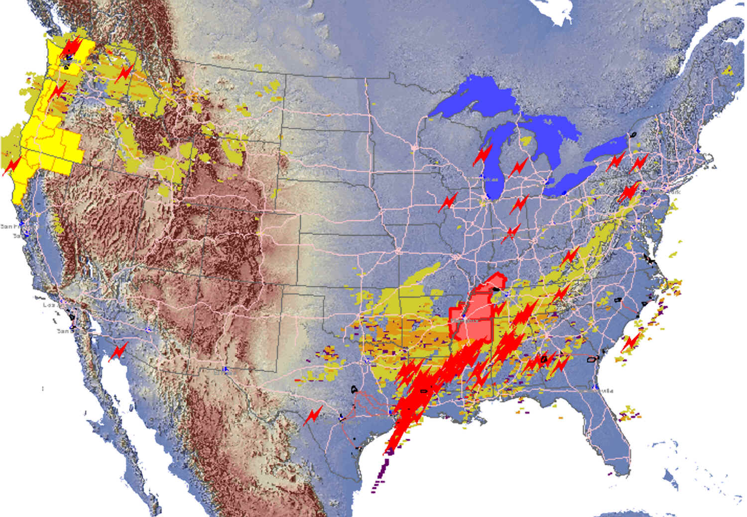
Real-Time Weather (Click above for larger image)
GeoDecisions is working on adding enhanced routing functionality to IRRIS. Soon IRRIS users will have access to accurate point-to-point driving directions.
In the IRRIS routing subsystem currently being developed, the user will select origination and destination points, as well as the type of military vehicles that will be traveling. IRRIS will then take into account real-time data, including traffic and weather reports, and static information, such as road width and load restrictions, to accommodate the vehicles before displaying an onscreen map of the best route.
Future Use
Even for civilians not involved with Homeland Security or government,
IRRIS has a future.Built entirely with open-architecture technology, IRRIS
offers the potential for state departments of transportation to integrate
their infrastructure information or intelligent transportation systems
with IRRIS to create a National Infrastructure Baseline system, a possibility
now under consideration by the U.S.Department of Transportation.
"This national system could provide private sector users with the type of transportation logistics information one could use, for instance, to run a fleet of business vehicles more efficiently or simply make daily commutes easier," said Jonathan Pollack, vice president of advanced technology at GeoDecisions.
For military and Homeland Security, government, and even civilian applications,
there has never been a "one-stop-shop" on the Web, that provides a common
operating picture for infrastructure, real-time information feeds, and
a tool for interagency coordination.As IRRIS continues to evolve, participating
government agencies are continuing to discover new uses for it.
Authors
By Marc Barthello, head of the office of the special assistant for transportation engineering, MTMCTEA & Alan Beiagi, senior development manager, GeoDecisions