Blue Raster Incorporates Esri Technology into DC Office of Zoning Map
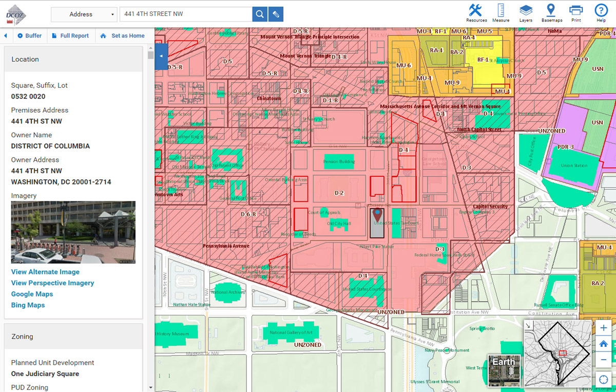
Today, Esri announced that the Washington, DC, Office of Zoning (DCOZ) has released a new 2016 Zoning Handbook and interactive Zoning Map. Esri partner Blue Raster, based in Arlington, Virginia, developed the map using the ArcGIS platform. Through their internal partnership, Zoning and the DC Office of Planning, realized a revision was long overdue. This is the first time the Zoning Regulations and Zoning Map have been comprehensively revised since 1958. The handbook and map are accessible from DCOZ's website.
"The new ZR16 Zoning Map application and the Zoning Handbook generate a greater active interest in zoning by presenting visual data and a lot of content in a clear and concise manner. Blue Raster effectively worked to translate DCOZ's vision into an application we are all proud of," said Nyambi A. Nyambi, chief technology officer, District of Columbia Office of Zoning.
The new Zoning Map includes the following:
- Detailed zoning data
- Customized reports for zoning and planning information
- Responsive design for mobile devices
- High-resolution cartographic printing and documents
- Ability to leverage the wealth of data from DC Office of the Chief Technology Officer open data
- New ways of accessing information for Washington, DC, citizens and businesses
"The team at Blue Raster is very excited to work with the DC Office of Zoning to deliver the new interactive mapping application," said Stephan Ansari, principal, Blue Raster. "Ready access to the new Zoning Regulations empowers DC government, citizens, and developers to continue the historic revitalization of our nation's capital."
The new Zoning Regulations will become effective on September 6, 2016.
"The Zoning Handbook will help residents in the DC area understand and use the updated Zoning Regulations," said Anthony Puzzo, Esri. "Blue Raster created an intuitive interactive map app to make the vast amount of important zoning information that is associated with properties in this area more accessible."
# # #
About Esri
Since 1969, Esri has been giving customers around the world the power to think and plan geographically. The market leader in GIS, Esri software is used in more than 350,000 organizations worldwide including each of the 200 largest cities in the United States, most national governments, more than two-thirds of Fortune 500 companies, and more than 7,000 colleges and universities. Esri applications, running on more than one million desktops and thousands of Web and enterprise servers, provide the backbone for the world's mapping and spatial analysis. Esri is the only vendor that provides complete technical solutions for desktop, mobile, server, and Internet platforms. Visit us at www.esri.com.
Esri, the Esri globe logo, GIS by Esri, ArcGIS, www.esri.com, and @esri.com are trademarks, registered trademarks, or service marks of Esri in the United States, the European Community, or certain other jurisdictions. Other companies and products mentioned herein may be trademarks or registered trademarks of their respective trademark owners.
Press Information:
Karen Richardson, Esri
Tel.: 909-793-2853, extension 1-3491
E-mail (press only): press@esri.com
General Information: info@esri.com