If you’ve ever wondered why, in this day and age, asset and geospatial information collection for new developments and construction projects is not an efficient process, you are not alone. While the majority of new asset management infrastructure information being designed and recorded is in digital form in CAD systems that are quite capable of being coordinate correct and including attributes and other key information, this data is often missing, provided in PDF files, or even worse, needs to be re-captured into GIS after the project is completed. In architectural design construction projects the use of BIM (building information models) and modern design software is becoming standard practice and has opened a new era of data capture, transfer and construction management, such that information provided when a building project is completed is up to date and orders of magnitude more complete, saving organizations millions of dollars. Why is this not the case for geospatial data and asset infrastructure projects?
It’s more than a technical problem, in fact it may be that technology is no longer the problem. Open Spatial for example has a cloud and desktop solution that includes the CAD tools, Data standards, online drawing validation prior to submittal and direct creation of attributed GIS data (you can find out more here – www.vaildation.openspatial.com. If you are planning on automating the “data” part of your CAD submittals you could look at the recent Directions Magazine webinar - 7 Aspects to Consider for Automating the Creation of GeoBIM Models and Digital Twins from CAD Drawings (directionsmag.com). Here, we examine the issues and what would it take to change the data flow and data validation relating to as-constructed plans and the transfer of information? Also, what would be the benefits?
We’ve always done it this way
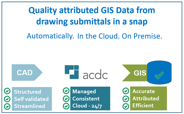
Typically, the current workflow of as-constructed plan submittals, and the data associated with them, is one that has been developed over some time. The process involves many steps and the involvement of various groups depending on the stage of the project. Resistance to change is exacerbated by lack of ownership of the entire process by one group, multiple requirements along the way and a lack of appreciation of the cost and impact of poor and incomplete asset information. The delay and cost of recapturing information after the fact is substantial and instead of being costed into the original project is often paid for by internal funds. The status quo is however changing. The ever increasing pressure to have accurate infrastructure data and the availability of solutions like ACDC from open Spatial (www.validation.openspatial.com) it could be that the industry is at the cusp of a revolutionary change in the work flow and way as-constructed submittals are validated and consumed into GIS and asset management systems.
We have a CAD standard
In an effort to streamline plan checking and make submittals consistent many organizations have a CAD standard. While this is an important start it doesn’t go far enough for the data concerned and manual checking is still required. CAD standards are focused on presentation within a structured set of layers, line styles and blocks but usually don’t include sufficient information on the attributes required, don’t include techniques for checking mandatory information is supplied. Using a CAD standard doesn’t ensure all entities are fully attributed. Point data in CAD drawings can easily be attributed but assigning attributes to linear and polygon features is difficult and seldom done. To go from CAD to GIS you need to standardize the CAD data AND match that to the features and attributes required for to GIS schema. So just having a CAD standard or a GIS standard is not enough. If you do happen to have both CAD and GIS standards, how are you checking the attributes and transferring it to your GIS?
What’s involved?
On many levels, the biggest change is a process change. For instance, switching the entering and checking of data from the end of the process to the beginning— during the design and drafting stage— allows accurate data to be captured by the group doing the design and even construction. Other process adjustments such as providing tools for designs to be pre-validated before submittal and enhancing validation techniques to include location, geometry and topology can ensure correct information such as diameter, depth, manufacturer, and project number are incorporated.
Further, linear features like pipes can be snapped and segmented from node to node to form topological networks. So, while it is good to provide a CAD template, the template should highlight mandatory entries and be connected to an automated validation system such as ACDC. Open Spatial’s ACDC supports multiple standards and easily validates and transforms design information stored in as-constructed drawings to GIS and Enterprise Asset Management information without recapturing the data. In this way, drawing submittals can be pre-validated before the design is approved.
The other key change in the process is ensuring the as-designed drawings are updated to reflect the as-constructed conditions and information before final acceptance. ACDC manages submitted data, validates its quality against organizational and industry standards and transforms it into geospatial and asset management information which can be automatically loaded into GIS and AMS/CMMS systems with minimum disruption to current workflows. These process changes help bring geospatial data and asset infrastructure projects more in line with architectural construction project data flows. Updating the process may require a more holistic approach across an organization such as requiring adherence to approved standards and automated validation before submittal. Such changes can radically save time and money and, most importantly, improve data quality.
What are the benefits?
By standardizing and automating the submission and validation of as-built drawings, there are radical changes in efficiency (time and effort) and improved data quality.
- Enable organizations to automate submission of as-built plan submittals. Going digital improves the content availability in the documents, reduces turn around time, improves communication and enables predictable record keeping.
- Speed up the process of plan check and submittal acceptance. This saves time for both external and internal parties.
- Validate that submittal drawings contain key attribute information. Creating improved data and more complete data.
- Automate consumption of data from submittals into enterprise data models and repositories. Data validation and capture can be reduced from days or hours to minutes. Read about a case study here - Case study - Open Spatial’s ACDC delivers rapid data management to South Australia Water
- Improve data quality. Validated data that matches your GIS schema is vastly superior to PDF or unstructured CAD submittals.
- Reduce recapture of existing data by staff. Staff can focus on higher value tasks and not have to recapture data that was accurate and digital in the first place.