I had the privilege, for the third year, of
participating in the New
York State Geospatial Summit, an eclectic event held in the wilds
of New York state. This is not a typical state GIS conference; that
event is usually held in the
fall. This is a national level conference tracking big issues,
which happens to be held in New York state. Attendance was up, so far
as I could tell from hand-raising, because previous attendees were
coming back and inviting their friends. Once again I want to advocate
for more small, all-plenary events, especially ones that get geospatial
professionals to think outside their daily work "boxes." On the way out
of the Welch-Allyn Lodge I heard the same statement made to the
organizers that I've heard for the past two years: "How are you going
to top this?"
Here are some of the issues, ideas and observations from this year's event, prompted by just six speakers.
Mixed audience. The mix of the audience at this event always impresses me. There are academics, local and state GIS people, non-profit representatives, and staff from consulting firms large and small. Most of these people clearly like to think outside the box; I met a few programmers, but they were very low key. The discussions and the questions don't get technical. It's almost as though this event is a "holiday" or "retreat" from the details of technology; here, we take a step back to see what we do in a broader context.
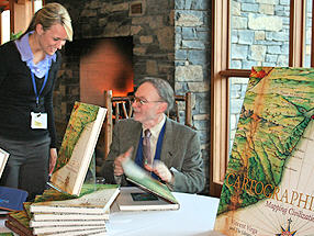
The Movies. It was Vincent Virga who
started this "meme." He's a
premiere photo editor and most recently, author, with the Library of
Congress, of Cartographia.
He loves movies and used them
several times to illustrate points during his talk. Did you know that
in North by Northwest the Capitol Building was moved, just for effect?
It's true. So, it's perfectly alright, he offered, that Chinese maps
also rearrange the true order of things. At the end of the day, Ed
Parsons of Google addressed the idea of the GeoWeb and storytelling. He
showed a clip from a silent movie highlighting how it used a then-new
technique of showing the same event from different perspectives, to
evoke emotion. That, he explained, is what we are looking to do on the
Web with maps: to tell effective stories.
Authoritative Sources. The challenge of using "authoritative" geodata along with user generated data came up several times. How will we manage them? Are both useful? Allen Carroll, chief cartographer at National Geographic, was among those who noted the issue, but he didn't seem to be concerned about his job. This conversation also prompted discussion of transparency in data sharing and use. We need to document both the sources and processes used when summary maps are developed, explained Eric Sanderson of the Mannahatta Project, a project of the Wildlife Conservation Society (more on that below). He noted in response to an attendee question that we also need to be clear on which maps are designed to reflect the current state of things, versus those that are artists' renderings or made from predictive models.
Archiving. Many of the ideas Virga shared highlighted how much
we can
learn about the people living at the time when historic paper maps were
created. How are we maintaining our map legacy for the next Virga? What
will that legacy be? The paper maps from the ESRI User Conference
Poster Session, Jack Dangermond shared, were at one time stored at the
Library of Congress. Later, they were sent back to ESRI due to lack of
space. It's not clear what their fate will be, perhaps they will be
scanned, he suggested. I noted that even if we do archive some of the
popular "online mashup maps" we may share little about ourselves since
so many of these look nearly identical!
Video Games and Geotechnologies. The Mannahatta Project story mesmerized the audience. The idea? Get a sense of what Manhattan Island (Mannahatta is the name the Lenni Lenape people gave the island) looked like before Hudson appeared. With geodata in hand and a recreated landcover, the next step is to share how different this area looked in the past. We saw a short photorealistic video made by combining the 3D GIS data, with fully rendered trees, into a video game engine. Wow. I learned, however, that it was a very expensive process. Sanderson shared another innovative way to depict this historical scene using a 300-foot scale model of the island in its primitive state. You walk on a clear floor that is mapped with modern-day New York City. You look down through the floor to see what that space used to look like. A simpler, perhaps more affordable outreach option: put photorealistic graphics on bus stops that would recreate the actual view some 300 years ago. This session prompted a conversation I've had several times with GIS users, especially those involved in 3D: When will we convene an event for 3D GIS people and video game developers to try to understand and learn from one another?
Why do we all look at our house first in a mapping app? I guess I never thought much about it, but Ed Parsons noted that it's a way to build trust. If the application or website "gets it right," that builds a level of trust. With that assurance, we can go explore areas that are less familiar.
The implications of public and private organizations hosting and sharing large geodatasets. We didn't get to delve into this topic in any of the panel discussions, but it came up several times in my conversations. One issue: If the dataset is large and in high demand, it may cost quite a lot to host it and it may bring down the servers! That would prevent a local government, for example, from doing its primary work of serving its citizens. Clearly, there are many layers beyond deciding to share geodata that need to be explored. Making it findable on the Web is just the beginning.
Who knows about Fire Eagle? I think it's one of the more interesting geo technologies in some time. We covered it in a podcast when it was announced and there's been definite buzz in the developer community. Still, as I expected, few in the audience (two, to be exact) admitted to being able to explain what it does. That's too bad. I don't say that because I think geospatial professionals will necessarily use it in their development or day-to-day work, but rather because of the tactic it takes in addressing development, privacy, findability, accessibility and portability challenges in today's data sharing world. (I cover Fire Eagle and other topics in this week's podcast. It's a short summary of my presentation at the Summit.)
[Disclosure: The Summit organizers covered travel, lodging and a gift - a signed copy of Virga's book.]
Here are some of the issues, ideas and observations from this year's event, prompted by just six speakers.
Mixed audience. The mix of the audience at this event always impresses me. There are academics, local and state GIS people, non-profit representatives, and staff from consulting firms large and small. Most of these people clearly like to think outside the box; I met a few programmers, but they were very low key. The discussions and the questions don't get technical. It's almost as though this event is a "holiday" or "retreat" from the details of technology; here, we take a step back to see what we do in a broader context.
 |
Authoritative Sources. The challenge of using "authoritative" geodata along with user generated data came up several times. How will we manage them? Are both useful? Allen Carroll, chief cartographer at National Geographic, was among those who noted the issue, but he didn't seem to be concerned about his job. This conversation also prompted discussion of transparency in data sharing and use. We need to document both the sources and processes used when summary maps are developed, explained Eric Sanderson of the Mannahatta Project, a project of the Wildlife Conservation Society (more on that below). He noted in response to an attendee question that we also need to be clear on which maps are designed to reflect the current state of things, versus those that are artists' renderings or made from predictive models.
 |
Video Games and Geotechnologies. The Mannahatta Project story mesmerized the audience. The idea? Get a sense of what Manhattan Island (Mannahatta is the name the Lenni Lenape people gave the island) looked like before Hudson appeared. With geodata in hand and a recreated landcover, the next step is to share how different this area looked in the past. We saw a short photorealistic video made by combining the 3D GIS data, with fully rendered trees, into a video game engine. Wow. I learned, however, that it was a very expensive process. Sanderson shared another innovative way to depict this historical scene using a 300-foot scale model of the island in its primitive state. You walk on a clear floor that is mapped with modern-day New York City. You look down through the floor to see what that space used to look like. A simpler, perhaps more affordable outreach option: put photorealistic graphics on bus stops that would recreate the actual view some 300 years ago. This session prompted a conversation I've had several times with GIS users, especially those involved in 3D: When will we convene an event for 3D GIS people and video game developers to try to understand and learn from one another?
Why do we all look at our house first in a mapping app? I guess I never thought much about it, but Ed Parsons noted that it's a way to build trust. If the application or website "gets it right," that builds a level of trust. With that assurance, we can go explore areas that are less familiar.
The implications of public and private organizations hosting and sharing large geodatasets. We didn't get to delve into this topic in any of the panel discussions, but it came up several times in my conversations. One issue: If the dataset is large and in high demand, it may cost quite a lot to host it and it may bring down the servers! That would prevent a local government, for example, from doing its primary work of serving its citizens. Clearly, there are many layers beyond deciding to share geodata that need to be explored. Making it findable on the Web is just the beginning.
Who knows about Fire Eagle? I think it's one of the more interesting geo technologies in some time. We covered it in a podcast when it was announced and there's been definite buzz in the developer community. Still, as I expected, few in the audience (two, to be exact) admitted to being able to explain what it does. That's too bad. I don't say that because I think geospatial professionals will necessarily use it in their development or day-to-day work, but rather because of the tactic it takes in addressing development, privacy, findability, accessibility and portability challenges in today's data sharing world. (I cover Fire Eagle and other topics in this week's podcast. It's a short summary of my presentation at the Summit.)
[Disclosure: The Summit organizers covered travel, lodging and a gift - a signed copy of Virga's book.]
From Our Homepage
Saying Farewell to an Amazing Journey
Communicating with Maps
Is There a GIS Career Ladder?
What does it mean to be geospatially smart? Series
Ways Real Estate and Property Developers Utilize Melissa GeoData for Data-Driven Decisions
Unlocking Value From Daily Satellite Imagery and Insights
Maximizing the Value of Your Address Data with Geo Addressing
How Indoor Mapping Enhances the Security of Smart Buildings
Look Ahead: AI, Location Intelligence and Efficiency
Collaboration Takes on Sea Level Rise & Dynamic Technology Environments
Brownies for Brownfields
Has Everything Been Mapped Already?
How Is Data Literacy Changing in an Artificial Intelligence Landscape
Portfolios for GIS Professionals: More Than Just Maps
How to Create a Distance Matrix in QGIS - A Step-by-Step Guide
7 Ideas for Bringing GIS into the K-12 Classroom
The Geography of Movement