The U.S.State Department estimates that there are more than 100 million unexploded ordnance (UXO) and landmines throughout the world. The vast majority of those affected by landmines are civilians in developing countries that are crippled or maimed while making small attempts to return to a semblance of peacetime normalcy by cultivating fields, gathering firewood, or just walking along a country road.
While landmines are cheaply produced and easily placed, removing them requires a substantial effort and cost. Budget model mines cost as little as 50 cents each to produce, while the price soars to from $300 to $1,000 to remove them.
Dr.Ken Rutherford, Assistant Professor, Department of Political Science, Southwest Missouri State University knows firsthand the pain and suffering inflicted by the indiscriminate laying of land mines. He is a bilateral lower leg amputee as a result of a 1993 landmine accident in Somalia. He went to Somalia with the International Rescue Committee (IRC) as part of an international humanitarian intervention there. Dr.Rutherford details his accident and recovery in "Landmines: A Survivor's Tale," the full text of which can be found on the Web at: www.maic.jmu.edu/journal/6.3/focus/rutherford/rutherford.htm. Describing the accident, he writes, "I slowly looked at Duale, whose face was covered with dust, then down to my feet. I saw a white bone sticking out where my right foot used to be. At first, I wondered if that was my bone or Duale's. It was mine." Later he observes, "Thus far, my medical care costs are in the neighborhood of a few hundred thousand dollars. What about the Somalis who are hurt by landmines? Who is going to help them? Who is going to pay for their care and therapy? There are thousands of victims around the world in places where having one's legs and arms is key to economic survival." Who indeed is going to help those unfortunates?
The International Trust Fund for Demining and Mine Victims Assistance (ITF) is now in its fifth year of funding and monitoring the demining activities in South-East Europe, which includes the countries of Albania, Bosnia and Herzegovina, Croatia, Serbia and Montenegro, and Macedonia. Its Web site is located at: www.see-demining.org/main.htm, where a full detailing of their programs can be found.
This region has long suffered land wars and the inevitable resultant laying of landmines. It is estimated that more than 2 million mines and UXO were placed during the Balkan crisis alone. Annually, between 18,000 to 20,000 kilograms of UXO, primarily from World War I are found and neutralized in Slovenia.
Before the ITF began its efforts to monitor and finance the demining activities in South-East Europe in 1999, there was no regional coordination of those activities. Each neighboring country had its own approach towards mine removal and there was a general lack of opportunity to coordinate those activities, as well as exchange information and experience. Upon the formation of the ITF, the European Commission (EC) prepared and proposed a geographic information system (GIS) project called the "Geographical Information System for Mine Action in South-East Europe" (GISMASE), which was jointly funded by European Commission and the U.S.State Department and implemented by the ITF, under the scientific guidance and monitoring of the EC's Joint Research Centre.
The goal of the project is the creation of high definition maps that will include the identification of mined areas and their socio-economic and security implications, as well as the development of GIS training capabilities so that the project can be locally supported.
Comments Borut Jagarinec of the ITF, "The problem with developing a regional GIS in South-East Europe stems from the fact that there are different organizations operating in the region and there is a need to collect, integrate, and synthesize the information collected by these different sources, which, unfortunately, have frequently used different methods, systems, formats, etc for assembling and structuring their data. One of the major tasks of the GISMASE project is not the unification of the GIS systems currently being used in the region, but the development and improvement of the regional landmine information systems (including GIS) so that information on minefields, surveys, incidents, and background information are all stored in a compatible format and can be exchanged between those organizations participating in the project."
ESRI's GIS software used in the project includes: ArcGIS, ArcInfo, ArcView,
ArcView Spatial Analyst, ArcIMS, and ArcEurope Base Map and Demographics.
The ITF has adopted a multi-resolution approach to the mapping of mined
areas to satisfy the diverse range of requirements that cover different
spatial scales. The requirements range from regional planning (1:100,000
scale maps), to tactical needs (1:25,000 scale maps), and the detailed
mapping and monitoring of mine clearance operations in the field (1:5,000
scale). For low-resolution coverage of the entire region, orthorectified
Landsat 7 satellite imagery with a land cover classification and change
detection for 1990 - 2000 was used.
On top of these coverages, basic vector layers found in ESRI's ArcEurope BaseMap, as well as data from other sources including minefield positions, soil type, slope, land cover, country boundaries, utilities, roads, railways, and rivers are used for analysis. Surveys, incidents, and background information acquired through regular regional information exchanges are also included in the GIS.
The ITF plans to employ the internet to share its data with other participants in the project and will use ESRI's ArcIMS server to distribute that data. Concludes Jagarinec, "Landmines are one of the last remaining plagues in the world and we are trying very hard, using a variety of methods, including GIS technology to eliminate them."

Figure 1.Landsat 7 composite image of Southeast Europe
(Click
for larger image)
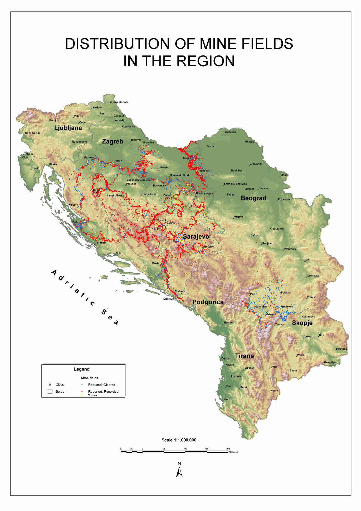
Figure 2.Distribution of minefields in the SEE region (developed
by GisData) (Click for larger image)
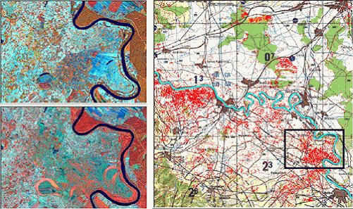
Figure 3.Inactive land in part of Bosnia and Herzegovina, derived
from 1990 and 2000 Landsat 7 imagery (developed by EarthSat)
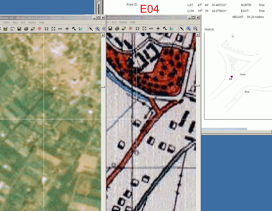
Figure 4.Points analyze for GPS campaign in Albania (Click
for larger image)
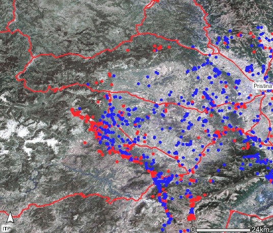
Figure 5.Minska polja Kosovo.jpg - Minefields near Pristina
(source GIS web server www.see-demining.org)
(Click for larger image)
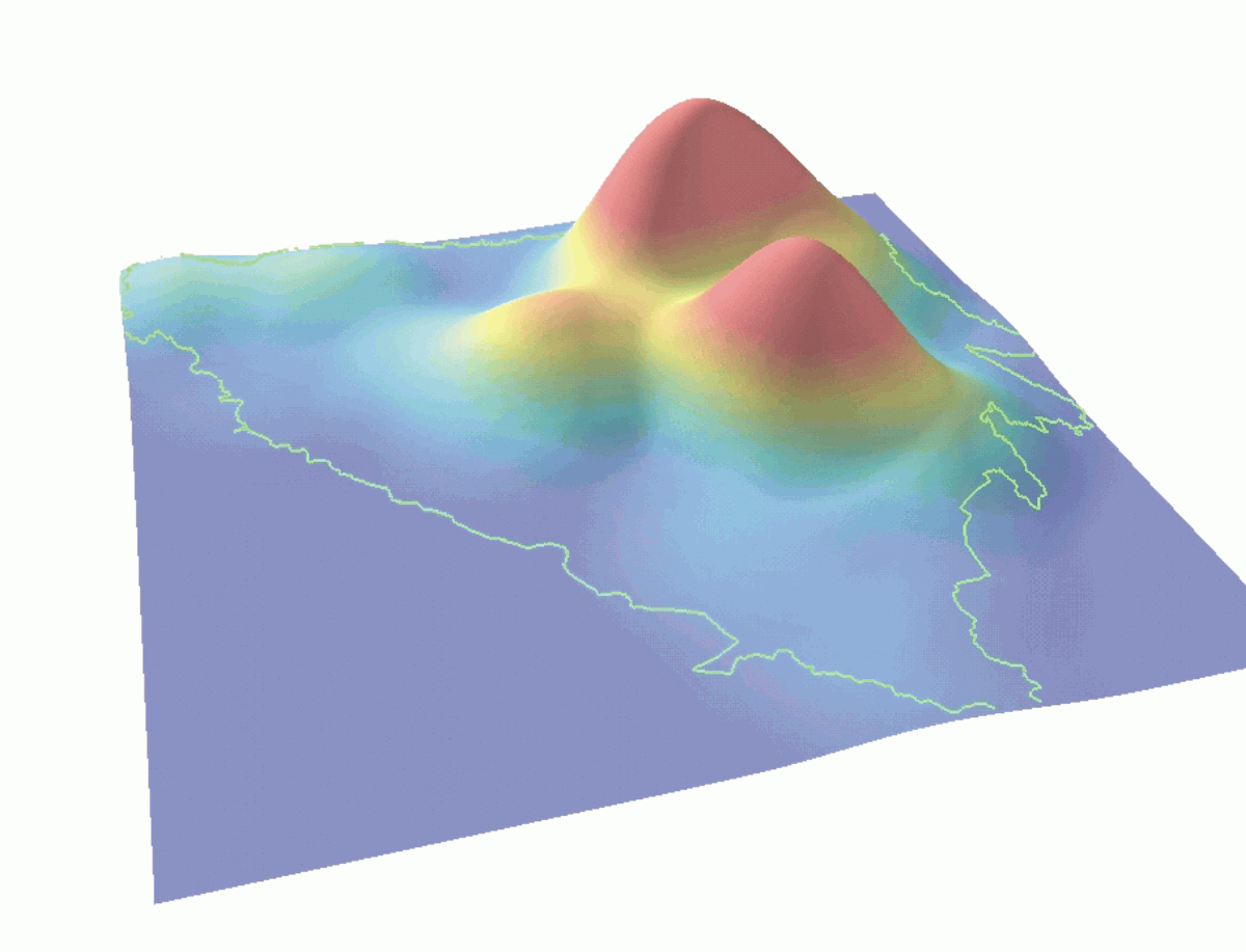
Figure 6.Frequency of mine victims in Bosnia and Herzegovina
(developed by GisData) (Click for larger image)
About the Author
Jim Baumann writes about international GIS-related topics for ESRI.
He has written articles on various aspects of the computer graphics industry
and information technology for more than 15 years.