Autodesk Software Keeps Denver's Airport Flying High
Situation
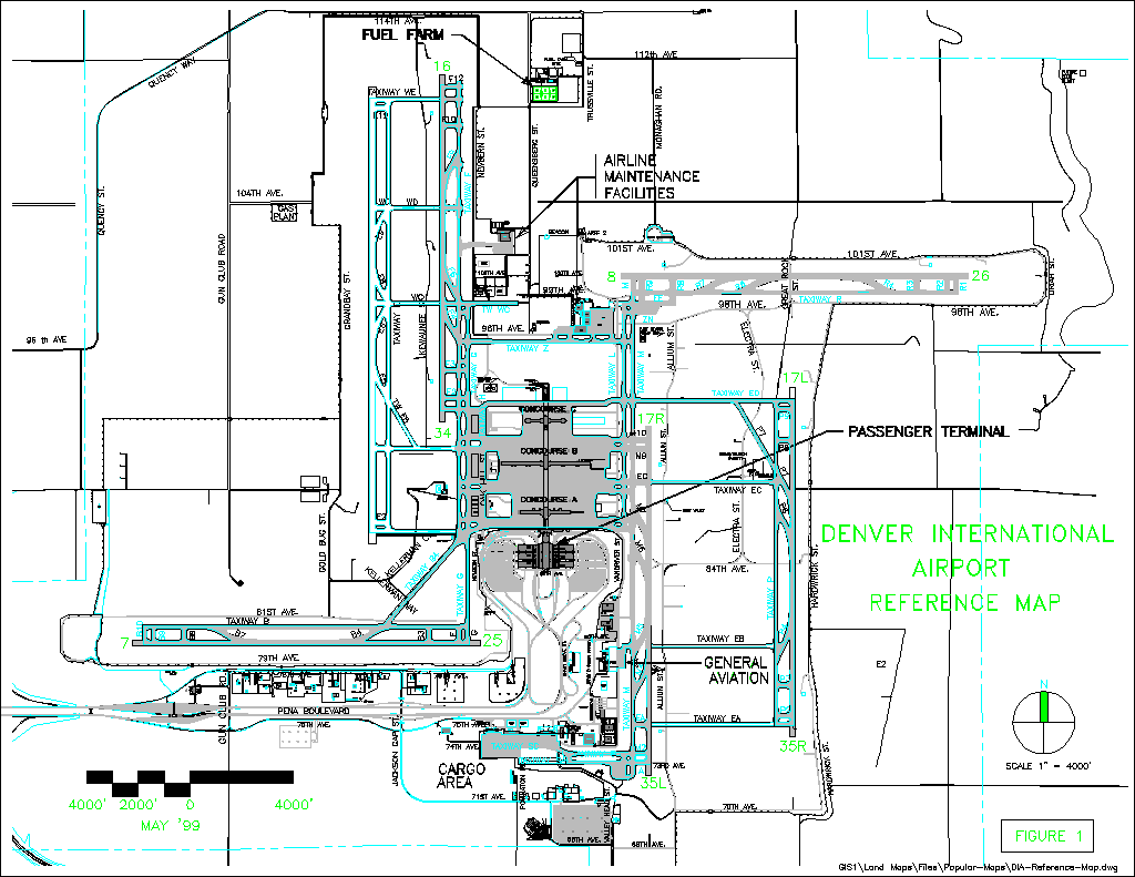
It's no exaggeration to say that Denver International Airport must be managed as if it were "a small city." In fact, it's more like a large city.DIA is one of the largest
|
||||
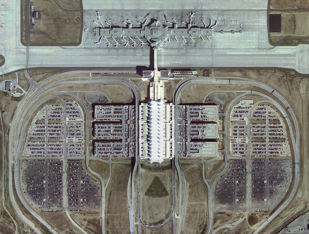
Finished in 1995 at a cost of almost $5 billion, DIA sprawls across 53 square miles, twice the size of New York's Manhattan Island.It is populated by 23,000 employees and 106,000 passengers, coursing daily through 89 gates to 1,450 flights.For passengers, it offers a chapel, an Islamic prayer hall and a 365-foot, glass-enclosed pedestrian bridge that spans the airfield.Snaking underneath the airport are a giant automated rail system, sewers, baggage conveyors, utility tunnels, 5,000 miles of fiber-optic cable and 11,365 miles of copper cable - enough, as the airport points out, "to run from New York City to Buenos Aires, Argentina."
The airport's caretakers monitor its many-layered infrastructure through a series of online models and GIS maps.While the hundreds of thousands of drawings in the airport's Oracle facilities database are different file types - DWG, ARC, raster, vector - by the time they reach DIA's end users, most have been converted to AutoCAD Map files.The airport standardized on Autodesk software, a good fit since AutoCAD was already the front end for its facilities management system.
DIA engineers maintain the airport's labyrinth of facilities with a cluster of Autodesk products - including AutoCAD 2000i, MapGuide, AutoCAD Map, Land Development Desktop, Survey and Civil Design.DIA's engineering office has made a hefty 166 gigabytes' worth of maps, drawings, plans and other documents available online to the airport and airline staff.Beyond the Oracle back-end system, this network runs on a mix of Unix and Windows NT servers, with a Windows front end.
Agency Challenges
Several groups of users need fast GIS information about the airport - not just engineers and facilities people, but contractors, consultants, property managers and administrators preparing reports.3-D drawings display the airport's complex baggage-handling systems below ground and airspace patterns above it."We often prepare map and design data for these offices, producing it on hard copy, CDs, e-mail and other formats," said David Dixon, the network| "Our engineers and contractors need to be able to find map data directly, through a straightforward interface." |
DIA needs Web-ready mapping software because many of those end users, particularly facilities engineers, also need to pull maps on their own from a browser-based interface.Some general users also read maps on the airport's Web-based intranet, which serves 1,000 people.Because AutoCAD Map and MapGuide embrace several kinds of map data and quickly serve maps out into Web formats, they function better in such a situation than many less flexible GIS programs in the marketplace, which can take hours to convert files.
The airport's utility engineers need detailed GIS charts and schematics to maintain systems such as HVAC (heating, ventilation and air conditioning), electric wires and fixtures, and escalators.If a water line breaks, engineers want to pull up a plan, pan and zoom to the correct place, locate the shutoff valve and quickly relay its position to the field.But the airport has neither the time nor the budget to spend on training every desktop map user.
|
||||
"My customers don't have time for training," Dixon says."But they're pretty good at 'mousing around' on their own.Our engineers and contractors need to be able to find map data directly, through a straightforward interface.That way they don't have to wait in somebody's office for help."
Solution and Benefits
Using AutoCAD and AutoCAD Map, Dixon's staff has found ways to make DIA's 100,000 CAD drawings more accessible.One was to create a many-tiered, interactive model of the airport that can be configured to reveal whatever information the user needs."It has two main components: facilities and land maps," Dixon says."You can look at the terminal, or underground, the roads, or the outside topography.You can construct it on your desktop to see electrical, plumbing, fire protection, communication.Basically, you can custom-build your own model of the airport.""When you offer the huge amount of data we do, the first thing you learn is that no one wants to wade through it all," Dixon says."So we
| "Basically, you can custom-build your own model of the airport." |
Another way was to widely distribute Autodesk's Volo View Express, a free viewer that allows users to review and mark up CAD drawings without AutoCAD software.The program makes it possible to deliver map data out to a broad range of people who aren't necessarily familiar with using CAD maps."We have 100 downloads of Volo View," Dixon says.Autodesk also allows managers to broaden the number of "authorized" users of its products with a distributed license pool - a feature the airport uses.
MapGuide
The engineers who use maps of DIA's underground utility locations use MapGuide, a browser-based interface that quickly delivers map data from several different GIS and CAD file formats.MapGuide also allows an office to generate statistics from maps.Its Internet platform, which comes packaged with Cold Fusion Web development tools, is designed to enable online collaboration.In addition to their own employees, most large airports deal with contractors, consultants or airlines that require access to facilities maps during| MapGuide is intuitive enough to serve as the front-end interface for any document system that deals with GIS diagrams. |
MapGuide is intuitive enough to serve as the front-end interface for any electronic document management system that deals with GIS diagrams.At DIA's Engineering Records division, Dixon is contemplating that option."Right now our front end is Microsoft Access, but most of the engineers and inspectors who are our chief customers come at things from a more visual standpoint," he says."They think in terms of the actual facility instead of queries and searches.As it stands now, because there are so many places where the data resides in Oracle, it can almost require an expert to find."
Land Development
With so much ground to cover among the plains surrounding the airport terminal, DIA surveyors and builders often have to modify their land maps or generate new ones to reflect improvements to roads, drainage, runways and other work.They take their "point" measurements outside with GPS devices or other surveying tools, then download those data into Autodesk's Land Development Desktop (LDD).Using companion products called Survey and Civil Design, the surveyors manipulate the survey data, shape terrain models if they need, and sometimes overlay their work with GIS facility diagrams to create multi-layered maps.While it makes sense for any agency to use interacting software modules once it has invested in one product, Dixon says his main criterion was simply to make
| DIA engineers now envision future systems that once seemed outlandish, such as crews with handheld devices displaying GIS data they download from on-site chips. |
DIA has also begun managing pavement maintenance with Paver, a GIS product developed in a U.S.military research lab.To maximize the useful life of DIA's 48 million square feet of pavement, engineers can track repairs and regular upkeep by clicking on GIS road and runway diagrams.This brings up special maps (in ESRI's ArcView format) that show the pavement's deterioration rate and maintenance schedules.
The airport's GIS has been a huge success in increasing productivity and enabling field technicians to respond efficiently to maintenance needs.DIA engineers now envision future systems that once seemed outlandish, such as crews with handheld devices displaying GIS data they download from on-site chips.Given the advances already in place, that day may not be far off.Until then, Denver's giant, space-age airport - the largest public works project in the world - is an open book to any employee with a computer.
A version of this article originally appeared in Geospatial Solutions.
The Denver International Airport's Autodesk solution was sold by Avatech Solutions.For more information about Avatech, visit www.avat.com or phone (410) 902-6900.
This case study was prepared by DLT Solutions of Herndon, Va., Autodesk's appointed master government sales and marketing partner.DLT and Authorized Autodesk Resellers deliver the complete family of Autodesk and companion products to federal, state and local government agencies nationwide.For a free demo CD, call 1-888-223-7084 or visit www.dlt.com/autodesk.GSA schedule # GS-35F-4543G.