
Farmers Adopt Advanced Remote Sensing Technologies from Slantrange


Advances in drone technology and remote sensing analytics are transforming modern agriculture, enabling farmers to monitor crop health with unprecedented speed and accuracy. SLANTRANGE, a San Diego–based data analytics company, is leading this transformation with low-cost airborne sensing tools that deliver actionable agricultural intelligence within minutes of flight completion.
The company has gained industry attention for its patented multispectral sensor technology designed to mount on third-party drone platforms. By measuring multiple crop health indicators invisible to the naked eye, SLANTRANGE provides farmers with real-time insights that help improve yield, optimize field management, and support long-term data-driven agricultural strategies.
Drone-Based Crop Monitoring Workflow
The process begins with the development of a crop-scouting plan identifying the fields to be surveyed and the specific issues to monitor. Using mission-planning software, farmers define the survey area on satellite imagery and automatically generate a waypoint flight plan based on camera parameters and image overlap requirements.
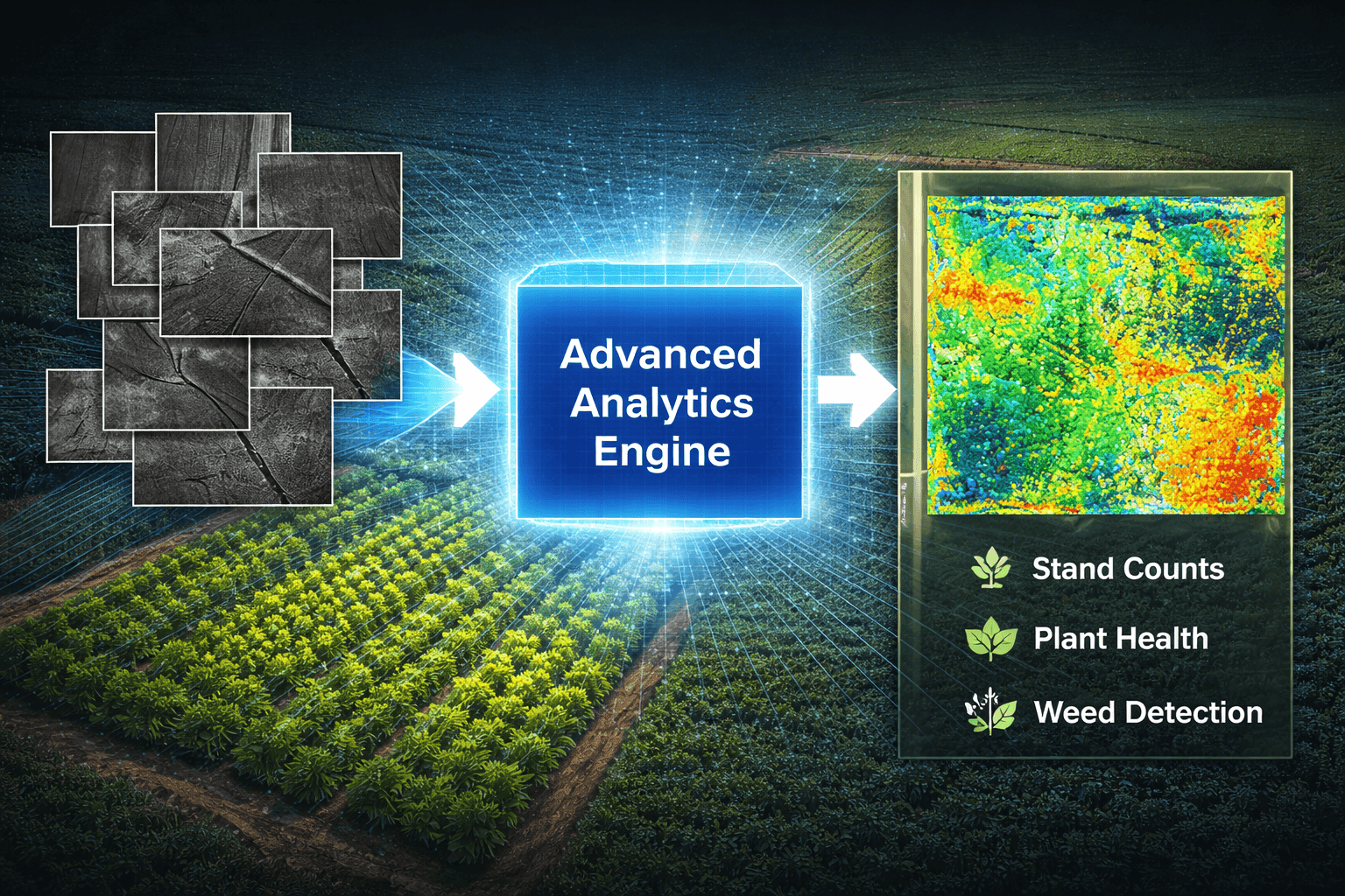
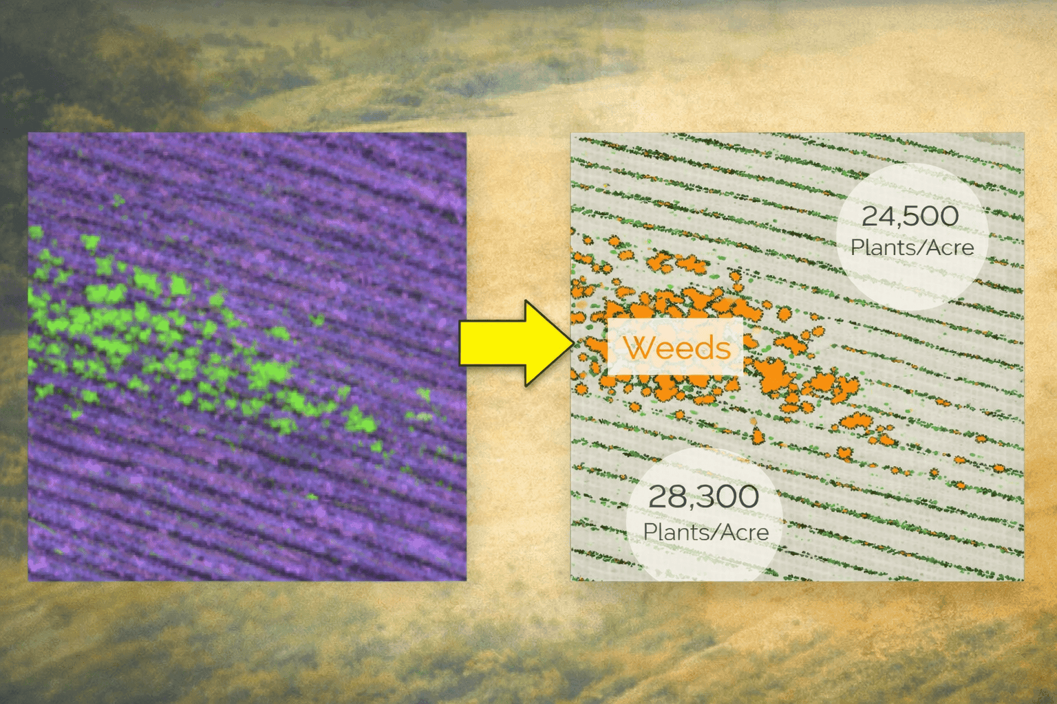
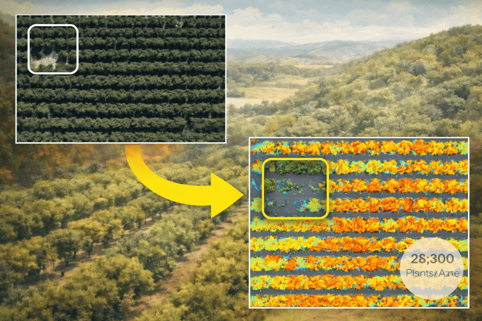
Once deployed, the drone autonomously captures imagery using SLANTRANGE sensors. After the flight, the collected data is processed into photo mosaics and analytical maps that highlight crop population density, growth stage, plant stress, weed coverage, and other critical indicators. These outputs are delivered as GIS-compatible shapefiles for further analysis in mapping platforms such as ArcGIS.
Multispectral Sensing for Precision Agriculture
Plant health and maturity can be determined by analyzing how crops absorb, reflect, and transmit sunlight. SLANTRANGE’s multispectral sensors are engineered to detect variations associated with photosynthesis, transpiration, and senescence, allowing farmers to identify emerging issues long before they are visible through traditional inspection methods.
This capability enables faster intervention decisions, helping farmers apply irrigation, fertilizer, or pest control measures more efficiently while reducing operational costs and environmental impact.
Delivering Actionable Field Intelligence
Processed imagery generated by SLANTRANGE analytics provides clear visualizations of crop performance across entire fields. Farmers can quickly identify weak growth areas, stand-count variations, and stress patterns that may require attention. The system also distinguishes crops from weeds, improving population counting accuracy and field management decisions.
With lightweight sensors designed for both fixed-wing drones and copter systems, the technology remains accessible for a wide range of agricultural operations while delivering enterprise-level analytical capabilities.
The Future of Data-Driven Farming
As precision agriculture continues to evolve, remote sensing platforms like SLANTRANGE are becoming essential tools for modern farm management. By combining drone imaging, multispectral analytics, and GIS-ready outputs, these systems empower farmers to transition from reactive field inspections to proactive, data-driven crop management strategies that support higher productivity and long-term sustainability.


