
The Role of Open Source GIS Tools in Mangrove Forest Conservation


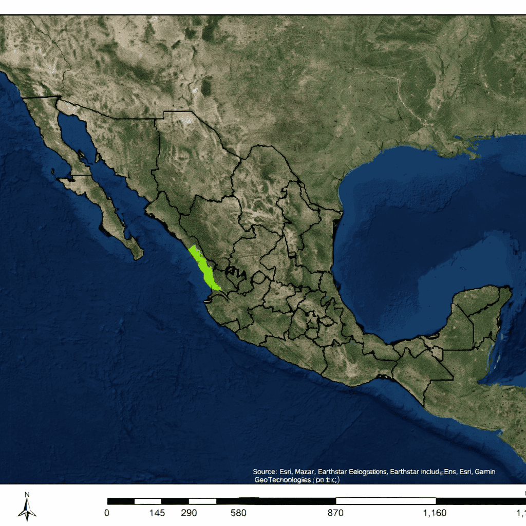
Mangrove forests rank among the most valuable coastal ecosystems on the planet, providing economic, ecological, and climate-related benefits that extend far beyond their boundaries. Along the Pacific coast of Mexico, between the states of Sinaloa and Nayarit near the Baja Peninsula, the Marismas Nacionales represents the largest continuous mangrove system in the region. This expansive wetland supports fisheries, protects shorelines from erosion, and plays a critical role in capturing and storing atmospheric carbon.
Local communities depend heavily on these mangroves for fishing and shrimp harvesting, making the health of the ecosystem directly tied to regional livelihoods. At the same time, mangrove forests act as natural climate regulators. They absorb carbon dioxide from the atmosphere and store vast amounts of carbon within their sediments, roots, leaves, and woody biomass. Despite these benefits, the Marismas Nacionales mangroves have experienced a steady decline over the past several decades.
One of the primary drivers of this degradation has been the construction of dams upstream. These structures disrupt natural hydrological processes, altering sediment delivery and salinity levels across coastal wetlands. Even small changes in water flow can have widespread consequences, weakening mangrove resilience and leading to long-term ecosystem loss.
To better understand and reverse these trends, conservation organizations such as Ecologists Without Borders (EcoWB) and Pronatura México turned to geospatial analysis. Their goal was not only to document environmental change but also to identify practical restoration strategies that could be implemented locally. Cost, accessibility, and transparency were key considerations, prompting the search for an alternative to proprietary GIS software.
A team of graduate students from the University of Washington recommended using InVEST, a free and open source GIS-based modeling suite developed by the Natural Capital Project. Designed to evaluate how environmental changes affect ecosystem services, InVEST offers a flexible framework for linking ecological data with human benefits.
Within this toolkit, the Coastal Blue Carbon model became central to the analysis. The model estimates carbon storage and sequestration in coastal ecosystems as land cover changes over time. Beyond measuring biophysical carbon stocks, it can assign economic values to stored and sequestered carbon, helping stakeholders understand the financial implications of conservation and restoration scenarios.
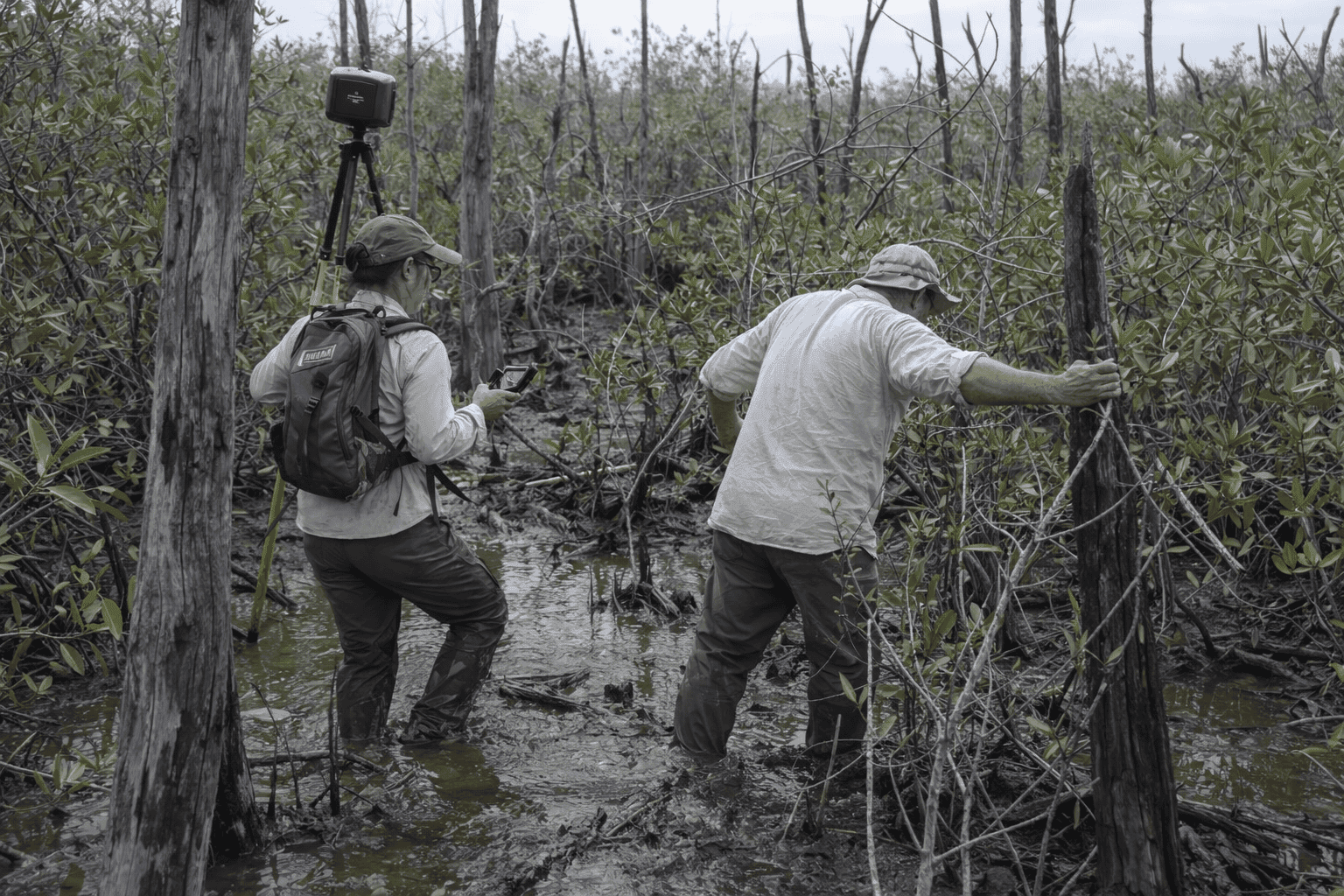
To prepare the model inputs, the project team combined historical land use and land cover data spanning from 1970 to 2010 with detailed field measurements collected within the Marismas Nacionales. The study area covered more than 770 square miles of mangrove forest. Local field data proved especially valuable, as the model allows users to replace generic assumptions with site-specific measurements, significantly improving accuracy.
Using these inputs, the team produced spatial maps illustrating carbon stocks, carbon sequestration rates, and the net present value of carbon storage across different parts of the mangrove system. Comparing data across decades revealed precisely where carbon sequestration had declined most sharply, highlighting priority zones for intervention. The team also modeled a future restoration scenario, demonstrating how ecosystem services could recover if degraded mangrove areas were restored.
These visual outputs became powerful tools for communication and decision-making. Maps made complex ecological processes understandable to local communities and government agencies, strengthening support for targeted restoration efforts. Mangroves were shown not only as biodiversity hotspots, but also as economic assets that sustain fisheries and protect coastal infrastructure.
Looking ahead, one potential incentive for conservation lies in carbon markets. By estimating carbon credits through open source geospatial models, restored mangroves could eventually generate revenue through the sale of carbon offsets. However, challenges remain. Mangroves are not yet fully integrated into international carbon credit systems, and standardized methodologies for measuring coastal carbon storage are still evolving.
Even so, the project delivered tangible benefits. Government agencies and community leaders became more engaged, and local capacity was strengthened through hands-on training in the use of open source GIS tools. The ability to rapidly identify damaged areas, recovering zones, and carbon-emitting sites has improved restoration planning and prioritization.
While continued research is needed to refine ecosystem service valuations, this work demonstrates the power of open source GIS. By lowering technical and financial barriers, tools like InVEST enable conservation organizations to conduct sophisticated spatial analysis, support evidence-based decision-making, and advance long-term mangrove forest protection.


