
Google's Geospatial Evolution is Open


Much has been prognosticated about the earth-shattering consequences of deprecating Google Earth Enterprise back in March of 2015. Uncertainty of the route Google was taking may have sent some companies scrambling to shift their geospatial technology stack, while others chose to wait it out, taking solace in Google’s official support through March 2017. Now, the situation looks a lot more clear. The future of Google Earth Enterprise is open.
The announcement Jan. 30, 2017 marks the beginning of a new milestone for GEE. The capabilities of GEE Server, Fusion and Portable will be open sourced under the Apache 2.0 license by the end of March this year and available to the global community of open source developers on Github.com. While the technical details of this seismic event are being wrought out, there is some certainty regarding the potential of a more open Google geospatial platform.
One very important outcome is that product support, from trusted Google Partners and the open source community, will continue for the current GEE stack including enhancements that inevitably will be made available. If you mothballed your GEE toolchain and applications, now is the time to dust them off. If you passed on investment in GEE because it was deprecated, now is the time to reevaluate how the power of open source might change that decision. If you sustained your GEE capability and have a large portion of your workforce that still relies on it, well, your ship has come in.
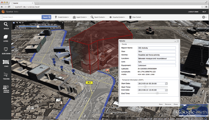
Image 1 TST’s iSpatial framework adds capabilities to enhance the GEE experience. One such use case (above) shows a mission planning tool using Google Earth. Source: Thermopylae Sciences & Technology
Thermopylae Sciences & Technology, working closely with the Maps Product Team since the deprecation announcement, have not let up, testing the latest updates from Google, coordinating on bugs, and incubating innovative ways to keep GEE functional for our users. Continued investment in keeping geo and mobile frameworks up to date with the core GEE capability has occurred as well.
With the open sourcing just around the corner, the opportunity for developing new codebase features and plugging in other components is on the horizon. The open source codebase will revitalize geospatial technology ecosystems and ensure that widely-used standards like KML, existing GEE Fusion assets and databases, and GEE workflows will be supported.
Some areas where GEE is now positioned to make renewed advances include support of a modern 3D browser experience, integration with other open source mapping toolkits, and APIs to do things that are presently only possible with public Google services. The platform will continue to thrive in disconnected environments thanks to customPortable Globesthat work in networks “air-gapped” from the internet.
The Google Cloud Platform can now be used to host open source GEE and provide scalable storage for the large raster databases created when working with global scale data. High resolution orthoimagery and other geospatial datasets available from Google make a nice complement to this capability. This is good news for all types of users: hobbyists, commercial and government.
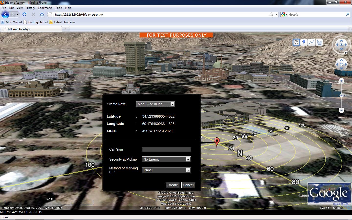
Image 2 A modified version of GEE was created and used for Diplomatic Security monitoring and evacuation. Satellite imagery and 3D capabilities grant an enhanced frame of reference for remote monitoring. Source: Thermopylae Sciences & Technology
How does all of this impact long-term GEE users with critical use cases? With commitments from companies like TST, having multiple engineering teams working closely with Google to prepare the open source GEE codebase, it means long-term global support is available. Working with other former Google GEE partners from around the world will ensure that a strong network and technology pathway exists to continue to provide support to organizations wishing to take advantage of the platform.
The roadmap for GEE is being redrawn, and this time around, the geospatial community will be in the driver's seat.
Interested in more articles and webinars related to Google?


