Operation Settings and Office Operations
Setting up a project based on PMBOK (Project Management Body of Knowledge) practices from the Project Management Institute (PMI) is simple for any professional project or program manager. However, the first step is to define the concept of "operations" with respect to GIS projects. Organizations must develop, organize and manage the company's operational team to foster top-quality, cost-effective operational performance, high standards of product quality and successful integration of the enterprise operations. The expected result is to manage and coordinate between staff and facilitate interdepartmental communications, and allocate tasks and resources as needed.
In the GIS environment, the process or series of acts involved in a particular form of work usually comes through the division of an organization that carries out the planning and operating functions. Consider a GIS company that wants to implement the strategic goal of providing a software application using a new framework system while simultaneously phasing out the existing data from the previous application. This is a strategic decision. The company would then develop new GIS applications to deliver to its customers. This represents a tactical decision to retrain the existing staff to support and maintain the day-to-day functions of the new application under the new framework. It is important to realize that the goal of operations management is to affect the entire system in a positive manner.
High Quality GIS Operations
Operational work is done to achieve business goals. Operations and projects have few intersection points during the product life cycle. Usually business processes or operations management is used to execute operations. In the GIS environment, projects normally are the means of executing those activities that cannot be addressed within the organization’s normal operations. Operations management in a GIS firm is an ongoing process where the output is repetitive and sustains the business.
Many GIS organizations are taking advantage of operations management to improve productivity, efficiency and customer satisfaction. This step requires employees to perform known tasks and adhere to structured processes involving changes to work habits that can sometimes be disruptive to organizations. Integrated GIS tools can streamline quality operations tasks and reduce user resistance, enabling organizations to get the maximum benefit from quality operations at lower risk. GIS organizations should have a set of criteria to improve performance by focusing on two goals: delivering ever-improving value to customers, and improving the organization’s overall performance. Teaching operations managers and workers to eliminate waste and bureaucracy, save money and make resources available for the specific activities that satisfy customers is at the core of quality operations management.
GIS Operations and Maintenance
To reduce the cost of operations and maintenance, a company needs to build a long-term strategy based on no increase in operations and maintenance staff. This type of strategy must fit into the existing operations and maintenance work flows, allowing the same staff to manage long-term operations and legacy technologies. GIS operations and maintenance must have a greater degree of self-management. Existing GIS technologies already tax the ability of operations and maintenance staff to monitor, repair, develop and expand GIS technologies. If GIS technologies have a weak management infrastructure, existing operations and maintenance staff will be overwhelmed and the long-term operations strategy in this case will be to hire additional operations and maintenance personnel.
Given the consensus among GIS technology vendors and operators that operational costs associated with GIS infrastructure must be decreased, a significant long-term strategic goal is to change the operations and maintenance paradigm.
SOT (Self Organizing Technology)
While long-term operations and maintenance capabilities can follow accepted geospatial technology specifications [such as those from the OGC] there are still significant technology differences between GIS vendors. These capabilities - self operating, self optimizing, self configuring - are the basic concepts of Self Organizing Technology (SOT). SOT is defined as set of use cases that cover the entire GIS life cycle: planning, development, deployment, operations and optimizing. SOT should be designed for multi-vendor solutions, with standard values utilized at key points to allow interoperability between GIS vendors. Some SOT algorithms are not standardized in order to allow for differentiation and competition between GIS vendors.
SOT allows for differentiation in the area of optimization algorithms and in the accuracy and efficiency of the SOT solution. SOT should also present some key challenges that allow further differentiation.
We need to build a new operations and maintenance architecture based on SOT and establish this as the standard architecture of operations and maintenance across the corporation. GIS solution vendors must address this issue as part of their long-term operations and maintenance strategy. To address this issue we need to develop some guidelines so that the operator can accept or reject any of the changes while monitoring SOT. Once the operator gains confidence in the SOT algorithms he can switch to the next stage, where changes are applied. The operator can view the changes applied by SOT anytime and distribute reports to view all changes made by the SOT algorithms.
In order to ensure SOT capabilities, we don't need to create a new technical workflow, but GIS vendors must have a clearer understanding of the service provider’s existing workflow.
Conclusion
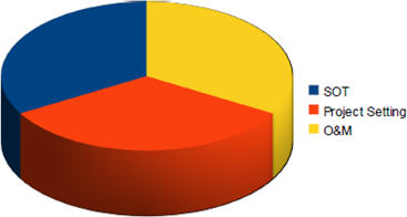
Generally, to reach high quality value in project operations, three major points must be considered: setting up a project, operations and maintenance (O&M), and self organizing technology (SOT). You can maximize the efficiency of setting up a project by developing, organizing and managing a company's operational team. This will guarantee high project quality operations in any GIS firm. Building long-term operations and maintenance strategy enables significant reduction to operational expenses when operators can demand a complete SOT solution, enabled by distributed operations capabilities that can be changed anytime. This would reflect a significant advantage over the competition.
 |