9801 Metric Blvd, Suite 200
Austin, TX 78758
Phone 512-251-5100
FAX: 512.251.5123
www.zebraimaging.com
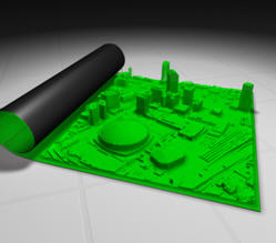
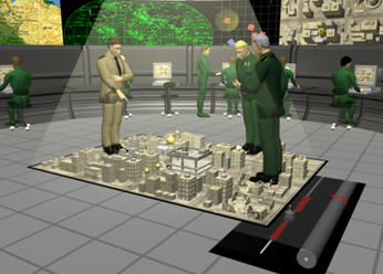
3D is now standard output for most CAD systems, and is commonly used for viewing terrain data and built environments. ZEBRA Imaging offers a product that allows you to view these data from more than one angle, without having to redraw the images on a computer screen. ZEBRA Imaging provides fairly large - 600mm by 800mm - flat media holograms. They are portable and can be created using a number of data sources; most importantly, they don't require special tools (e.g. glasses or scopes) for viewing.
The holograms are used in a variety of ways, including military visualizations, project presentations and concept demonstrations for investors. The holograms make traditional flat drawings look a little bland. What is really fun with these holograms is that you can pass your hand through them.
 |
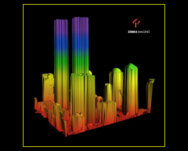
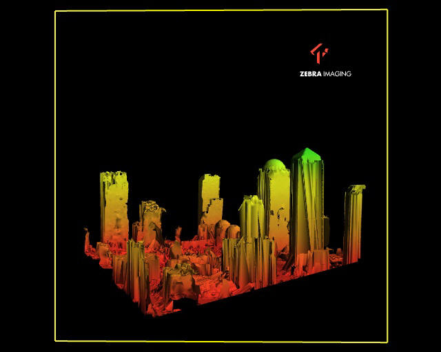
From ZEBRA Imaging literature:
- 3-D perspectives are visible horizontally and vertically; one can look over and under the image and from side to side without glasses or goggles
- Wide angle of view - horizontal viewing is over 95 degrees, allowing many people to walk around and view an image simultaneously
- Allows for unlimited size while maintaining the integrity of the image
- Images are projected several feet in front of or behind the hologram and appear to be floating in air
- Compact and portable - images are flat or flexible plastic panels that can be stored and shipped easily, taking up very little space
- Any 3-D volumetric data set from any source may be used
 |
 |
 |
 |
 |
 |
From Our Homepage
Saying Farewell to an Amazing Journey
Communicating with Maps
Is There a GIS Career Ladder?
What does it mean to be geospatially smart? Series
Ways Real Estate and Property Developers Utilize Melissa GeoData for Data-Driven Decisions
Unlocking Value From Daily Satellite Imagery and Insights
Maximizing the Value of Your Address Data with Geo Addressing
How Indoor Mapping Enhances the Security of Smart Buildings
Look Ahead: AI, Location Intelligence and Efficiency
Collaboration Takes on Sea Level Rise & Dynamic Technology Environments
Brownies for Brownfields
Has Everything Been Mapped Already?
How Is Data Literacy Changing in an Artificial Intelligence Landscape
Portfolios for GIS Professionals: More Than Just Maps
How to Create a Distance Matrix in QGIS - A Step-by-Step Guide
7 Ideas for Bringing GIS into the K-12 Classroom
The Geography of Movement