Take the case of a national insurance company that began to see its major competitor grow market share by always being the first to place agents in new markets.It discovered that its competitor was using up-to-the-minute aerial photography to place agents where it could clearly see new housing developments in progress. No amount of data crunching was ever going to provide a view of this ground truth.
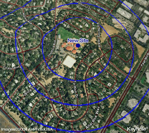
Click image for larger
view.Image shows Palo Alto, CA., at a tilted view.
Or what about the sales representative excited to be given expanded territories, only to discover that a significant portion of the new geography was extremely difficult to navigate due to the presence of mountain ranges, road construction, lakes or other natural barriers?
The fact is, without the benefit of ground truth to complement your systems and data there is a much higher probability that you will make a serious and costly resource or investment error.It is for this reason that Tactician Corporation recently announced that it has integrated its award winning Tactician® Online marketing portal with Keyhole® 2 PRO, the latest release of Keyhole Corporation's pioneering Internet 3D earth visualization solution.
Made famous by images of Baghdad provided to network television during the early days of the U.S. invasion of Iraq, Keyhole 2 PRO is high performance 3D client software combined with an Internet hosted massive database of satellite images and aircraft fly over photography.It enables anyone with an Internet browser to virtually zoom from space to a street level image of almost anywhere on the globe.All users have to do is point to where they want to go and the software "flies" them there in a matter of seconds.

Click image for larger
view.Image shows Tahoe, CA's terrain in 3D.
By integrating this exciting new technology with Tactician Online's mapping, analytical and data tools, Tactician has now made possible a compelling ground truth solution with significant business implications for sales, marketing and real estate professionals.As before, Tactician Online users can create maps that accurately define market opportunities, trade areas, sales territories, and media markets, but they can now also overlay these maps on interactive, high resolution full color earth images from Keyhole 2 PRO.With marketing and thematic overlays in place, users can then view their locations down to specific street corners or buildings, tilt and rotate the view, zoom in or out, pan around, print high quality images, or quickly share views with others online.The ability for users to create such ground truth images enables them to explore new dimensions of location intelligence and make correspondingly better geographically targeted resource and investment decisions.
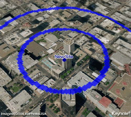
Click image for larger
view.Image shows downtown San Diego, at a tilted view.
One early advocate of the Keyhole 2 PRO link to Tactician Online is Jerry Herman, principal of J.J. Herman & Associates, a commercial real estate broker in Cleveland, Ohio."The integration of Keyhole 2 PRO with Tactician Online has opened up a new world of competitive advantage for me and for my clients," Herman said."In just the last couple of weeks I have been able to use the combined power of the two technologies in a couple of different applications.First, I was able to help a restaurant franchisor client differentiate itself by demonstrating its ability to provide potential franchisees with a 'no surprises' market selection tool.Second, I used the integrated solution in some general commercial real estate consulting assignments."
"Demographics and location
realities are critical in franchising and the commercial real estate market,"
Herman continued."I'm excited that Tactician Online now allows me and
my clients to see exactly what's going on at street level.As good as mapping
technologies, analytics and bundled data layers are these days, there are
times when a one dimensional map is just not enough."