1. Geocoding (mapping) contact data often reveals hidden relationships and opportunities that may not otherwise be apparent.
The cliché about a picture being worth a thousand words applies here. The simple one- or two-click process of mapping contact locations enables users to visualize market penetration, market coverage and competitive pressure. Some mapping solutions not only render point maps but also generate cluster and heat maps of the same data. Cluster maps display the number of contacts in specific areas and heat maps illustrate data location intensity.
Maps are informative and often tell a business story but they are even more useful when shared. Many CRM location-based service (LBS) solutions give users the ability to email maps and even insert maps in PowerPoint, SlideRocket, Keynote and other presentation applications. (See Figure 1)

Figure 1. PowerPoint
2. Business mapping solutions complement the query or lookup feature of CRM/SFA applications by adding proximity searches.
CRM and sales force automation (SFA) applications can find contacts within a state, city and ZIP Code(s), but location-based services enable users to find contacts bounded by geographic features. The left screen shot below renders a search area bounded by Highways 280, 101, 85 and Woodside Road in the San Jose area. The right image below illustrates finding contacts along Highway 35E in North Dallas. Although searches like these are extremely valuable, they are very difficult to accomplish without the use of a mapping tool.
More advanced LBS applications are capable of summing contact record numeric fields captured in a proximity search. In other words, simply drawing a search polygon or circle around a specific area can produce total sales, total profit, and total population for the enclosed geography.

Figure 2a. Polygon Proximity Searches

Figure 2b. Polygon Proximity Searches
3. LBS/business mapping makes call planning an integral part of any CRM or SFA solution.
In addition to visualizing and spatially capturing contacts, CRM/SFA users also need driving directions. Business mapping or LBS solutions are perfect for this task because they create multi-stop, turn-by-turn driving directions to selected contacts. Some LBS applications create both optimized and sequential routes and others enable users to also insert stop times and stop types.
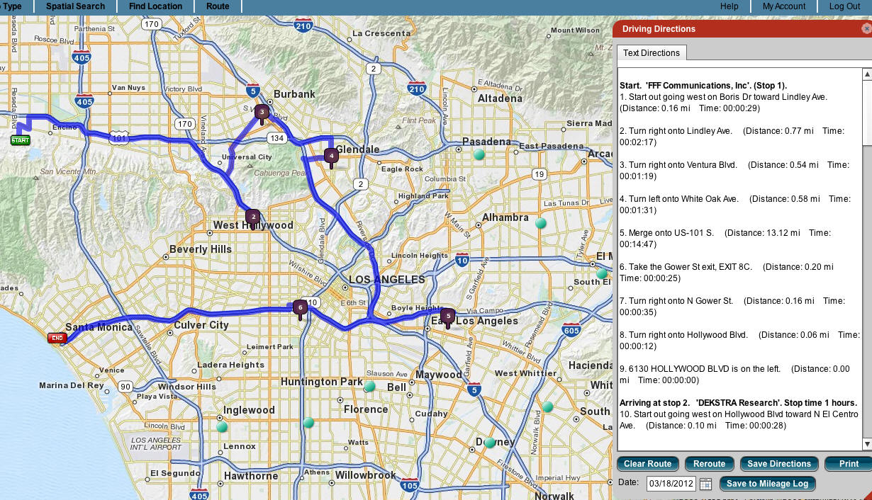
Figure 3. Route Planning
4. Business mapping applications create mileage logs.
As part of the routing process the more advanced business LBS solutions create mileage logs. Mileage logs are invaluable reports because they automate the process of documenting business miles traveled for company expense reimbursement or possible tax deduction purposes.
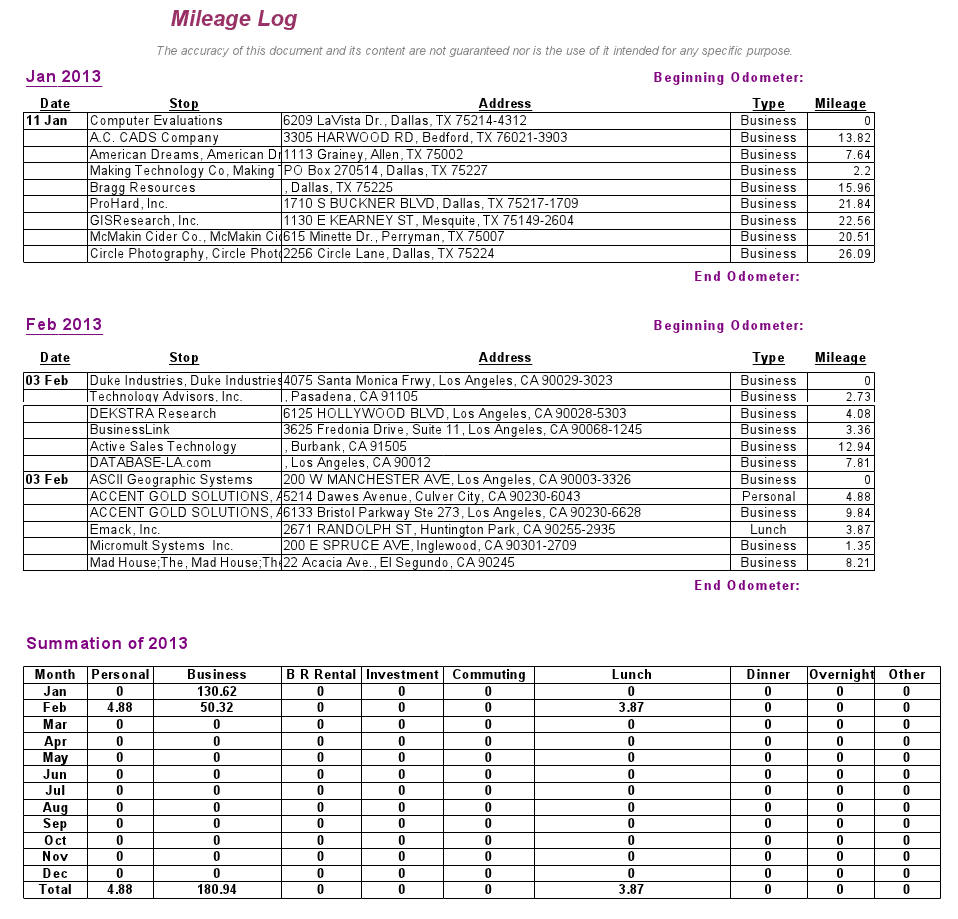
Figure 4. Mileage Log
5. Integrated mapping solutions make accessing maps easier because they execute within the host CRM application.
One of the biggest deterrents to using a business mapping application is that before a file can be mapped it must first be exported from the CRM application and imported into the LBS program. This is further complicated by the fact that the results of proximity mapping searches are far more useful if they can be used in the CRM solution. This means exporting the result of a proximity search, and then importing it back into the CRM solution. In other words, to receive the maximum benefit from a business mapping program, CRM/SFA users are required to execute two file exports and two file imports.
The screen shot below shows an LBS application that adds mapping, routing and mileage tabs to the toolbar of Act!, a popular CRM application. This type of integration completely eliminates the laborious export/import process because it operates from within the host CRM application.

Figure 5 – Embedded application
Explore more:
Location Intelligence
From Our Homepage
Saying Farewell to an Amazing Journey
Communicating with Maps
Is There a GIS Career Ladder?
What does it mean to be geospatially smart? Series
Ways Real Estate and Property Developers Utilize Melissa GeoData for Data-Driven Decisions
Unlocking Value From Daily Satellite Imagery and Insights
Maximizing the Value of Your Address Data with Geo Addressing
How Indoor Mapping Enhances the Security of Smart Buildings
Look Ahead: AI, Location Intelligence and Efficiency
Collaboration Takes on Sea Level Rise & Dynamic Technology Environments
Brownies for Brownfields
Has Everything Been Mapped Already?
How Is Data Literacy Changing in an Artificial Intelligence Landscape
Portfolios for GIS Professionals: More Than Just Maps
How to Create a Distance Matrix in QGIS - A Step-by-Step Guide
7 Ideas for Bringing GIS into the K-12 Classroom
The Geography of Movement