
Geospatial And Location Intelligence Explained


Choosing where to place a road, how to route people away from flood exposure, or how much carbon a suburb should offset all depends on seeing geography as usable evidence. Geospatial and location intelligence turns geographic data and information into practical insight by combining imagery, map layers, and analytics in a form people can act on.
At its core, location intelligence is a way to analyze place. It draws from geospatial data, then presents that information in software that supports decision-making for business, government, and infrastructure planning. In my experience with GIS tools, the real value appears when separate layers line up cleanly and start telling the same story.
Recent advances have pushed this field into a new phase. Better capture systems, artificial intelligence, and wider coverage are opening up sharper analysis for more industries. Nearmap sits near the front of that shift, using frequent collection and high-resolution data to improve understanding of conditions on the ground.
That makes location intelligence useful for looking backward and for forecasting ahead. It helps people study change over time, test assumptions, and build a clearer picture of the built environment.
How Location Intelligence Works
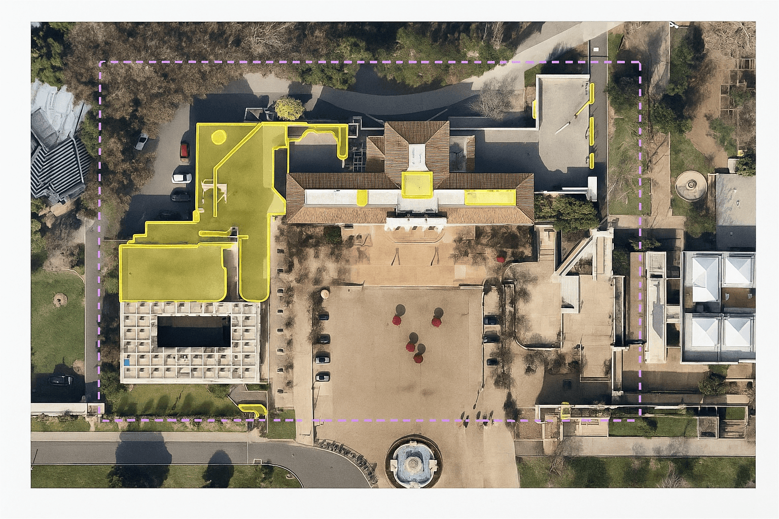
A single image can tell you a lot, but location intelligence adds the layers behind it. The method brings together multiple data sets in a visual environment, then applies data analysis so users can inspect a place, measure it, and interpret patterns without wrestling with raw files.
Nearmap Vertical is a good example of how this works in practice. Users can open high-resolution aerial imagery, review historical coverage, and measure distance or building area directly on screen. In a quick interface check, this kind of workflow usually takes only a few clicks, which matters when teams need fast answers from a computer instead of a field visit.
The broader idea connects closely with a geographic information system, or GIS. A GIS platform such as ArcGIS or software built to integrate with CAD lets teams combine imagery with business intelligence, dashboard views, and spatial analysis. That blend supports research, management, and mathematical optimization in a way a static map cannot.
Why Businesses Use Location Intelligence
| Industry | Use Cases and Applications | Key Benefits |
|---|---|---|
| Government | Remote property inspection and land-change review | Better planning and stronger transparency |
| Insurance and Financial Services | Underwriting, renewals, and claims assessment | Faster risk review and more consistent decisions |
| Architecture, Engineering, and Construction | Site measurement and progress tracking | Less fieldwork and clearer project oversight |
| Disaster Recovery | Damage assessment and safer route planning | Quicker response and earlier action on the ground |
Government
Public agencies use location intelligence to inspect properties remotely, monitor land change, and support planning decisions. It also improves transparency by giving stakeholders access to the same geographic information. One council used Nearmap high-resolution aerial imagery to identify thousands of previously unrecorded buildings, which produced a more accurate view of urban growth and supported future land-use policy.
Insurance and Financial Services
Insurance and finance teams depend on current information because timing affects risk and money decisions. Updated location intelligence helps with underwriting, renewals, and claims by giving staff a reliable view of site conditions. With current and historical data available in one place, remote assessment becomes faster and more consistent.
Architecture, Engineering, and Construction
Survey work can consume a lot of time before a project even begins. Location intelligence reduces that burden by giving project teams remote access to site detail, including building dimensions and vegetation cover. It also helps track change over time, which is valuable for forecasting growth and checking how work is progressing.
Disaster Recovery
Nearmap ImpactResponse provides post-event ground insight that helps response teams assess damage and choose safer access routes. After a major event, that speed matters. Teams can begin planning without waiting for every ground report to arrive, and that can shorten the first response window by hours in some cases.
Use cases continue to expand across sectors. The same underlying technology can support real estate review or transport planning, depending on how the data set is assembled and what decision needs to be made.
Across business settings, the benefits are fairly direct. Teams make decisions faster because the map, imagery, and supporting data sit in one view. They also cut some site-visit costs, improve day-to-day efficiency, reduce avoidable risk, and give customers a smoother experience when answers arrive sooner. Over time, that sharper view of place can also create an edge over slower competitors.
Why This Data Matters
Location intelligence data creates a distinct point of view because it pulls together information that might otherwise sit in separate systems. Once connected, those layers become far more useful for planning and forecasting. You can think of it like reading overlapping map overlays - one layer gives context, while the next reveals the pattern.
That matters in areas shaped by climate and rapid change. Businesses may use satellite imagery to study flood exposure, while planners look at soil conditions or the effects of climate change on infrastructure near the sea. The same approach can support wildfire response or energy planning where temperature and sea surface temperature influence operations.
From a business perspective, the practical gain is time and cost control. Teams can inspect a site remotely, confirm measurements, and improve customer experience without sending people out for every check. Frequent capture also strengthens the picture of truth on the ground, which improves forecasting and helps reduce issues before they grow.
It also supports a wider range of analysis than many people expect. Retail teams can study consumer behaviour and local marketing patterns. Utilities can use the same kind of spatial analysis for asset checks, while telecommunications teams can review coverage and network planning. In other settings, agriculture groups track field performance, and public health teams map the spread of local conditions. Combined with cloud computing or satellite sources, the result is a more responsive tool for management and long-range decision-making.
Learn More About Location Intelligence
If you want to see how location intelligence could fit your business or organization, a tailored demo is a practical next step. That kind of hands-on review usually makes the technology easier to judge, especially if you want to compare software workflow, data quality, and how well the system supports your everyday decisions.


