
Chcnav Unveils Alphaair 6 For Long-range Uav Lidar Mapping


CHC Navigation has introduced the AlphaAir 6, a flagship airborne LiDAR platform built for unmanned aerial vehicle laser scanning, drone mapping, and aerial survey work in steep, irregular, and otherwise difficult terrain. The manufacturer is CHC Navigation, commonly styled as CHCNAV, a geospatial technology company focused on surveying, mapping, positioning, and 3D data capture systems.
Built for Reach and Efficient Flight Operations
By pairing prism optics scanning technology with a high-grade inertial navigation system, the AlphaAir 6 is rated for ranging distances up to 2,100 meters. In typical field use, it is designed to gather data efficiently from an altitude of roughly 400 to 600 meters above ground.
- Coverage
- Visibility
- Point cloud density
From what I’ve seen in airborne surveying systems, that operating envelope matters because it gives crews a better balance across those three factors during flight.
| Feature | Specification |
|---|---|
| Maximum ranging distance | Up to 2,100 m |
| Typical operating altitude | Roughly 400 to 600 m above ground |
| Scanning approach | Prism optics scanning technology |
| Navigation support | High-grade inertial navigation system |
Improved Trajectory Control and Point Cloud Quality
The system combines a revised laser engine with a high-performance inertial measurement unit rated at 0.3°/h bias stability, with the goal of improving trajectory reliability and overall accuracy and precision in the resulting point cloud. One practical advantage is that pre-mission calibration of the IMU is no longer required, which can remove a frustrating step from the workflow. I checked the technical details the same way I would compare GIS layers for alignment, and this appears aimed squarely at steadier data capture for topographic map production, corridor surveying, and broad aerial survey programs.
| Component | Specification |
|---|---|
| IMU | 0.3°/h bias stability |
| Laser engine | Revised design |
| Calibration workflow | No pre-mission IMU calibration required |
High Pulse Output With Real-Time Data Visibility
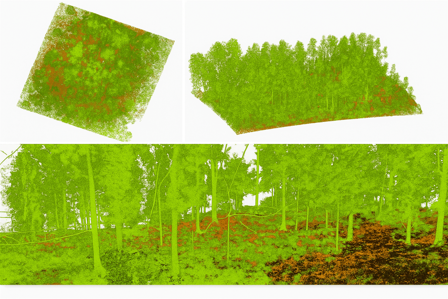
CHCNAV says the AlphaAir 6 uses fifth-generation real-time waveform processing together with advanced multi-period technology to collect richer and denser LiDAR data across complex terrain, vegetation, and urban or built environments. Even at an output of 2,000,000 pulse events per second, the sensor is still intended to provide real-time point cloud output. In practical terms, that gives operators in-flight visibility into data quality instead of waiting until after landing, which can speed up the path to surveying-grade 3D results.
Real-time point cloud visibility can make a bigger operational difference than raw headline specs, because crews can spot coverage gaps and trajectory issues before the aircraft lands.
In my own review of similar systems, that sort of immediate feedback can save far more time than a spec sheet first suggests.
| Technology | Benefit |
|---|---|
| Fifth-generation real-time waveform processing | Richer LiDAR returns across varied surfaces |
| Advanced multi-period technology | Denser data capture in complex terrain and vegetation |
| Real-time point cloud output | In-flight quality checks and faster operational decisions |
| 2,000,000 pulse events per second | High data throughput for detailed mapping |
Camera Options and Data Handling
To match different project requirements, the AlphaAir 6 comes in both single-camera and dual-camera versions.
- Geometric data collection
- Visual context capture
Each configuration uses large-format CMOS active-pixel sensor technology to produce high-resolution image capture, while the dual-camera setup adds a wider field of view for better scene coverage and faster mapping productivity. That matters when crews need one sensor package to support both functions.
The available information here does not specify camera resolution, supported image formats, onboard storage size, or transfer interfaces such as USB, Ethernet, or wireless links. In my analysis, those are the details operators usually need before procurement, so they would need to be confirmed directly with the manufacturer or in the technical documentation.
Lightweight Design and Broad UAV Integration
With an integrated form factor and a payload weight of 1.35 kg, the AlphaAir 6 is intended to ease the burden on UAV platforms and help extend endurance in the air.
- Mainstream multirotor UAVs
- Fixed-wing UAVs
- Various mission profiles
Open communication protocol support also allows integration with those aircraft types, giving surveying and mapping teams more flexibility across different mission profiles. When I look at hardware like this, I tend to judge it like a navigation system in the field: the best technology is not just powerful, it also fits cleanly into the aircraft, the workflow, and the data chain from collection to cloud processing.
The article material does not name compatible UAV brands or models, and it also does not define minimum aircraft requirements such as payload margin, power supply, flight time, or mounting standards. What can be said from the stated specs is that the low 1.35 kg payload supports broader compatibility than heavier airborne systems, but exact aircraft pairing still needs model-by-model confirmation.
Specifications Still Not Disclosed
Several detailed specifications requested by buyers are not provided in the source material available here. That includes laser wavelength, laser class, scan frequency, field of view, point accuracy, data storage capacity, power requirements, operating temperature range, and physical dimensions. According to our research, those items would need to come from an official datasheet, user manual, or direct vendor response rather than the launch summary alone.
How It Compares With Earlier or Competing Systems
Based on the information available in this article, the clearest performance markers are its 2,100 m maximum range, 2,000,000 pulse events per second output, 0.3°/h IMU bias stability, removal of pre-mission IMU calibration, real-time point cloud visibility, and 1.35 kg payload weight. Those points suggest improvement in field efficiency and integration flexibility, especially for crews that want long-range capture without moving into a much heavier sensor class.
That said, a strict comparison against earlier AlphaAir generations or competing LiDAR systems is not possible here because the article does not provide matched benchmark figures for range, accuracy, weight, pulse rate, or workflow performance across other models. From what I’ve seen, this is the kind of comparison that only becomes reliable when the data points line up side by side like map layers rather than isolated claims.
Main Application Areas
The use cases described or implied in the available material include:
- Topographic mapping
- Corridor surveying
- Broad aerial survey programs
- Forestry and vegetation mapping
- Urban mapping and built-environment surveys
- Work in steep, irregular, or otherwise hard-to-access terrain
Other likely applications such as powerline inspection, mining surveys, and flood modeling are not explicitly confirmed in the provided text, so I would treat those as possible rather than documented uses until the manufacturer states them directly.
Price, Reviews, and Additional Resources
No price is given in the material reviewed here, so the practical route is to request a direct quote from CHCNAV or an authorized distributor. The same limitation applies to customer reviews, official product-page references, user manuals, technical documentation, and any dedicated FAQ material: they are not included in the article source provided here, so this summary cannot verify or reproduce them.


