
Advanced Gnss Ionospheric Sensor Reaches Orbit


The U.S. Naval Research Laboratory, or NRL, has placed the GNSS Orbiting Situational Awareness Sensor, known as GOSAS, into outer space as one of three experimental payloads. From what I’ve seen in satellite navigation work, launches like this matter because better ionosphere data usually leads to more dependable navigation and communication performance.
Launch Details and Mission Context
GOSAS flew aboard the Space Test Program’s STP-Satellite-7 mission, which lifted off at 4:33 a.m. PDT on April 7 from Vandenberg U.S. Space Force Base in California. The launch was carried out under the United States Space Force, placing the satellite into orbit for research tied to GPS signals, radio frequency behavior, and the broader GNSS environment around Earth.
The other payloads on the same satellite were the Lasersheet Anomaly Resolution and Debris Observation instrument, or LARADO, and the Gadolinium Aluminum Gallium Garnet Radiation Instrument, called GARI-1C.
Why GOSAS Matters for Navigation and Space Weather
The purpose of GOSAS is straightforward: improve the reliability of systems used by warfighters for navigation and communications. In practical terms, that means studying how space weather, plasma, ionization, and electron density in the atmosphere of Earth affect signal quality, line-of-sight propagation, and the accuracy and precision of the Global Positioning System.
When I checked the mission description, the technical aim was clear. GOSAS is a CubeSat-compatible, programmable dual GPS receiver built to characterize the orbital GNSS environment and generate high-quality ionospheric space weather products. That includes data tied to total electron content, scintillation, phase behavior, refraction, diffraction, frequency shifts, and density changes that can distort GPS signals in low Earth orbit.“The GOSAS is a CubeSat-compatible, programmable dual GPS receiver designed to characterize the orbital GNSS environment and produce high-quality ionospheric space weather products,” said Scott Budzien, PhD, NRL research physicist and GOSAS principal investigator. “Understanding and predicting space weather is critical for ensuring the accuracy of GPS and the integrity of military communications.”
That summary lines up with what engineers usually see in the field. A satellite navigation device is only as good as the signal path between antenna and receiver, and the ionosphere can behave like a shifting map layer that bends, delays, or roughens the radio wave. In my own analysis of GNSS systems, that kind of noisy data can resemble raw GPS traces before filtering, where the signal is present but the environment keeps pushing it off course.
What the Sensor Is Expected to Measure
GOSAS should help researchers build a better map of how the ionosphere behaves across longitude, altitude, and changing weather conditions driven by the sun. That includes tracking electron movement, particle activity, scintillation physics, interplanetary scintillation effects, and phase variations that influence GPS, Galileo, and other satellite constellation services. The resulting data can support remote sensing workflows, software models, and algorithm development used to improve navigation, timing, and communications across the United States and beyond.
I looked through the available mission notes for a few minutes, and the pattern is familiar: collect better sensor data in orbit, compare it across environments, and refine the model until weak spots in the signal become easier to predict. It is not unlike comparing GIS layers on a map to see where one distorted surface is affecting the full route solution.
GNSS, Ionospheric Effects, and Why They Matter
An ionospheric effect on GNSS is the change that occurs when navigation signals pass through the ionosphere, the charged upper region of Earth’s atmosphere filled with free electrons and ions. Because GNSS signals are radio waves, that layer can slow them down, bend their path, shift their phase, or make their strength fluctuate before they reach a receiver on the ground, in the air, or in orbit.
In plain terms, ionospheric means related to the ionosphere. That atmospheric region sits above the denser lower layers and is strongly influenced by solar radiation, which is why its behavior changes with time of day, season, latitude, and solar activity. From what I’ve seen, this is one of the main reasons a clean-looking satellite geometry can still produce messy positioning errors.
A GNSS sensor is the receiving hardware and supporting electronics that detect signals from global navigation satellites and turn them into position, timing, or environmental measurements. In a mission like GOSAS, the sensor is not just calculating location. It is also measuring how the signal itself behaves so researchers can infer what the ionosphere is doing along the path, much like reading distortions across overlapping map layers to understand where the surface changed.
The four main GNSS constellations are GPS from the United States, GLONASS from Russia, Galileo from the European Union, and BeiDou from China. Each system provides satellite-based positioning and timing, and modern receivers often combine signals from several of them to improve coverage, resilience, and accuracy.
High-Precision Impacts, Scintillation, and User Mitigation
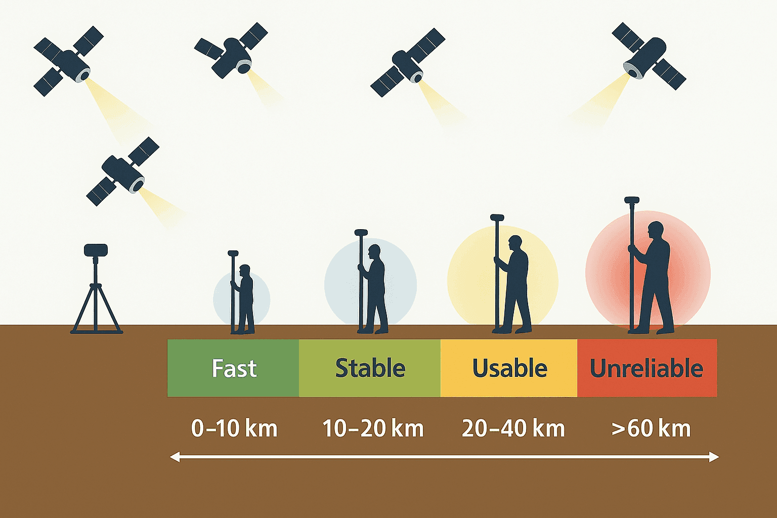
Ionospheric activity matters even more in high-precision GNSS work because centimeter-level or tightly timed applications depend on very small measurement errors. Surveying, machine control, aviation support, precision agriculture, and scientific positioning can all suffer when the ionosphere introduces excess delay, rapid phase changes, cycle slips, loss of lock, or degraded ambiguity resolution. In practice, the receiver may still track satellites, but the solution becomes less stable or less trustworthy.
Ionospheric scintillation is a rapid fluctuation in GNSS signal amplitude and phase caused by small-scale irregularities in electron density. When scintillation becomes strong, the signal can fade, jump, or decorrelate enough to reduce carrier tracking quality and positioning accuracy. This is one of the more disruptive effects because it can turn a normally smooth signal path into something that looks, analytically, like a noisy GPS trace with repeated dropouts.
These disturbances occur most often in equatorial regions, in high-latitude auroral zones, and during periods of elevated solar activity such as solar maximum. They are also commonly more active around sunset, after dusk, and during transitional periods such as dawn or dusk, when ionospheric structure can change quickly.
Common ways to mitigate ionospheric disturbances include using dual-frequency or multi-frequency GNSS receivers, applying correction services, combining signals from multiple constellations, and relying on receiver algorithms that detect and down-weight corrupted observations. Operators also use forecasting tools, quality-control thresholds, and more robust tracking strategies when scintillation risk is elevated.
For scintillation specifically, detection often relies on measures such as the S4 index for signal intensity fluctuations and phase-based monitoring for rapid carrier instability. Mitigation can involve stronger receiver tracking loops, better antenna and firmware design, adaptive filtering, observation screening, and fallback logic that removes unstable signals before they damage the position solution.
How GNSS Is Used to Monitor the Ionosphere
GNSS is widely used to monitor the ionosphere because every satellite-to-receiver path passes through that charged region and carries clues about what happened along the way. By comparing how signals arrive on different frequencies and from different viewing angles, researchers can estimate total electron content, identify scintillation, track phase disturbances, and map where conditions are changing over time.
The resulting products can include total electron content maps, scintillation indicators, delay estimates, phase measurements, and model inputs for forecasting and operational warning systems. That is a big part of why a sensor like GOSAS matters. It helps turn ordinary navigation signals into measurement paths that reveal how the atmosphere is affecting the entire GNSS environment.
Connection to Earlier NRL Work
GOSAS follows earlier work by NRL, specifically the GROUP-C experiment, short for GPS Radio Occultation and Ultraviolet Photometry-Collocated, which operated on the International Space Station from 2017 through 2023. That project unexpectedly detected GPS ground interference, adding another useful piece to the research picture around signal disruption and space-based monitoring.
The current mission began in 2020 with a clear objective: raise GPS accuracy for the warfighter. With a dedicated sensor now in orbit, researchers should be able to gather cleaner operational data about the ionosphere, atmosphere, and space weather conditions that shape modern navigation and radio communications.


