
How Do Drones Navigate Without Gps


Inside a tank, a mine drift, or a ship hull, the Global Positioning System usually drops away fast. That is where the answer to how do drones navigate without GPS becomes practical rather than theoretical - they rely on onboard sensor systems, visual reference data, and in some aircraft, LiDAR with simultaneous localization and mapping to hold position and move safely through space.
Most professional drone operators are used to aircraft that depend on satellite navigation for hover stability and location awareness. That works well outdoors, but it breaks down indoors and in confined structures where GPS signals are weak, reflected, or completely blocked.
As I read through this material, the pattern was familiar from a GIS perspective. Once the satellite layer disappears, the unmanned aerial vehicle has to build its own local map from sensor input and computing on board. That shift is why so many inspection teams now use platforms designed for GPS-denied work.
Industries with the most to gain include mining and oil and gas, along with operators responsible for power assets or sewer infrastructure. In these settings, getting reliable information from a confined area often matters more than covering open ground.
What a GPS-Denied Drone Actually Does
A GPS-denied drone is built to fly and hold orientation by using onboard sensor input instead of the Global Positioning System. Consumer models often use satellite navigation as their main reference for position in the air, but that approach becomes unstable once the signal degrades.
In a GPS-denied environment, the aircraft either cannot see enough satellites or receives distorted GPS signals. The result can be drift, poor hover performance, or erratic movement. For indoor inspections, that is a serious limitation.
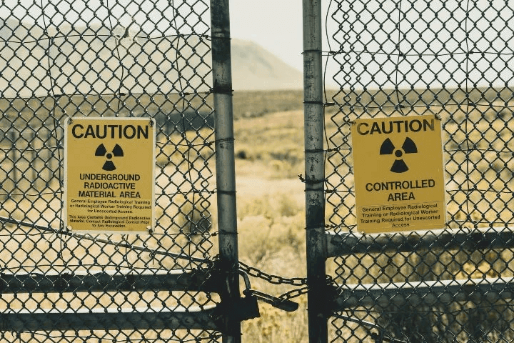
There is another reason some teams avoid GPS entirely. At sensitive sites such as a nuclear power station, personnel may prefer a drone that does not depend on anything associated with outside location systems, even if the security concern is more about perception than actual data exposure. GPS itself does not need an internet link, but site policies and operator preference still shape equipment choices.“. . . one of the FAA’s requirements will be the ability to navigate in the event of a GPS outage . . . because GPS signals can often be degraded at low altitudes in urban areas-exactly where the highest precision is needed.”- NASA
“. . . one of the FAA’s requirements will be the ability to navigate in the event of a GPS outage . . . because GPS signals can often be degraded at low altitudes in urban areas-exactly where the highest precision is needed.”
- NASA
How Drones Fly in Places With No GPS
Can a drone work without GPS? Yes, if the platform has the right navigation technology on board. Professional systems do this with sensor fusion and onboard computing. Basic consumer or hobbyist drones can still fly without GPS in a manual or attitude mode, but they usually lose position hold and demand much more pilot control.
The key is replacing satellite position fixes with local sensor fusion. That usually means optical sensing and an inertial navigation system, with software that keeps updating the drone’s estimate of where it is. Some aircraft also use a barometer or magnetometer to steady altitude and heading, and a few rely on radio-based positioning such as UWB or fixed RF beacons when the job site supports it.
- Optical sensors - Visual cameras that read nearby surfaces and motion
- Inertial measurement unit - Tracks movement and attitude
- LiDAR - Helps with mapping in dark or low-texture spaces
- Sensor fusion software - Combines the incoming data into a usable position estimate
Visual sensors act much like the aircraft’s eyes. They read nearby surfaces, measure motion, and feed information into an algorithm that supports stability. At the same time, an inertial measurement unit tracks movement and attitude. Put together, those inputs give the drone enough data to hover and move with useful accuracy and precision.
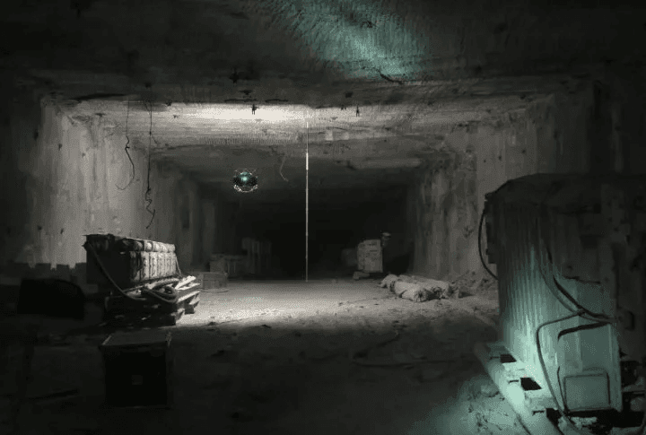
Some systems add LiDAR, which improves navigation and mapping in dark or texture-poor environments. With simultaneous localization and mapping, the drone builds a live map while also locating itself within that map. I tend to think of that process like field mapping with no reliable base layer - the platform keeps creating its own reference frame as it goes.
A SLAM-enabled platform such as Flyability’s Elios 3 combines camera-based information with LiDAR data so the operator can see a 2D or 3D representation of the environment during flight. In tight structures, that extra spatial context can save minutes on every pass and reduce the chance of contact with walls or equipment.
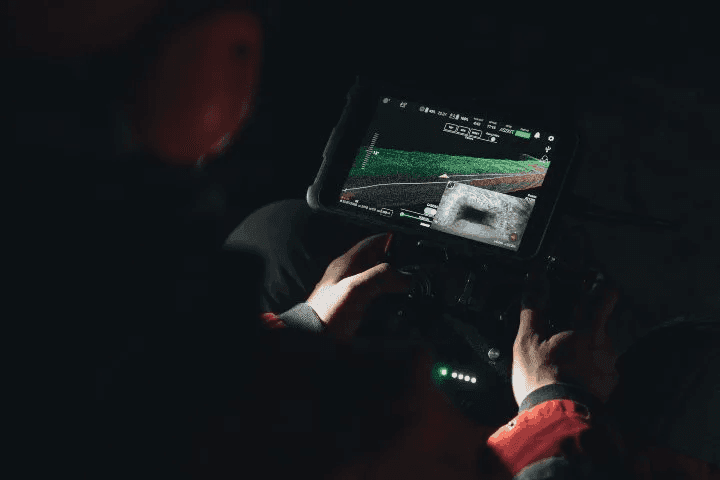
LiDAR stands for Light Detection and Ranging. The sensor sends out laser pulses, then measures the return to calculate distance and shape. From that stream of data, the software can generate an image or map of the surrounding structure in real time.
That sensing method is especially useful where dust, clutter, or partial obstruction would limit a normal camera. In some search environments, LiDAR can read through light debris or vegetation better than standard optical systems, which expands the practical range of autonomous drone work.
When GPS-Denied Navigation Becomes Necessary
Flying without GPS is not new. Early drones often lacked advanced positioning support, and many of them were difficult to control. The difference now is that modern sensor packages and onboard computing have made non-GPS flight far more dependable.
Many current aircraft can switch into a non-GPS mode, but a true GPS-denied platform is designed around that condition from the start.
- Aircraft with a switchable non-GPS mode - Useful when the signal drops, though pilot workload usually rises fast
- Purpose-built GPS-denied platforms - Built for enclosed or obstructed spaces where satellite navigation is unreliable from the start
That difference matters in narrow spaces, poor weather, or regulated operations where resilience is part of the requirement. FAA and EASA expectations around safe continuation of flight during a GPS outage have pushed this issue further into the mainstream. The same need appears in military or security environments where jamming or spoofing is a real possibility, and a drone has to keep working from onboard references instead of trusting the satellite feed.
Indoor Inspection Work
Large industrial assets are often metal, enclosed, and hostile to satellite navigation. Boilers and pressure vessels are common examples, and the same applies to storage structures deep inside plants. In those spaces, a GPS-based drone has very little to work with.
Critical Infrastructure Sites
Drones are now common around military facilities and power plants because they collect inspection data quickly. Even so, operators at critical infrastructure often prefer systems that avoid GPS dependence altogether. In the U.S., concern around data handling sharpened after a 2017 document raised questions about drones made by Chinese manufacturers. That debate did not prove GPS itself was unsafe, but it did push many agencies toward self-contained systems.
Wind Turbines and Bridges
Wind turbine interiors create a difficult environment for navigation. Metal housings and mechanical equipment interfere with signal quality, while the working space leaves little room for pilot error. A similar issue appears under bridges, where steel and reinforced concrete can disrupt satellite reception. In both settings, stable local positioning is far more useful than unreliable GPS.
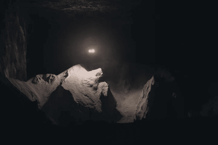
Ships and Underground Mines
Maritime inspection teams often work inside cargo holds or fuel tanks where metal blocks outside signal access. A regular drone may lose position quickly there. Mines present the same challenge in a different form. Once the aircraft moves underground, the satellite layer is gone, and dust or rough surfaces can complicate visibility. That is exactly where GPS-denied systems earn their place.
For mining crews, this has direct operational value. The drone can enter unstable areas and return image data or map information without exposing a worker to loose rock or unsupported ground.
Search and Rescue and Damage Surveys
Dense tree cover and collapsed structures can interfere with satellite navigation and radio signal quality. During search and rescue, that is more than an inconvenience. A drone that maintains position through onboard odometry and sensor fusion lets the pilot focus on the search area instead of fighting the aircraft.
The same logic applies at disaster sites. Rubble and steel can distort GPS signals, but a drone using its own sensor-based navigation stack can continue through the area and gather information for responders.
Where These Drones Are Used
As the technology matures, more sectors are adopting drones that can work without satellite navigation. Oil and gas operations rely on them for internal inspection, while power generation teams use them around enclosed assets where access is difficult.
Mining is another strong fit, and so are public infrastructure operators managing tunnels or sewer systems. Maritime inspection remains one of the clearest use cases because the metal environment inside a vessel is especially harsh on GPS.
Why Operators Use Them
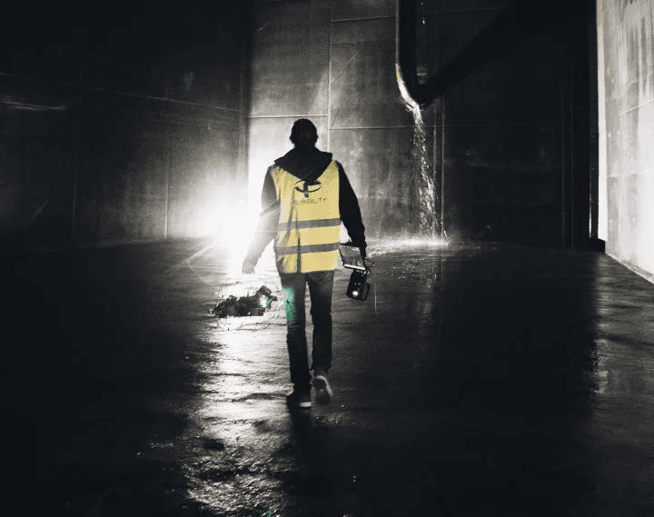
The main benefit is straightforward. A drone that does not depend on GPS can fly in places where ordinary aircraft cannot maintain stable navigation. That opens access to confined structures and hazardous spaces that used to require rope work or shutdown-heavy entry procedures.
- Access to confined or hazardous spaces
- Visual records and spatial data from the same flight
- Improved safety for personnel
- Reduced downtime with faster inspections
There is also a data advantage. With a camera and LiDAR working together, the operator can collect detailed image records and a usable map in the same flight. In my experience, that kind of layered output is much easier to review later because visual context and spatial information line up like two clean GIS overlays.
These systems also improve safety by moving people away from heights and unstable surfaces. They can reduce downtime as well, since inspections often take less setup time and fewer personnel than conventional methods. On some jobs, even saving 20 minutes per entry adds up quickly over a week.
Use Cases for GPS-Denied Drones
| Use Case | Industry | Mission | Results | Why GPS-Denied Flight Mattered |
|---|---|---|---|---|
| Stockpile Measurement in a Salt Mine | Mining | A team at a salt mine in Germany needed to estimate the volume of stored salt using LiDAR data gathered by Flyability’s Elios 3 indoor drone. | Personnel captured the required information without placing anyone in harm’s way. The inspection workflow stayed remote from start to finish. | Because the work was underground, a drone dependent on satellite navigation could not have functioned there. A self-positioning aircraft was essential. |
| Remote Hull Inspection With Major Savings | Maritime | C-Bird was asked to inspect the hull of a 250 meter cargo oil tanker during a certified class inspection governed by the American Bureau of Shipping. | The Elios 3 delivered full hull coverage with LiDAR scanning and visual inspection from its 4K camera. The aircraft also kept operating in temperatures above 45 degrees Celsius. The job avoided about 10,000 hours of scaffolding effort and cut as much as $1 million from a single inspection project. | Inside a steel vessel, GPS-based flight would have been unreliable at best. SLAM-based positioning made the inspection practical and fast. |
| Ore Pass Investigation in 10 Minutes | Mining | A large mining operation in Colorado faced an ore pass hangup that blocked material flow. After two months of drilling and blasting, the cause still was not clear. | Using the Elios 3 and its 3D Live Map, the crew identified the source and exact position of the obstruction in about 10 minutes. | The entire task took place underground, where satellite navigation could not support the aircraft. A drone built for GPS-denied work was the only realistic option. |


