
London Borough of Harrow Expands Its Digital Twin With Drone Data


The London Borough of Harrow has introduced a new digital twin that supports remote inspections of public buildings and creates richer online experiences for residents across Harrow, London.
Drone Surveys Add Detail to the Borough Model
High-quality aerial data gathered by an unmanned aerial vehicle is helping Harrow London Borough Council carry out maintenance checks more quickly and at lower cost. At the same time, 3D computer graphics and a detailed map of public parks are being used to encourage people to spend more time in outdoor space. The council is also testing the same technology to improve planning for action against illegal dumping.
With Site Scan software from Esri UK, the authority is collecting and processing drone data to build precise 3D modeling outputs for key locations, including leisure centres, parks, arts facilities, and other council property. This information strengthens an existing low-detail twin by adding higher image resolution only where it is most useful. In practice, Harrow’s strategy is to combine a borough-wide low-detail model with targeted high-detail drone capture at priority sites, creating a hybrid data approach that balances investment, risk, cost, and practical value.
| Location Type | Data Resolution | Purpose/Use Case |
|---|---|---|
| Leisure centres | High resolution where needed | Asset inspection and maintenance planning |
| Parks | High resolution for selected areas | Public engagement and outdoor experience mapping |
| Arts facilities | Targeted high resolution | Property review and management |
| Other council property | Combined low- and high-resolution data | Cost-controlled digital twin development |
Historic Roof Inspections Cut Cost and Reduce Risk
One early use case involved roof inspection work at Headstone Manor and Museum, a Grade I listed building first dating from 1310 and a significant part of local history in London, United Kingdom. By relying on drone captures instead of scaffolding and manual checks, the council avoided a more expensive survey process and saved £12,000 on that project. The approach also reduced disruption while delivering better information about the roof and the wider asset.Ben Jones, Head of Digital at London Borough of Harrow, said the drone-led method is already reducing both time and money demands while supporting the council’s aim to operate more intelligently and efficiently. He added that a relatively small investment in 3D data could generate substantial financial returns in the coming years.
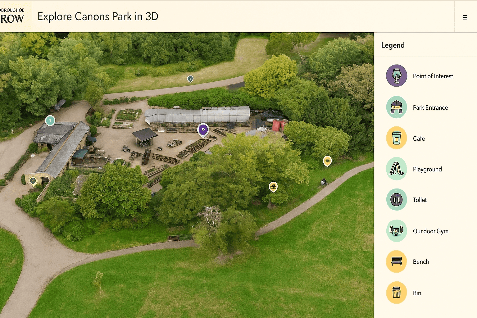
Parks, Health, and More Engaging Online Experiences
Through the Healthier Harrow programme, the council is using immersive 360-degree park imagery to support health promotion and attract more people to green space. Canons Park is among the first examples made available. Harrow has found that interactive 3D visuals are more compelling than standard 2D presentations when showcasing parks, libraries, and leisure sites.
The wider initiative is focused on health, wellbeing, healthier living, and health equity by helping residents discover local amenities more easily. In practical terms, these experiences go beyond what people expect from a static map or even tools such as Google Street View, because the digital twin can combine layered geographic information system data with more realistic environmental views.
Using 3D Data to Address Illegal Dumping
Harrow is also piloting drone-based surveying to support action against fly-tipping. Detailed 3D modeling of locations vulnerable to illegal dumping should help the environmental team decide where to place fencing, signage, and closed-circuit television equipment. Because the system shows each site in full spatial context, teams expect to gain better insight into why some areas attract waste dumping more than others.Sam Tizzard, Head of GIS and Data Manager at the council, said that using a drone together with Site Scan provides a quicker and more affordable way to inspect buildings and other assets. He noted that combining high- and low-resolution data keeps development cost under control while still delivering detail where it matters. In his view, this is a low-cost, low-risk route to a more useful digital twin, with especially strong savings potential for roof inspections.
How Esri Technology Supports the System
- Processes unlimited drone flight data in the cloud
- Produces 2D and 3D outputs
- Generates point clouds
- Creates detailed mesh surfaces
- Allows measurement of distance, area, and volume
This work builds on Harrow’s earlier low-resolution aerial and street-level coverage of the borough. The council is developing its digital twin on Esri geographic information system technology so it can integrate, visualize, and analyze the many forms of data needed to support planning, asset management, and service delivery. The same framework could also be valuable for issues such as weather monitoring or even flood response in the future.
Next Steps for the Harrow Model
- Automate addition of Building Information Modeling files
- Integrate Autodesk Revit models
- Train more staff to operate drones
Longer term, Harrow wants to feed live data into the twin, potentially including traffic and weather inputs, and to test live drone monitoring at suspected illegal dumping hotspots. This would give the borough an even more responsive platform for planning, maintenance, and public services.Our experts believe this case shows how digital twins in local government can move from simple visualization to practical decision support. As data capture becomes more affordable and more departments contribute information, the long-term potential includes smarter asset management, stronger planning, and better outcomes for residents.


