
OS Tool Could Accelerate Sustainable Homebuilding And Biodiversity Goals


A new Ordnance Survey solution may help advance the Government’s plan to deliver 1.5 million homes while supporting sustainable development and biodiversity outcomes.
New Support for BNG in England
Ordnance Survey has introduced a ready-made resource for developers working across rural and urban England, designed to help them meet the requirement for a 10 per cent Biodiversity Net Gain. The tool supports planning and land use decisions by improving access to habitat data and strengthening project workflow from early review through site delivery. It also contributes to biodiversity and nature management by helping teams identify existing habitat conditions earlier, spot areas with restoration potential, and plan how development can avoid unnecessary ecological loss while supporting long-term habitat enhancement.
Under Defra rules, developers submitting planning applications must measure existing habitat conditions with the official biodiversity metric, provide a biodiversity gain plan, secure gains on-site or through biodiversity offsetting and credits, and then manage and monitor the resulting landscape for 30 years. Defra has also confirmed that this policy will apply to Nationally Significant Infrastructure Projects from November, broadening its impact across England and the wider United Kingdom.
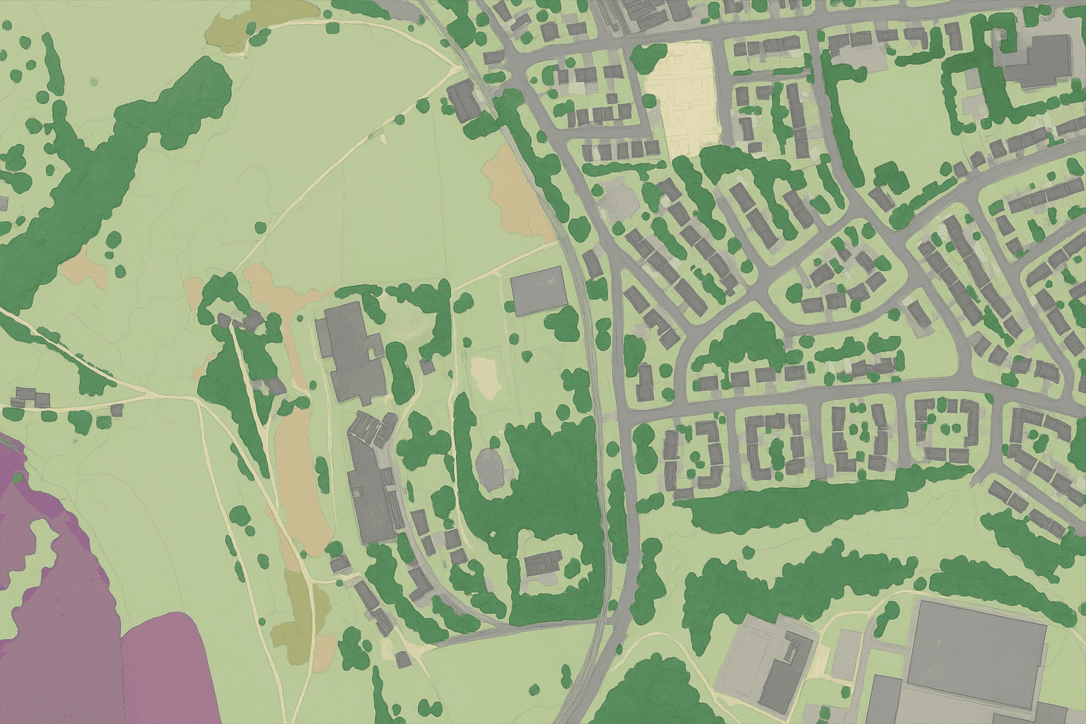
How the Data Set Helps Developers and Ecologists
OS Enhanced Land Cover Beta is a land cover and habitat intelligence product designed to give users a more complete picture of how land is being used and what ecological characteristics may be present across a site or wider area. Its purpose is to combine multiple spatial inputs into one working data set so developers, ecologists, planners, and land managers can assess habitat patterns, support BNG requirements, and make earlier decisions on environmental risk and opportunity.
The data set functions as a core database that brings together topographic information, land cover detail, aerial photography, OS terrain modelling, and third-party habitat sources. These layers are integrated to give users both broad landscape context and site-level detail, helping them move from initial screening to more focused survey planning.
| Data Source | Description | Role in OS Enhanced Land Cover |
|---|---|---|
| OS topographic data | Base mapping that shows physical features and boundaries | Provides the spatial framework for locating habitats and site features |
| Land cover data | Classification of how land is covered and used | Helps identify broad habitat and land-use patterns across sites |
| Aerial photography | Image data showing visible surface conditions | Supports visual interpretation and refinement of mapped land cover |
| OS terrain modelling | Elevation and landform information | Adds physical context that can influence habitat type, drainage, and suitability |
| Natural England Living England | Habitat-related source material | Strengthens habitat identification and ecological interpretation |
| Rural Payments Agency crop map | Agricultural land-use information | Improves understanding of crop cover and managed rural land |
| UKHab system | Habitat classification framework used in ecological assessment | Helps align the product with habitat categories relevant to the statutory biodiversity metric |
This combined structure gives users access to features and layers that include topography, land cover classes, aerial imagery inputs, terrain information, habitat source material, crop mapping, and UKHab-aligned classification support. The data is intended to function as a map-based foundation for geographic information system work, allowing teams to review habitat distribution and land condition in one place rather than switching between disconnected sources.
Its most important use is in BNG assessment, whether for desktop analysis at the start of a project workflow or for ecologists conducting field checks. Before detailed surveys begin, users can review:
- Land cover
- Vegetation
- Species potential
- Natural environment patterns
The data can also be structured in formats used by Esri environments and GeoPackage delivery, making it easier to work with polygon boundaries, landscape units, and site-level map layers. The article does not provide further technical detail on coordinate system, update frequency, or a full download pathway, but it does show that the product is designed for practical use in established spatial analysis workflows.
Beyond BNG assessment, the same wider view can support environmental planning, conservation, and land management by helping teams compare multiple sites, identify habitat links across larger areas, and understand where ecological enhancement may fit alongside development or infrastructure pressures. This can be useful for early conservation screening, land stewardship planning, and strategic decisions about where to prioritize survey effort or habitat creation.
In some cases, this wider view may also support:
- Wildlife corridor planning
- Flood management
- Flood risk review
- General risk management
For example, wildlife corridor planning can benefit from seeing how habitat parcels connect across neighboring land. Flood management and flood risk review can draw on terrain and land cover context to understand where natural features may affect water movement or storage. General risk management can also improve when habitat creation proposals are reviewed alongside wider land-use constraints.Integrated land cover data can give project teams a stronger starting point for biodiversity net gain assessment by combining habitat evidence, landscape context, and mapping detail in one view.
One practical example comes from Wessex Water, which used OS ELC information to assess the biodiversity profile of hundreds of locations within one spatial picture and apply those findings to 30-year BNG planning. That kind of joined-up data helps organizations understand habitat composition at scale, improve environmental analysis, and make better-informed planning decisions for sustainable development across the natural environment.
The main target users described here are developers, ecologists, landowners, planners, and other organizations involved in land management and environmental assessment. The partners and source contributors referenced in the data include Natural England, the Rural Payments Agency, and the UKHab framework. Within the scope of this article, OS Enhanced Land Cover is presented as an integrated product rather than a direct like-for-like comparison with other land cover mapping products, so only its distinguishing characteristics are clear here: it combines multiple authoritative sources, supports BNG-led workflows, and is intended for use across both urban and rural settings.


