
From Open Source GIS to Heritage Management: The Arches Project


Cultural heritage professionals increasingly rely on digital tools to inventory, protect, and manage historic places. However, traditional GIS platforms alone often fall short when it comes to handling the complex relationships inherent in heritage data. To address this gap, The Getty Conservation Institute and World Monuments Fund have collaborated to develop Arches, an open source Heritage Inventory and Management System purpose-built for cultural heritage management.
Arches is designed to help institutions gather, access, and preserve critical information about immovable heritage assets. Rather than requiring organizations to build custom systems from scratch—often at great expense—Arches offers a flexible, standards-based platform that can be deployed at local, regional, or national scales. An alpha version of the software was released in early 2013, making its open source code and documentation publicly available.
Open Source Foundations and Purpose
Arches is built on proven open source geospatial technologies, including PostGIS, GeoServer, and OpenLayers. While heritage organizations could theoretically assemble their own solutions from these components, Arches provides a turnkey system specifically tailored to heritage workflows. It embeds international standards and best practices directly into the platform, enabling institutions—especially those with limited funding or technical staff—to adopt a robust, extensible system with far less effort.
Unlike conventional GIS implementations, Arches focuses on stewardship rather than pure spatial analysis. It emphasizes long-term data preservation, interoperability, and semantic clarity, ensuring that heritage information remains usable and meaningful over time.
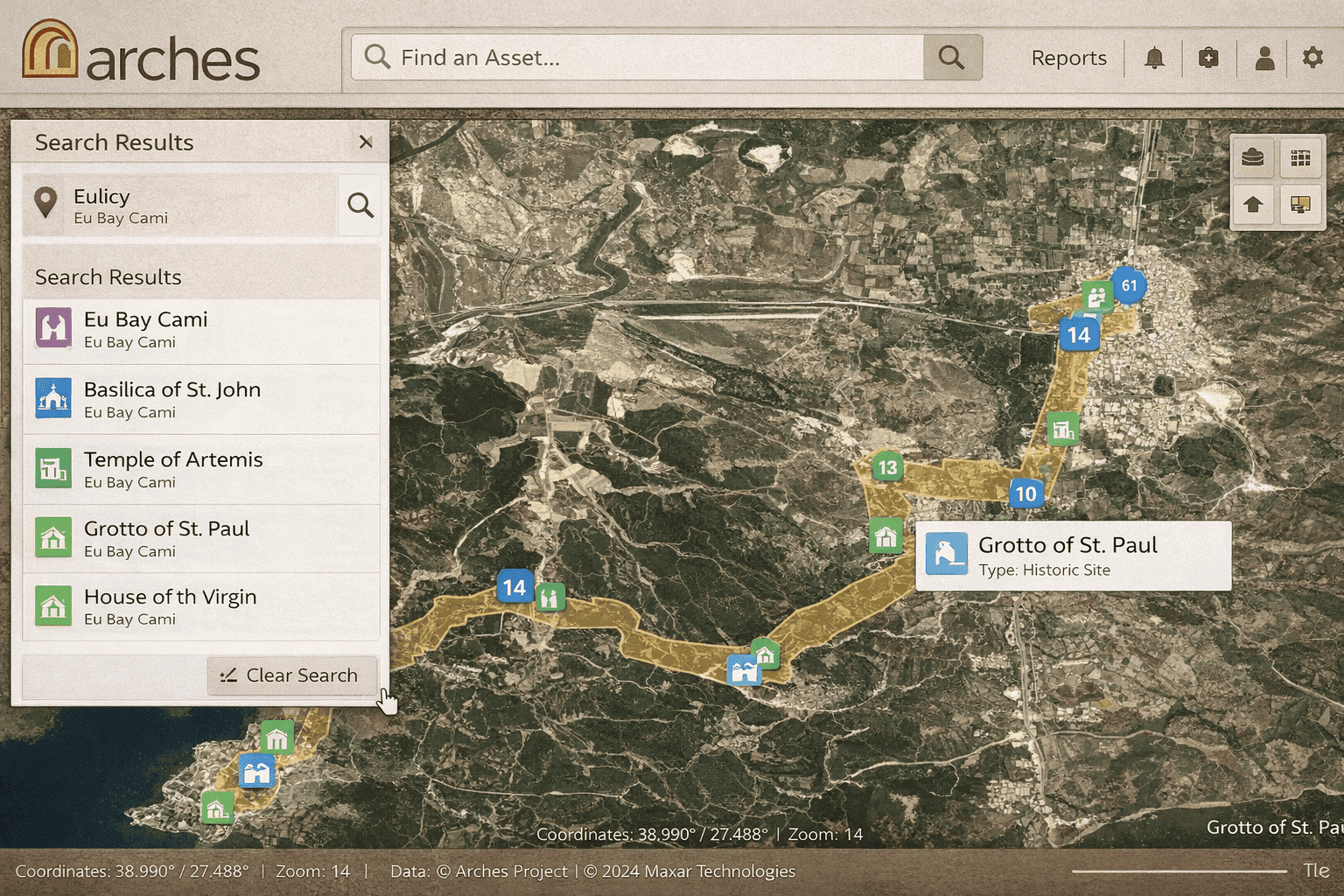
(Insert image: Arches UI mockup showing polygon-based heritage search and impact assessment for development projects)
System Design and Key Contributors
The initial development of Arches was led by Farallon Geographics, selected for its experience building innovative, open source geospatial systems. Farallon worked closely with the Getty Conservation Institute and the World Monuments Fund to define use cases, system architecture, workflows, and data migration processes.
A major design insight was recognizing that heritage data cannot be managed effectively as simple map layers. Instead, Arches implements an ontology-driven approach to capture relationships between physical sites, historical events, people, organizations, and documentation. To support this, Arches integrates ElasticSearch for advanced querying and SKOS-based thesauri for managing controlled vocabularies and taxonomies.
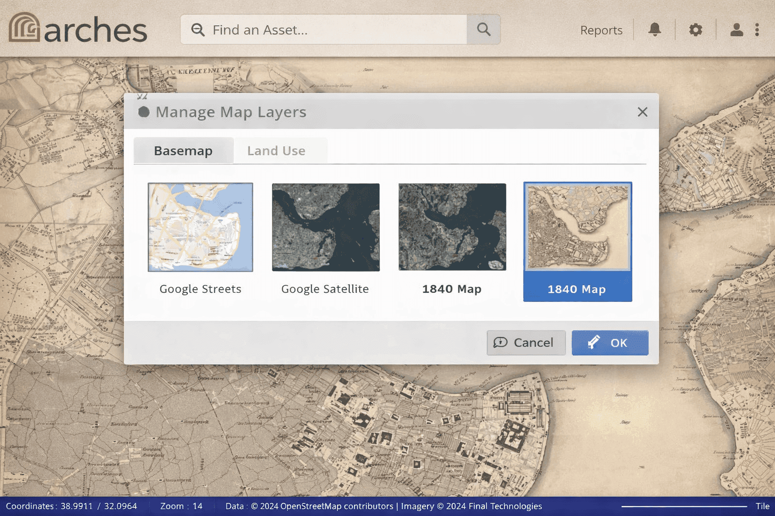
(Insert image: Arches UI mockup showing layer library with Google Maps, satellite imagery, historic maps, and OpenStreetMap)
Interoperability and Standards Compliance
Interoperability is central to Arches’ design philosophy. The system supports Open Geospatial Consortium (OGC) standards to ensure compatibility with desktop GIS applications, web mapping platforms, and online basemaps. It also relies on modern web standards—HTML5, JavaScript, and CSS3—allowing access across browsers and devices without proprietary dependencies.
Crucially, Arches implements the CIDOC Conceptual Reference Model, a widely adopted ontology for cultural heritage documentation. This semantic framework enables rich descriptions of heritage assets and supports future publication of data as RDF triples, promoting data longevity and cross-platform reuse.
Beyond GIS: A Heritage Inventory and Management System
Although Arches incorporates many GIS components, its creators intentionally avoid labeling it as a GIS. Cultural heritage data is inherently relational, involving networks of objects, actors, events, and concepts rather than isolated spatial features. Managing these relationships requires semantic structures and controlled vocabularies that go well beyond traditional GIS capabilities.
For this reason, Arches is best described as a Heritage Inventory and Management System—one that combines geospatial awareness with semantic rigor to meet the real-world needs of heritage professionals.
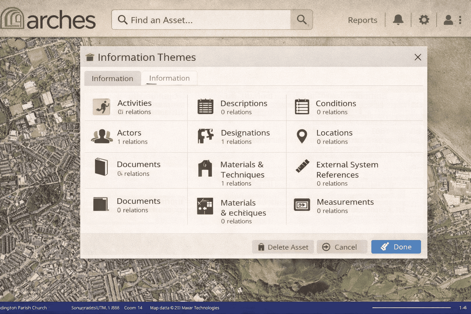
(Insert image: Arches UI mockup illustrating relationships between a heritage asset, historical events, actors, and documents)
Conclusion
The Arches Project represents a significant step forward in cultural heritage data management. By combining open source geospatial technology, international standards, and ontology-based data modeling, Arches provides a sustainable, adaptable solution for heritage institutions worldwide. It demonstrates that effective heritage stewardship requires more than a GIS—it requires a system designed to capture the full complexity of human history embedded in place.


