
Mars Global Localization: Nasa’s Perseverance Rover Learns to Self-locate


Audio is not provided for this article.
Update from NASA’s Jet Propulsion Laboratory.
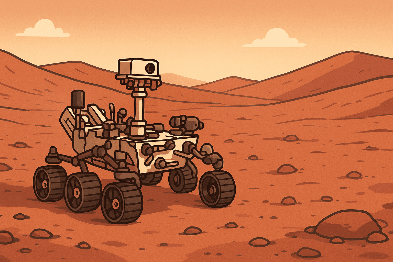
A new system named Mars Global Localization enables the Perseverance rover to pinpoint its position on the Red Planet without human intervention. More broadly, global localization is a map-based technique that estimates a rover’s absolute position by aligning what it sees on the ground with an orbital reference map.
Picture driving solo across a harsh, trackless desert with no roads, no map, no GPS, and just one daily check-in to learn where you are. That has been Perseverance’s reality for five years on Mars: it could estimate its general area, but precise coordinates still had to come from Earth—until now.
Video: How Perseverance Learned to Self-Locate on Mars.
Developed at NASA’s Jet Propulsion Laboratory in Southern California, the approach rapidly matches 360-degree navigation-camera panoramas against onboard orbital terrain maps so the rover can determine its location without calling home. In practice, the software tests many candidate alignments across the landscape and selects the position whose match is strongest and most distinct from alternatives. The method is most effective when the scene contains stable, recognizable landmarks; performance can be challenged by feature-poor terrain, dramatic shadow changes, or dust and haze that mute surface contrast.
Running on the high-speed processor originally used to communicate with the Ingenuity Mars Helicopter, the algorithm computes a position fix in roughly two minutes, narrowing the rover’s pose to about 10 inches (25 centimeters). That level of precision is typically achieved under favorable terrain and lighting; accuracy can vary depending on how much distinctive surface texture is visible and how closely current conditions resemble the orbital reference maps.It’s effectively like giving a Mars rover its own GPS. Now it can figure out where it is and travel much farther on its own, expanding science return—and the same idea could benefit other fast, long-range rovers, said JPL’s Vandi Verma, chief engineer for robotics operations.
This expansive panorama, built from five stereo nav-cam pairs and matched to orbital imagery, was used to lock in the rover’s position on Feb. 2, 2026. Credit: NASA/JPL-Caltech.
The upgrade pairs perfectly with the rover’s AutoNav self-driving system, which already replans around hazards en route to a set destination. AutoNav has become so capable that daily progress was mostly constrained by uncertainty in the rover’s exact pose. Now Perseverance can pause, localize precisely, and continue toward distant targets without waiting for instructions from Earth, enabling longer drives, fewer check-in delays, and more confident routing around hazards when margins are tight.Precise localization is the hinge of autonomous exploration: when a rover can trust where it is, it can plan farther ahead and spend more time on science instead of waiting for guidance.
The rollout follows another milestone from the team: the first use of generative artificial intelligence to pick drive waypoints—choices normally made by human operators—letting the rover cover more ground while reducing team workload.
Beyond Visual Odometry
Unlike on Earth, Mars has no GPS satellite constellation to locate surface explorers. Robotic and crewed missions must therefore rely on alternative methods to determine position, often combining wheel odometry and inertial sensing with camera-based tracking, plus periodic updates derived from orbiter imagery and Earth-based analysis.
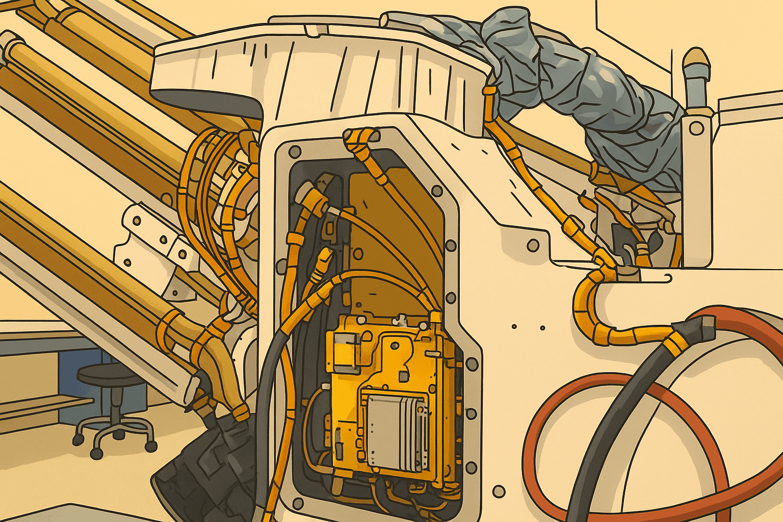
The localization software runs on a fast commercial processor inside the Helicopter Base Station—the upper, gold-colored unit integrated into Perseverance—which previously relayed communications with the Ingenuity Mars Helicopter. Credit: NASA/JPL-Caltech.
| Navigation Method | Description | Advantages | Limitations |
|---|---|---|---|
| Wheel Odometry | Estimates motion from wheel rotation and steering data as the rover drives. | Fast and continuous. Requires no images. | Wheel slip and uneven terrain can quickly introduce error. |
| Inertial Measurement | Uses onboard gyros and accelerometers to track changes in orientation and motion. | Works through brief visual dropouts. Helps stabilize attitude estimates. | Drifts over time. Must be corrected with other references. |
| Visual Odometry | Tracks geologic features in images taken every few feet and accounts for wheel slip. | Improves local accuracy compared with wheel-only dead reckoning. | Small errors accumulate; on long traverses the estimate can drift by more than 100 feet (up to 35 meters), causing the rover to stop early to avoid suspected hazards and await guidance from Earth. |
| Earth-Based Landmark Localization | Sends rover panoramas to Earth, where specialists align them with Mars Reconnaissance Orbiter imagery to update coordinates. | Provides an absolute correction tied to orbital maps. | Can take a day or more. Depends on communications and ground-team time. |
| AutoNav Hazard Avoidance | Autonomously detects hazards and replans a safe path while driving toward a destination. | Reduces risk from rocks, slopes, and other hazards during traverses. | Still depends on a reliable position estimate to maximize daily drive distance. |
| Map-Based Global Localization | Uses rover panoramas and onboard orbital terrain maps to compute an absolute position fix on the rover. | Reduces reliance on Earth-based updates. Enables longer autonomous traverses. | Can be challenged by low-contrast scenes, changing illumination, or areas with few distinctive landmarks. Requires onboard compute and memory safeguards. |
When a drive ends, Perseverance typically sends a 360-degree panorama to Earth. Mapping specialists then align those images with views from the Mars Reconnaissance Orbiter and return the rover’s coordinates and next-drive plan—a cycle that can take a day or more. With the new localization method, the rover performs the matching itself, confirms its position, and proceeds along its preplanned path.We’ve added a brand-new capability, said Jeremy Nash, the JPL robotics engineer who led the effort. A long-standing challenge in robotics is now flying in space, and deploying it for the first time has been thrilling.
The team began work in 2023, validating the algorithm against data from 264 prior rover stops.Capture panoramic images with rover cameras.Extract features from images.Match features to orbital terrain maps.Estimate rover pose.Verify solution with cross-checks.
How Ingenuity Helped
The Helicopter Base Station is key: its commercial processor—similar to mid-2010s smartphone chips—runs more than 100 times faster than Perseverance’s two radiation-hardened main computers, which are based on hardware introduced in 1997. Ingenuity’s technology demonstration, and the long-lived performance of the base station hardware, gave the team confidence to run demanding map-based localization workloads on that commercial processor rather than reserving them for slower flight computers.
As a technology demonstration, Ingenuity accepted the risk of using unproven commercial processors in both the helicopter and the HBS. The gamble paid off: designed for up to five flights, the rotorcraft ultimately completed 72.Ingenuity proved that commercial processors can work on Mars—it was like a gift. That performance opened the door for us to tap the HBS compute power, Verma said.
To ensure reliability, the team added a “sanity check”: the HBS runs the algorithm multiple times, and a main rover computer verifies that the solutions agree. During testing, a consistent 1-millimeter offset revealed damage in about 25 bits—just a tiny fraction of the processor’s 1 gigabyte of memory—so the team built a way to isolate those bits during execution.
Beyond the global localization workflow, these cross-check and memory-guard techniques are poised to aid future missions that adopt faster commercial processors. The team is also targeting lunar operations, where challenging lighting and long, cold nights make exact positioning even more critical. Similar map-based localization could also support other long-range robotic explorers by enabling faster traverse planning, more reliable return-to-route behavior after detours, and quicker recovery from accumulated navigation drift during extended drives.
More About Perseverance
NASA’s Jet Propulsion Laboratory, managed by Caltech, built Perseverance and oversees its operations for NASA’s Science Mission Directorate as part of the agency’s Mars Exploration Program. Perseverance is exploring Jezero Crater to study ancient environments, collect rock and soil samples for potential return to Earth, and demonstrate technologies for future exploration; more reliable self-localization helps it reach diverse targets efficiently and place observations and sampling sites in accurate geologic context. Learn more about Perseverance.


